I had heard the Red Rocks Century was one of the hard ones. I thought I’d like to do it; and, I was right, mostly. It is truly a wonderful ride through the beautiful Front Range Colorado mountain terrain. But, on this day, I started out too fast, and had to hang on like grim death.
“For five years the Red Rocks Century, formerly the Healing Wheels Tour, has been known as the toughest and most scenic of the Colorado Front Range cycling events.”
~ 303cycling.com
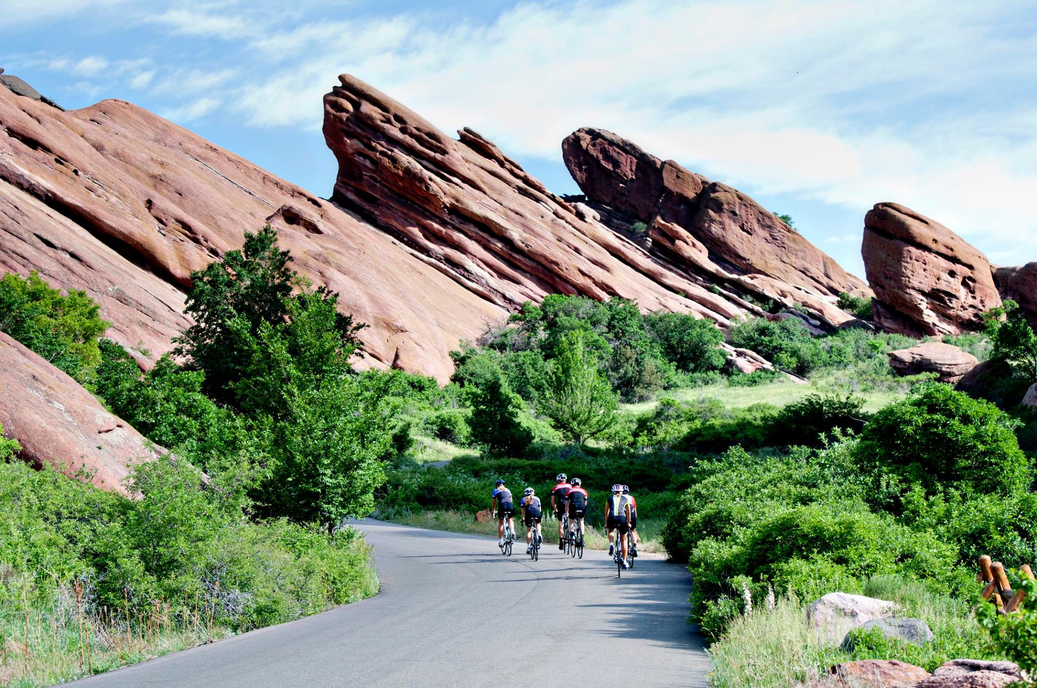
Iconic photo of Red Rocks Century
I selected the Red Rocks Century from among a number of great sounding rides. I was originally interested in the Copper Triangle (8/3), and then it was the USA Pro Challenge Experience (8/10). I settled on the Red Rock Century because of the low cost (boring, eh?) and its reputation as being hard (yes, seriously). I was also attracted to the relative closeness of the start/finish to my home; I could be home in the early afternoon.
The Red Rock Century would be my 2nd long organized ride; my 1st was the Triple Bypass. This one would be 96 miles vs. 120 mile with 10,200′ vs. 10,900′ of climbing. While shorter by 24 miles, the Red Rocks route would be somewhat steeper.
I wondered how much better I would ride than I could muster on the Triple Bypass. My endurance and speed seemed to be getting better over the last few weeks. The week before, I rode from Lafayette to Brainard Lake, and then through the town of Raymond on my way to Lyons. I made it home after 6 hours, completing a 84 mile / 7400′ ride. And, the previous weekend, I had finished the Mt Evans Hill Climb in under 3 hours. I was feeling very strong and confident.
Unfortunately, three days before the Red Rocks ride I started to come down with a cold, or some cold like symptoms. I hoped it was allergies, but it didn’t seem like it. Over the next couple days, the symptoms didn’t get worse, but they didn’t go away. I stopped my workouts all together (no taper) to fend off the illness, imagined or otherwise; but, it didn’t seem to do any good. I resolved to proceed with the ride no matter what, and just take it slow. I hoped that by going slowly, I could ride 96 miles and climb 10,200′ of elevation with an illness. Consequences be damned!
My only other concern was getting lost. The route seemed complicated, and me with no GPS or bike computer, I had to rely on a map in my pocket. I just couldn’t see how that was going to work. I hoped for good signage.

Red Rocks Century Route (I had to recreate to get the correct altitude gain)
I arrived at Bandimere Speedway, the start of the Red Rocks Century, at 4:45am for a 5:30am race start. I was the 5th vehicle in the lot that could hold 2,000 vehicles. I picked up my packet and made ready to ride (after waiting for the organizers to run to the store to buy a box of pins). During a brief start delay at the start line, I looked around at the mass of riders around me and was surprised to only see 100-150.
We set off at 5:40am, following our police escort (5,767′ elevation).
I was delighted to find myself among the first 30 cyclists on the road. Maybe I’ll get a high finish! But, no; I quickly realized that the fast riders would, annoyingly, be going by me all day. Rather than a buzz kill, though, I found this inevitability to be a motivator; I’d stay away as long as I could, dammit.
So much for my plan to take it easy. But what the heck, I felt great.
I started passing riders until I got behind a strong-looking, largish (for a cyclist) fellow on a $5,000 bike who looked like he knew what he was doing without going too fast for me to follow. I decided to ride his wheel for a while.
The pair of us pedaled north up the frontage road adjacent to C-470, then turned onto Alameda Rd heading west through North Dinosaur Park. After a climbing, winding few miles (~4.5 miles overall; 500′ of climbing; 2.1% grade), we turned onto Trading Post Rd to descend past Red Rocks Park to reach Red Rocks Park Rd on which we descended toward Morrison reaching Bear Creek Rd (Hwy 74) after losing most of the elevation gains of the day (~6 miles overall).
We would climb to the famous Brooks Forest Inn for the next 19 miles, gaining 3,000 feet; 1,000 of which would occur in the last 3.5 miles.
The first 15 miles of this section wasn’t too bad. I followed my lead-out for about 1/2 this distance until I got squeezed out in a merging of two groups. Rather than go to the back or sit in the wind, I powered ahead to catch a guy in a Copper Triangle Jersey who had blasted past both groups earlier but was still in sight. I caught up to him after about 20 minutes and hung on his wheel. He was fast!
Luckily for me, the Copper Triangle guy knew where he was going. I followed him through a complicated multi-way, weird-angled, stop-sign intersection; I had no idea where to go and saw no sign or mark on the road until after we were through the intersection. We picked up another rider (Tony) who said he had been dropped from the lead group, and he couldn’t figure out where to go, either.
The three of us turned onto Brooks Forrest Rd, heading toward our first water/food station of the day (the 1st scheduled water station had not opened yet when we went by). With the grade steepening, my earlier extravagant energy expenditures began to catch up to me. With about 2 miles to go to the top of the climb, I got dropped. I didn’t bonk; I just could generate enough power anymore.
I put my head down, got into my lowest gear, and spun my legs as best I could manage (creating an oxygen-free dead zone along the way). And, I kept Tony in sight. Eventually, the top neared and, at 8:45am (25 miles in; 8,918′), I stopped for a much needed rest. Copper Triangle guy was gone already, but Tony was just leaving.
I discovered, to my horror, that the aid station didn’t have any electrolyte replacement other than Poweraid. Crap! (I left my Nuun at home thinking there was a zero chance of this outcome). Yuck. I filled and finished a bottle anyway, and then refilled both bottles. I also ate a banana and a Clif Bar, counting on a long descent down Shadow Canyon Rd. to digest. Then I took off, seeking to catch Tony if possible.
Surprisingly, I caught him quickly, and we traded leads back down to Hwy 73, which we followed back into Evergreen (after a quick recovery from a wrong turn). As we approached Bear Creek Rd from the opposite direction, completely turned around and not finding any route signage whatsoever, we stopped to consult the map. We correctly divined a left onto Bear Creek Rd was the way; and then, we barely managed to notice the turnoff to the left to Upper Bear Creek Rd.
This beautiful cycling route had turned into orienteering exercise.
We followed Upper Bear Creek Rd for 4.5 miles, passing Evergreen Lake and then turned right onto Witter Gulch Rd (42 miles in; 7451′ elevation). WARNING: if you ever see this name on a road sign, and you are not ready for a leg destroying climb, flee.
Witter Gulch Road was a beautiful ride. It would be one of my favorites if nearer to my home. It is 4.6 miles of 7.1% grade (including many double digit spots), gaining 1,736 feet to reach Squaw Rd at 9,187′. Apparently, the last 2 miles of Witter Gulch Road was only recently paved; the last 3 miles is a sustained climb of almost 8% with multiple switchbacks near the top. Thankfully my Mt Evans ride had prepared me, mentally, for this leg killer. Tony wasn’t so fortunate; he kept saying it was steeper than anything he had ever done.
Tony led the first part as my legs were still recovering. When it was my turn, I found I was strong again. I pushed hard to reach Hwy 103. At the end of the road, Tony was starting to fall back a little bit (~30 feet); after the last switchback, I yelled back that it was almost over.
Turning onto Hwy 103, I happened upon a group of riders from Evergreen. We chatted for a while, while the grade allowed a bit of talking. They laughed about how much I would ‘like’ the Floyd Hill climb back to Evergreen. And, Tony was gone. I’d dropped him somewhere since the start of Hwy 103.
After a few miles, the Evergreen group pulled off the road to enjoy the views. So I was all alone, not chasing anything but the clock. Except for the two real cyclists who rode past Tony and me earlier, I was still among the first 5-10 riders as far as I knew. I liked the feeling and didn’t want to let anyone get by me without earning it. So I kept pushing.
I found the aid station at Squaw Pass at 11:15am and stopped to refill my bottles and grab some food. As I was leaving, Tony pulled in. I asked him what happened to him. He replied, “I got my ass kicked!” He wished me well, and I took off with fresh legs to climb to Juniper Pass (54.5 miles in; 11,148′) and then to fly down past Echo Lake to Idaho Springs (71 miles in; 7,500′).
The descent was fun and fast. It was my 3rd descent from Echo Lake in over the past month; I knew the road well. As I entered Idaho Springs, I had some idea of where to go but managed to catchup to another rider who seemed to know where to go. Together we passed through downtown and found an aid station at a public restroom I had used many years ago on a rafting trip. As I arrived, just leaving the aid station was my old pal, Copper Triangle guy, who I’d last seen before the top of the climb to Brook Forest Inn.
Another bottle refill and a banana, a quick pee, and then another hello to Tony who was just puling in, and then I left chasing Mr. Copper Triangle. He was somewhere ahead of me, but I was lost. I tried to use 25th street to cross under I-70 (per the instructions) but couldn’t figure it out. I backtracked and then sprinted ahead to stay within sight of another rider who had passed me (#3) during my wandering.
We followed the on-ramp to I-70, but stayed on the far frontage road and then to a bike path which followed I-70 along the canyon wall, which skirted the I-70 tunnels. Frankly it wasn’t much of a bike path: patches of dirt and wildly undulating terrain. But since the route was still descending, I was strong enough to catch up to my new guide, but my climbing legs were dead. The last climb, Floyd Hill, would not go easy for me.
We crossed under I-70 to US-6, and then took the steep ramp to Evergreen which I had always wrongly imagined was an on-ramp to I-70 (76 miles in; 7,200′). This was Floyd Hill, the 1.8 mile, 6% grade segment the Evergreen riders told me with a chuckle I would enjoy. I did not. My new guide was too fast, and I was too slow; but, I held on long enough to catch up to my original target, Copper Triangle guy.
The two of us climbed up the steep ramp in the burning sun, sucking down the exhaust from 100 cars backed up due to the tunnel blasting delays. It was a hell. Slowly we approached Evergreen. My legs were spent; I couldn’t keep up sitting in the saddle, and so had to stand up to claw back any gaps.
Another (and last) rider passed us (#4 so far for my day), and then the hard part was done. We exited Floyd Hill (Hwy 40) onto Rocky Village Dr. (80 miles in), and then lost and gained a hundred feet over the next 4 miles to connect with Evergreen Parkway. We rode north on Evergreen Parkway a short way to reach Kerr Gulch Rd (84 miles in; 7,784′) and the descent back into Morrison.
The descent was nice except for the volume of cars driving down the two-lane, winding road with only an intermittent shoulder. I stayed behind Copper Mountain guy to make sure I could find the finish line.
Thirteen miles later we hit Morrison and a confusing intersection. I followed the police officer’s directions and ended up ahead of Mr. Copper Mountain on a bike path for the last couple hundred yards of riding. I raced ahead with visions of a top 10 finish. As I passed under the finish arch at 12:40pm (96 miles in), I couldn’t find a single Official to ask for my official finishing time (I didn’t know that no one keeps track in a Century ride). And since the shorter route options had already finished, the finish line expo area was jam-packed with people. So, I had no idea if I had my top 10 finish; I admit it was a letdown.
And then I saw Tony. We congratulated each other on a good day of riding, and then the sky opened up and dumped rain. We sat under a huge tent eating our free fish tacos & free beer as I told him of finally catching Copper Triangle guy.
I finished in 7 hours, including 40 minutes of stopping time. That’s about a 15 mph average, which is about the same as I did on the Triple Bypass. I’m satisfied.
P.S. – I did finally come down with a cold the next day.

Leave a comment