The Backstory
Time after time, I find that an ambitious adventure goal combined with an equal willingness to suffer optimizes personal reward. I’ll admit this statement may not sound sane; heck, it doesn’t even feel true during my adventures. But, while large goals lead to large rewards, overly large goals lead to failure and bitter disappointment. For me, complete satisfaction comes only when I give my maximum effort and use all my courage to just barely succeed in an adventure. My pursuit of this feeling, perhaps a bit too casually, is the backstory to my Triple Bypass Ride adventure of July 12, 2014.

Photo of my bike model borrowed from internet
When I finally got into road biking in June, 2014 after a 15-year courtship with the sport (I finally bought a bike), I immediately started looking for adventure and fitness in organized, long, mountain rides. I quickly stumbled upon on upcoming Triple Bypass Ride, which I’d heard about and secretly coveted in the past. The ride was only 2.5 weeks away, but I was able to secure a spot in this long-ago sold-out event by buying a registration from a guy whose wife forbade his repeat participation. This left almost no time for training, but that suited me just fine. I would have signed up if the ride were the next day. I just didn’t have any doubt I wanted to do it. And the Triple Bypass Ride sounded like just the sort of challenge I was looking for, particularly since I had never in a single day ridden more than 40 miles or gained more than 5,000’ in elevation. And, I immediately told everyone of my plans.

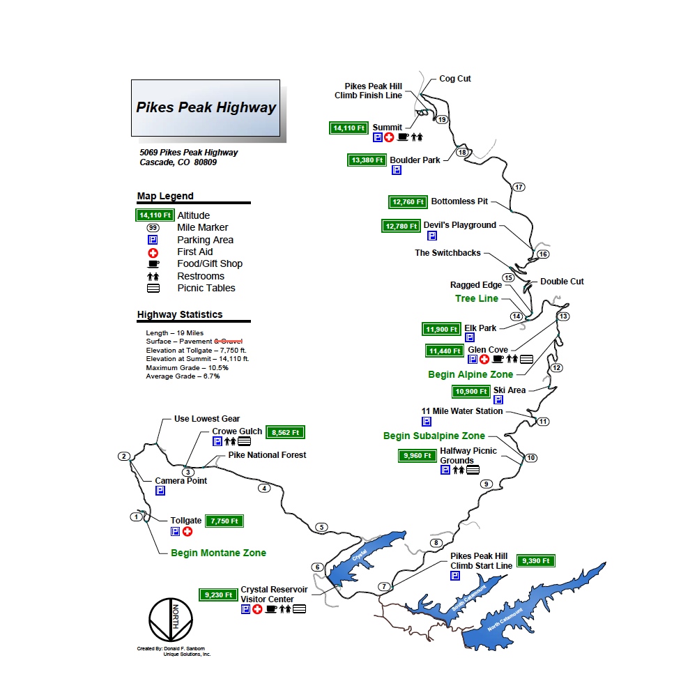
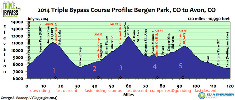
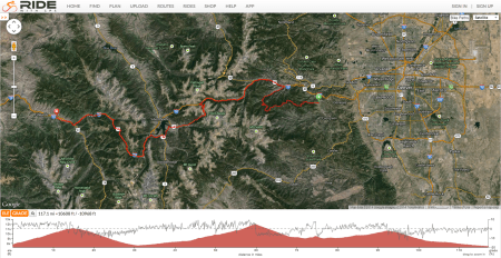
Official Triple Bypass Map and Elevation Profile
Having publicly committed myself to the effort, I surely would hate to not to finish (DNF). No doubt most people thought my DNF was a near certainty, making such an outcome especially embarrassing. Heck, I couldn’t even allow some uncontrollable factor, such as weather or mechanical breakdown get in the way since that would be a too convenient excuse. My ego insisted that I push the chance of any failure to as close to zero as possible.
Two Weeks To Go
(dominant emotion: excited to do this fun event; anxious to figure out how to do it)
Once registered for the Triple Bypass, I immediately set out to determine what to bring and how to carry it with me along the 120-mile course. I read articles and blogs, and discovered, with no surprise, that good weather is not ever to be expected. In fact, the mountain weather has been quite horrific on past Triple Bypass rides, including slushy snow and freezing rain, lightning storms, and daylong drizzle. I started buying stuff: rain jacket (waterproof & lightweight & highly visible color), arm/leg warmers, shoe covers, rain gloves, and bike packs to carry it all. Naturally, this was just in case my good weather luck failed to save me.
My research also revealed that many people consider the Triple Bypass to be their ultimate endurance achievement, and is only attempted after years of training and multiple experiences with shorter, less demanding mountain rides. Oh, yeah. The sense of fear and thrill, essential for great adventure, was growing in my mind. And, I could feel it in my body. This was going to be a great adventure.
It did occur to me that I wasn’t certain I could do it, and I had no idea how long it would take if I could finish. I thought I should see how hard I could ride on the one weekend I had before the big day. I decided I would do my first long bike ride, targeting 80 miles and 7,000’ in the foothills west of Boulder. My plan was to just keep riding until I was home again, and then I’d be able to estimate my finish time for the Triple Bypass. And, I’d also be able to tell Susan when to come get me in Avon (assuming I could not get a standby seat on the 5 pm bus back to Evergreen and my car).
One Week To Go
(dominant emotion: building excitement plus increasing stress)
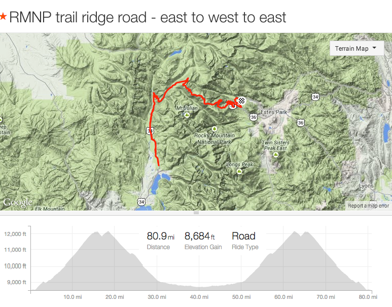
On July 4th, I set out from home at 7:30 am, planning to ride a loop around Lyons, Ward, and Boulder that would cover approximately 80 miles and 7,000’ of elevation. I planned to get water in Ward and again in Lyons if necessary. Of course, I had no idea how long it would take; I told Susan I might be gone for as long as 8 hours based on my experience the week before on RMNP’s Trail Ridge (climb 5,000’ and travel 40 miles) that took 4.5 hours (including a mechanical issue).
My ride was great at first. I had a fun ride out to Lyons (I reversed the loop direction at the last-minute), racing everyone I could find. Once past Lyons, the climb up to the Peak-to-Peak highway went slowly, as I had burned up too much of my leg strength racing to Lyons. Oh well, a lesson learned. The descent was a blast interrupted only by a stop for water and a bar. I even added an extra climb up Old Stage Road before heading home. I stopped at Lefthand Canyon Road & Highway 36 to call Susan to tell her that I’d be home before 2 pm and that there was no way I’d need more than 9 hours to do the Triple Bypass. But by the time I neared home, the low water (4 water bottles in 6 hours) and food consumption had me light-headed and exhausted. I was not just bonking, I was on the verge of passing out. And, it took me 3 days to fully recover!
It was an important lesson. I needed to eat and drink much more and do so continuously throughout a long bike ride. I wouldn’t make that mistake again. And, I needed to avoid tiring myself before the hard climbs; racing for ego sake was a mistake to avoid. But, I also learned that I could ride long enough to do the Triple Bypass.
A bit wiser, I established a Triple Bypass game plan to conserve and continuously replenish my muscle fuel to avoid the bonk. I would stop at every rest stop for water and food; I knew from recent personal experience to avoid dehydration, which would overwhelm all my other efforts. And, I would strictly avoid pushing myself too hard at any point to avoid becoming irrecoverably exhausted or sick to my stomach.I just had to reach Vail Pass (90 miles)…it would be downhill the rest of the way.
All that was left was the weather. To see if the weatherman thought my weather luck would hold, I checked the long-range forecast to find day after day of bad afternoon thunderstorms. Crap. I’d have to find a way to carry my new bad weather gear. And, I’d have to ride faster to have any chance of avoiding the bad afternoon weather.

Official map provided by ride organizers
The Day Before
(dominant emotion: exhilarated; full of adrenaline)
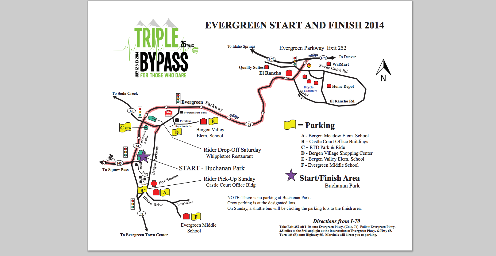
I took a ½ day off from work on Friday to pickup my ID stickers in Evergreen, get familiar with the parking / start area in the daylight (ride started pre-dawn), and practice pack my gear to see what fit in my limited carrying capacity (unless I wore a backpack) and finally resolve what I would bring.
I also did a final weather check and found an 80% chance of thunderstorms starting at 1pm; the rain and lightning risk would almost certainly find me on the ride by 1 pm. I had until then to get off the high passes, and I maximized my chance of doing so by starting early. So the plan was to start at 5 am, the earliest allowed start. And, to aid going faster, I decided to not bring a backpack, and just carry what I could carry in my pockets and on my bike.
Race Day
Start
(dominant emotion: excited to be a part of a big event; worried by the massive uncertainties)
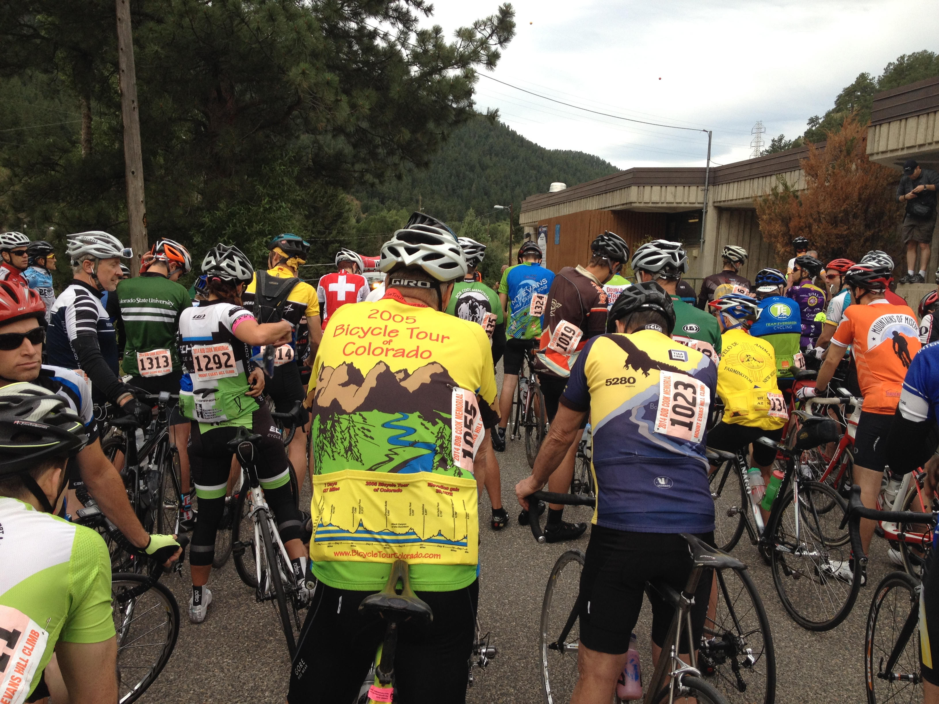
I arrived at Bergen Park in Evergreen at 4:40 am to find it alive and crawling with people, cars and bikes. I was far too late for a great parking spot. I drove around a bit and squeezed in as quickly as possible. After taking one last look at the pile of gear that I would leave behind, I rode toward the start line, one of hundreds of riders (3,500 were projected for the ride). I went across the start line at 5:10 am, according to the starting official who I asked as I rode past. I was the only rider without a bike computer or even a watch. We left Bergen Park heading West on Squaw Pass Road (Highway 66 turning later into 103) traveling toward and then over Squaw & Juniper Passes.
It was a surreal experience, riding in the dark along side and behind 100’s of bikes with red and white lights steadily shining or blinking in unique patterns. It was a poor time to be dazzled by the pretty lights. I focused on looking at the backs of the riders ahead of me to avoid touching tires. Later, the dawn breaking over the mountains made for a wonderful memory. I stole a moment to wonder if I could just follow other cyclists or would I eventually need to navigate for myself.
I started riding at a light pace to warm up and make sure I retained enough strength the get over Loveland Pass, 60 miles up the road, as well as be able to ride the entire 120 miles. It felt a little strange going so slowly; my breathing was so slow I felt like I was sitting behind a desk. I probably couldn’t have stayed with it at all except everyone seemed to have the same plan.
 1st Rest Stop – Juniper Pass (see #1 in course profile)
(dominant emotion: torn between going faster vs. being conservative)
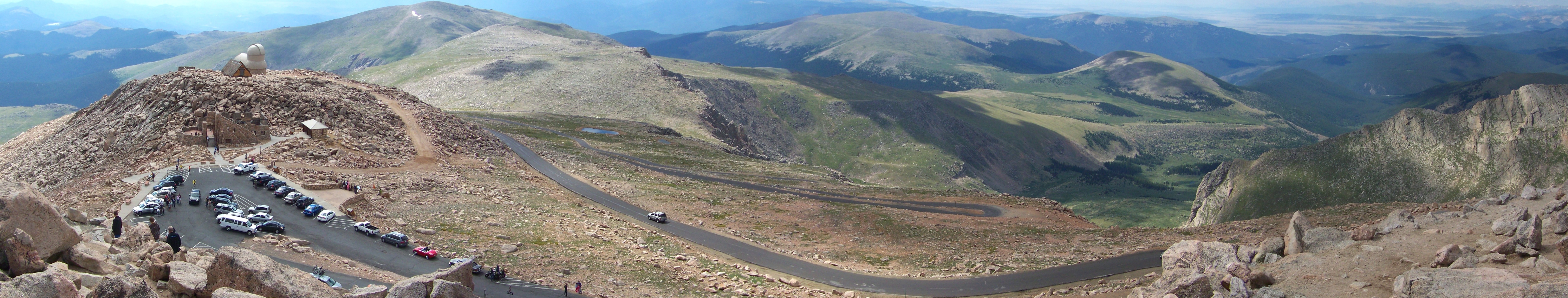
As the road toward Squaw pass (9,807′) steepened, the crowd started to thin out and the faster people made themselves known. My pace crept higher. I didn’t try to stay with the fastest few, but I felt confident enough to go faster. I found a group of big, strong guys and stuck to their wheels. A nice descent after Squaw Pass reminded me of the pleasure of speed, which I continued in a fast climb to Juniper Pass (11,140′). After 18 miles, at 7am, the 1st aid station appeared from around the bend (7:08am stop). Even though I didn’t need a rest, particularly not right before a long, steep descent into Idaho Springs 18 miles away, I was obedient to my plan, which was to replenish the 2 bottles of water/electrolyte consumed between the start and each of the five aid stations, and to eat during the ride and at the aid stations. I also started texting Susan to keep her apprised of my progress.
Me: Top of 1st pass. 2 hrs so far
Susan: Woo hoo!!!! Great job
It was an amazing sight: heaps of bananas, orange slices, Clif bars and shots, and sandwiches. Thinking that I could digest while descending, I ate a banana, ½ a PB&J, a Clif bar, drank a bottle of Cytomax, and grabbed 2 Clif shots for future use. After about 10 minutes, after I couldn’t think of anything else I should do, I set off down toward Echo Lake and Idaho Springs, gradually disregarding my plan to rest while coasting down the road. I passed Echo Lake (at the entrance to Mt. Evans Road) and continued to Idaho Springs at a fast pace.
At the bottom of the descent, the riders were thinned out pretty well with only about 20 or so around me. As we entered Idaho Springs, we were greeted by the residents lining the road with signs waving and cow bells clanking. Their enthusiasm and encouragement added fuel to my fire, against all logic and expectation.
From Idaho Springs, we followed the frontage road for another 11 miles to the 2nd aid station just before Georgetown at Georgetown Alvarado Road, where I stopped at 8:15am. I enjoyed the sightseeing along the way from a much closer and slower platform than offered by my normal 70 mph drive up I-70. I also found another group of guys to follow, this one a bit faster than the first.
2nd Rest Stop – Georgetown Alvarado Road
(dominant emotion: exhilaration; having a blast!)
At the 2nd rest stop, I refilled my bottles and established a pattern of peeing at every opportunity. I consumed half a banana and a peanut butter & banana sandwich (a lifetime first). All of this only took 10 minutes, as this was when I started feeling stressed about my time spent at the rest stops. I didn’t want to waste any time I might need to dodge the rain (and to have a respectable ride time). What resting was actually necessary was the big question I could not answer.
Susan: Hope you are feeling good!!! (sent earlier)
Me: Good so far.
Me: Loveland pass coming up. That is the key
The frontage road passed by Georgetown and then transitioned into the new Bakerville- to-Loveland Bike Path adjacent and parallel to I-70 through Silver Plume and Bakerville, ending just before the Loveland Ski Area.I was amazed to discover that it was possible to ride a bicycle along the I-70 path without actually using the highway. Along the way I found a muscle-bound cyclist, cruising alone at a fast pace, and I locked onto his wheel. We passed many riders over the next 13 miles. He was doing the Double Triple (I could tell from the color of his bike #); I figured his need to save something for the return trip would suit my need for a moderate pace. He held a brisk pace all the way to the Loveland Ski Resort aid station without looking to me to take a turn pulling, despite the wildly undulating terrain (they don’t smooth out the grade for bike paths). We reached the aid station at 9:57am, just under 5 hours after I started.
3rd Rest Stop – Loveland Ski Resort
(dominant emotion: disappointed but determined to finished)
I decided to take a longer rest; the weather was holding and I was starting to worry about how hard I had pushed to stay with the body-builder. I was feeling a bit of pre-cramping in my quads and generally could feel the energy draining from my body. I was only 56 miles in, only ½ way mileage-wise, and still had 2 of 3 passes to surmount. Quick math said an optimistic 10 hours to finish, which was disappointing and left me vulnerable to the approaching thunderstorms. I started worrying that I might be in trouble.
Susan: How is weather? (sent earlier)
Me: At Loveland rest stop.
Me: Weather ok so far. Threatening
Susan: Yippee!!!
Me: Starting to breathe hard
Susan: Pace yourself!!!
Susan: Hardest part will be the last 20. How many miles to go?
Me: Halfway I think.
Me: The next 4 will be the hardest. The last 30 are downhill
Susan: Hang in there!!!
I found a place to sit and stretch my back, which felt so good it was hard to stay focused. I also kept pumping the fluids and and carbs, continuing to focus on real food. After a wonderful 20 minutes, I got back on my bike and started up Highway 6 toward Loveland pass.
Satellite image of route with elevation and grade profile. Grades: 0%: a flat road; 1-3%: Slightly uphill but not particularly challenging. A bit like riding into the wind; 4-6%: a manageable gradient that can cause fatigue over long periods; 7-9%: starting to become uncomfortable for seasoned riders, and very challenging for new climbers; 10%-15%: a painful gradient, especially if maintained for any length of time; 16%+: Very challenging for riders of all abilities. Maintaining this sort of incline for any length of time is very painful.

Photo of Loveland Pass highpoint marker borrowed from internet
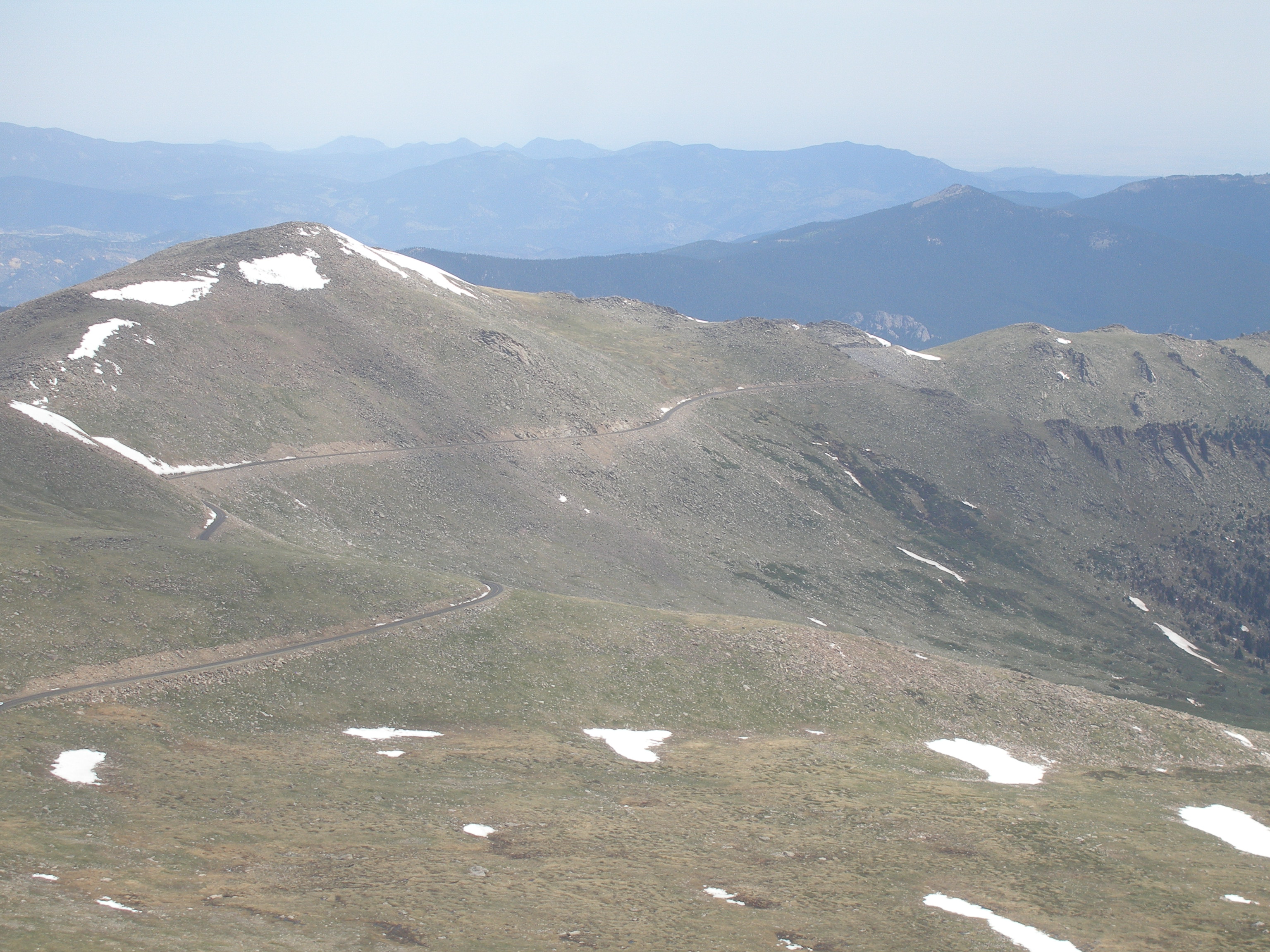
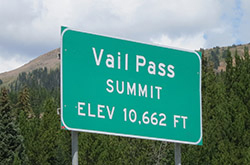
Loveland pass was only 4 miles away but that just meant a shorter distance to gain 1,200 feet to get over the 11,990′ high-point. I got into my low gear and spun my legs, passing many people along the way. It was a grind interrupted only by having to smile for the photographer (I didn’t buy this photo; $$$). I focused on working my legs, and, suddenly, I was done. The road didn’t quite reach the top of the world, but it sure felt good to be done climbing. I pulled to the side of the road to send Susan a text at 11 am that was not delivered due to a lack of a cellular connection.
Me: At top of pass (not delivered).
Me: Downhill for a while (not delivered)
Susan: “…..”
The backside of Loveland Pass is spectacular. And, I don’t know what happened to all the riders. I had the road almost to myself. I sped down past A-Basin and then Keystone, where the road leveled out. There was still a bit of a down angle but also a miserable headwind eating my momentum. I got as small and pushed hard to get out of the wind, but almost immediately I felt a twinge in my hamstring. Cramp. Crap. I sat up immediately to avoid the full on cramp. I stood up and stretched my legs as I had seen Tour riders do. I was able to keep going, but had to go easier on the legs. I also had to go fast enough to keep the riders ahead of me in sight so I’d know where to turn.

Photo of Hwy 6 descending from Loveland Pass toward A-Basin Ski Resort (borrowed from internet)
4th Rest Stop – Breckenridge H.S.
(dominant emotion: hanging tough but worried; happy to only have 13 miles of climbing left)
The route turned west onto Swan Mountain Road which goes over Swan Mountain, climbing 500 feet of some of the steepest grades despite not being a mountain pass. The descent was fast and tight (steep!), ending in Breckenridge at the 4th aid station. I stopped for a 15-minute break to let my muscles collect fuel and electrolytes, hoping to stop the progression of cramps. The weather was still holding, but dark clouds were brewing over Vail Pass. I felt the pressure building to hurry, but I feared ending the ride prematurely in a ball of cramped muscles.
Me: In Breck now, 77 miles in
Susan: Love you!!!! Weather?
Me: Ok so far. It’s a blast.
Me: 13 miles to go to end of uphill
Susan: You can do it you can do it rah rah rah!!! Proud of you!!!
I set off alone on the Frisco bike path toward Copper Mountain but quickly got onto the back wheel of an older guy (probably my own age) who was doing the Double Triple. He was a bit slower than my earlier pace setters, but that suited me just fine. My hamstrings would seize if I pulled too hard, and my quads would simply quit after a few seconds of standing. I only had to ride 13 miles to finish the rest of the uphill section.

Photo I purchased from official photographers of Triple Bypass. The prices were too high to get more than one.
The two of us passed a few people on the twisting, crowded, and narrow bike path, but mostly just kept a steady pace. I should say a steady effort, since the bike path continued in the crazy up and down pattern established between Georgetown and Loveland. After a short distance, we were passed by a small group moving just slightly faster. My pace-setter decided to hang onto their wheel, so I had to up the effort a bit to hang on as well.
The entire group eventually started trading lead-outs, significantly upping the pace. Fortunately, the closer we got to Copper Mountain, the stronger I felt. I was surprised and delighted. We hit Copper Mountain Ski Resort after 7 miles, and after stopping for a red light (my 2nd of the day), I took off in an adrenaline-fueled sprint. The grade increased quickly and soon I realized I was alone. But now feeling good and only having 6 more miles to Vail Pass, I continued to press forward, standing to climb the steep sections while pushing a big gear on the flatter sections. My legs continued to feel strong as well as less and less inclined to cramp. I arrived at the last aid station atop Vail Pass at 1:06pm (just after a 1pm photo opp; see photo).
5th Rest Stop – Vail Pass
(dominant emotion: relief! I was going to make it!)
What a relief! At that point, I knew that I would make it. I had ridden 8 hours and had nothing but downhill ahead of me. I would not only finish, I would have a respectable time despite my cyclocross bike and lack of training. I loaded up again on liquid and food, and even, finally, ate the Clif shots I had stashed at the 1st aid station. They were rather gruesome but felt like just the thing for a final energy suck.
Me: Top of vail pass. Downhill from here
Susan: Woo hoo!!
Susan: We will have a prize for you (photo of giant berry pie)
Me: Awesome
Susan: You are!!!
Me: I’ve been fighting cramps
Susan: Oh no!!! Drink drink drink!!!

Photo of Vail Pass Summit sign borrowed from internet
I started down alone after a 10-minute eat/drink/pee break. I just flew down the bike path despite an incredibly strong headwind, slowing my pace only periodically to avoid flying into oblivion. I wasn’t certain of the route, so I just stayed on the bike path heading downhill. I quickly reached Vail, exiting the bike path onto the old Frontage road. The headwind was even worse on the flats. I pushed to catch up to a large rider ahead of me so I could hide from the wind and follow him to the finish. Another rider went by at a much faster pace, and I jumped to his wheel instead.
This new guy was very strong. I hung on and took a turn in the front while we picked up more riders. At end of my next turn in the front, I moved over to drop to the back…only to find no one there. I looked back just as the strong rider flew past me with 2 new, stronger riders on his tail. Shit.
I had seconds to decide whether to chase. Fortunately, I was on a slight downhill grade which allowed me to power up to close the gap. It was good that I did as I had no idea where to go once exiting Vail. I followed this group up a frontage road until it turned into a bike path. On the short uphill sections, the group would again open a gap on me. But my legs would not quit; I closed every gap. The winding bike path roughly followed Highway 6 until dumping us onto that poorly maintained highway just outside of Avon. It was an exhilarating experience. And, adding danger to the mix, the poor road was full of holes. I had to watch the road ahead of the riders in front of me, as they were not reliable about avoiding or signaling obstacles.

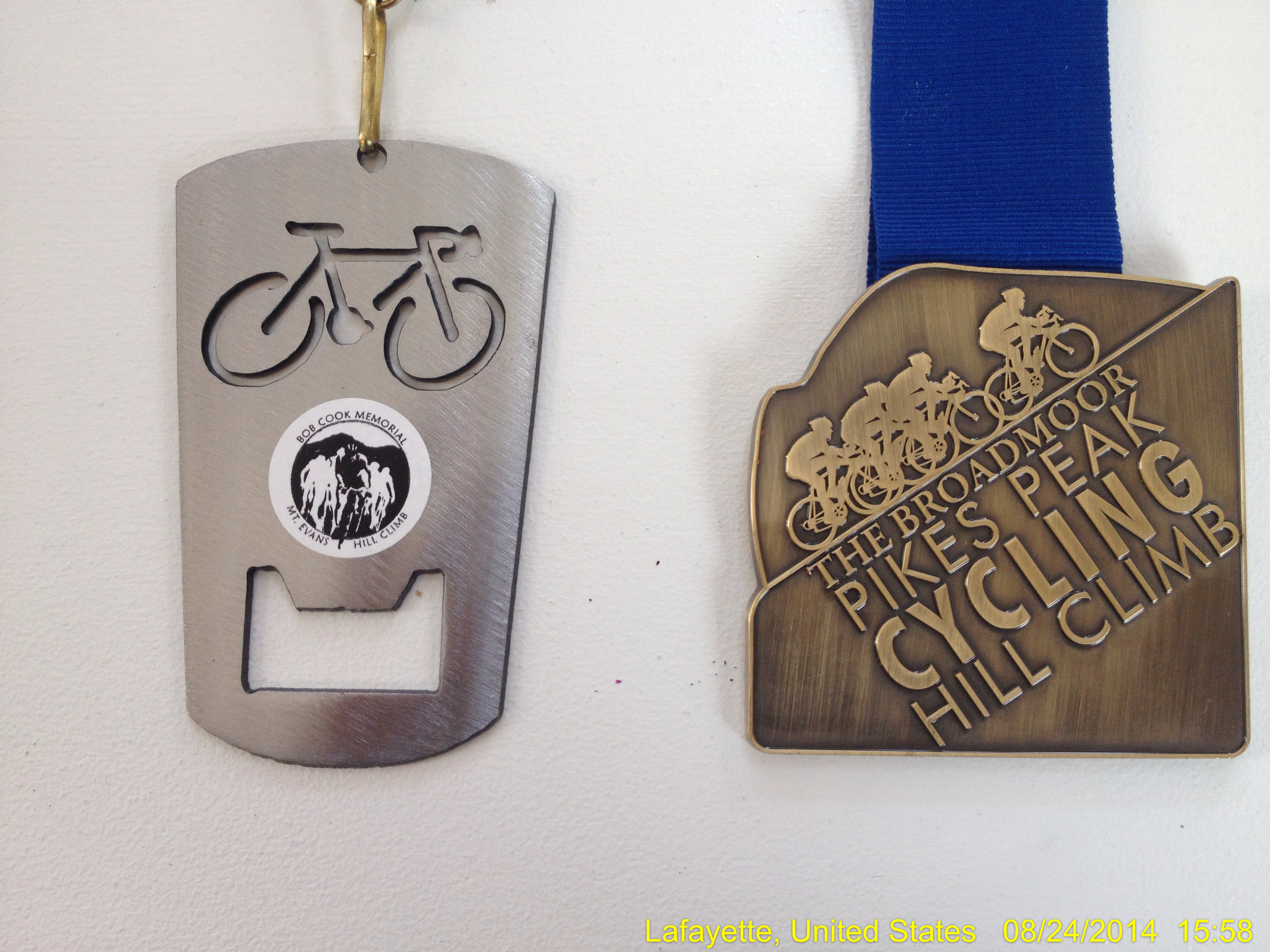
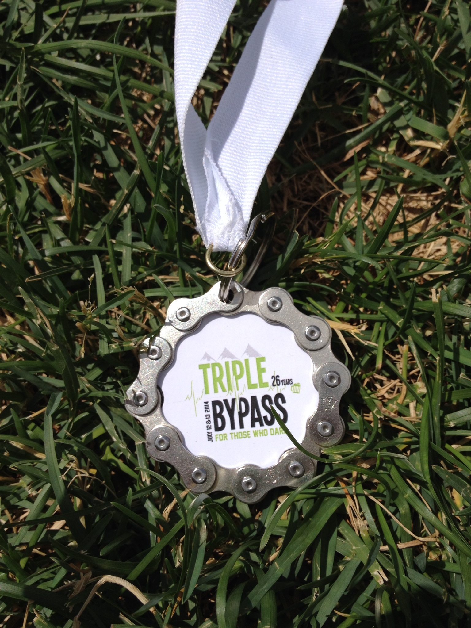
I took this photo of my medal (1 of ~3,500) given to Triple Bypass finishers. It is laying in the grass next to the finish line in Avon, CO. The photo is available for any who want to borrow it.
The Finish – Avon (living on adrenaline and endorphins; great while it lasts)
We entered Avon in a sprint, and enjoyed the cheers of the crowd. I finished at 2:10pm, for a 9-hour ride, including approximately 65 minutes of rest time. With a moving time of about 8 hours, I averaged 15 mph. Not bad for an old dude riding a pair of fat, knobby tires on a perfectly fitted, brand-new, fire engine red bike.
Me: Finished
Susan: You rule!!!!
Susan: Doing the happy dance here!!!
Me: (photo of Triple Bypass medal
Susan: Today you reminded me why I love you so much
Me: Luv u too

Official map provided by ride organizers
Susan and I made plans to do the Triple Bypass together in 2015. It is a great experience made perfect by perfect weather. Susan was also delighted to avoid driving 5 hours to get me when I was able to get on a shuttle back to Evergreen (and my car). On the ride back, I chatted with a guy who opened my eyes to many such rides held in Colorado. This was going to be a very good summer.
Lessons Learned:
- Do not try to lose weight on the bike; eat and drink more than enough
- Avoid any deficits in water or calories; eat and drink multiple times per hour
- Focus on real food; many hours of processed goo will make you sick
- Consume a lot of electrolytes, especially sodium
- Work with other riders to combat the wind
- Descent is an effective but dangerous place to pick up time
- Avoid needing a rest; recovery is impossible unless on a long descent
- Be ready for weather by using lightweight junk; leave bulky, high-quality gear at home (plastic bags, latex gloves, etc.)
2014 Triple Bypass By the Numbers:
RIDERS
- 4,600 Total Riders
- 3,500 on Saturday
- 1,500 on Sunday
- 1,000 Double Triple Riders
- 30 Relay Groups
- 43% of the riders were first-timers
- 83% Men
- 17% Women
TOP STATES REPRESENTED
- Colorado
- Texas
- Illinois
- Minnesota
- Nebraska
- Missouri
COUNTRIES REPRESENTED
- Japan
- Mexico
- Canada