Posts Tagged ‘flatirons’

Kamikaze Overhangs vs. Wits

October 20, 2013

October 19, 2013

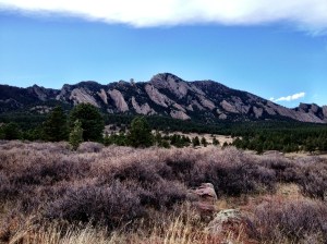
For a cold but clear late October Saturday morning, Brian had identified a new route on the 1st Flatiron as a target for our ongoing, weekly search for exercise and adventure.

And he was so right, aided by a bit of poor preparation by the Joe and Brian team.

While it is a Cardinal sin of climbing to fail to prepare due to mere laziness, in this instance our lack of preparation might just have been the flavoring that made the day so good.  Perhaps there is an argument for purposefully leaving without all the information just for the sport of living by your wits.

From my own CliffsNotes: Rules, Laws, etc. 

  1. Climber’s Luck Maxim: luck is not an attribute, but rather a symptom of preparation (with a nod to Branch Rickey); good preparation plus determination = good luck plus success
  2. Silver Lining Maxim: sometimes, good things come from setbacks, if you let them.  “When it gets dark enough, you can see the stars” (Salk). “Adversity reveals genius, prosperity conceals it” (Horace) also known as “Necessity is the mother of invention”.
  3. The ‘Path Less Traveled‘ Axiom: finding your own path or using a seldom used, less well known route adds to the adventure and can get you into some serious trouble.

Below is an annotated photo showing our route (in red) and the well established Kamikaze Overhangs route (in blue), at far as I can tell (but don’t take my word for it).  I believe we correctly started on the Kamikaze Overhangs route, but then spent most of the day climbing between the Kamikaze and Zig Zag routes before finally finishing on the Kamikaze route at the very top, after skipping 2 of the 3 official ‘overhangs’.  Along the way, and in spite of all our errors, we found good climbing and great adventure, and enjoyed the heck out of living by our wits, such as they were.

kamakazeroutedetail10192013

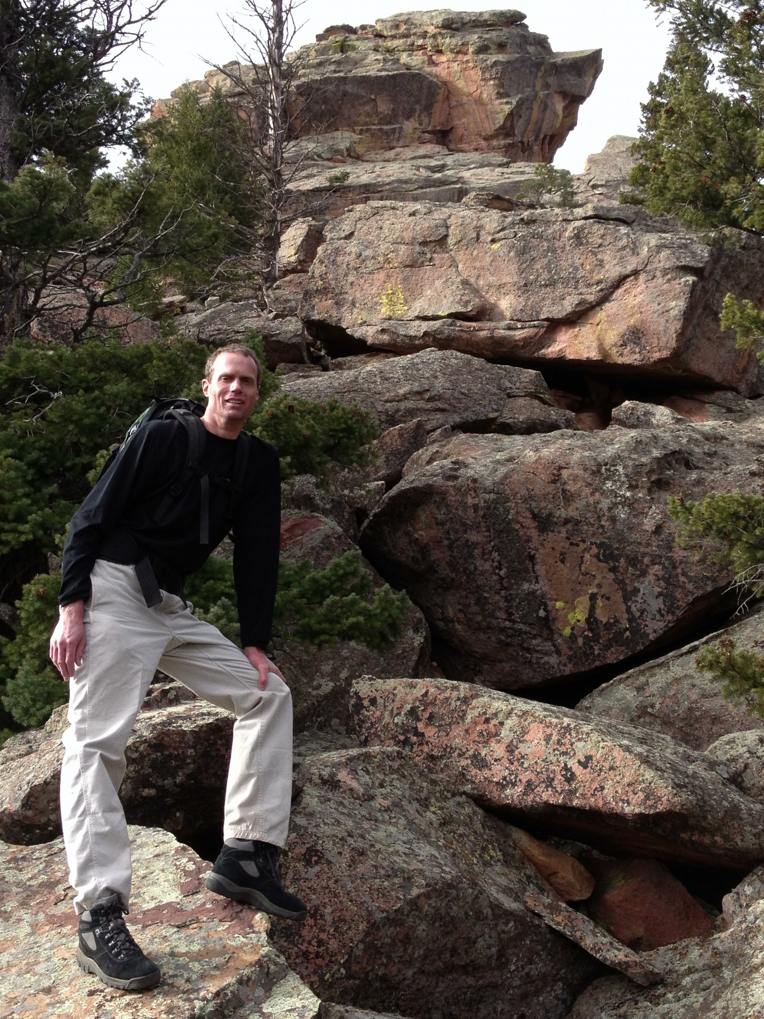
We met at the Chautauqua parking lot at 8:30am, which was a bit later than normal to allow the cold morning temperature to reach into the 40’s before we put flesh on stone.  As we navigated the flood damaged trails toward the start of the climb, we talked about the day’s adventure.  I had read the route information Brian emailed but neglected to bring the printout of the Mountain Project page.  Hoping that Brian had prepared better, I inquired as to his readiness. He indicated he had studied the page and memorized the key bits of beta.

I should point out that, at this point, my judgment remained handicapped with the misunderstanding that the route was a new route, found only on easily updated Mountain Project (MP) website.  And, while I failed to recognize the route name on the MP page as a long established route, I had placed great significance on the sparseness of the information and lack of user comments offered.  I interpreted this as evidence of a general lack of information in the climbing community.  It was a poor assumption, yet it explains that my only regret was in the forgetting to bring the hard copy I had taken such care to print out.

I announced that I’d rely on Brian’s memory as I knew almost nothing about the route.

I did happen to recall some mention that the route started “a couple switchbacks above Fandango” and so, without seeking any confirmation from Brian, I headed to that spot, the site of last week’s climb.  When we arrived at Fandango, Brian announced that we had gone too far.  After a bit of back and forth, we agreed to go up a couple switchbacks to check it out.  I thought I could recognize the start based on the photos I had seen the day before. Once we hit the next section up, we both agreed it was the right start.

Pitch 1 – the 1st roof

I thought I should take the 1st pitch since Brian would naturally want the crux roof further up the rock.  Brian agreed and indicated that the route went straight over the lichen covered roof about one rope length overhead and directly below a tree with slings.  I recalled the pitch had an ‘s’ rating indicating run-out. Brian added that there was an alternative route to the right somewhere that  was easier.  I assumed the escape right was near the direct roof, and it was my intention to find it.  As it turned out, I didn’t find it because the alternative route is the Zig Zag route start, which goes right early in the climb and stays far right of the tree with slings.

The potential for a long  leader fall is indicated by an ‘s’ (serious) … after the rating of the climb.  A climb rated ‘s’ will have at least one notable run-out the potential for a scary fall.  ~Rossiter

I slowly worked my way up the rock finding little pro to ease my mind and wandering widely to make use of the few opportunities presented. I tried to make out a path to the right, but nothing looked good.  I continued higher until I was below the thickly lichen covered roof which I  surprisingly found to be quite easy and well protected.  I pulled over the roof and setup a belay at the slung tree.

Brian quickly followed, remarking that the route finding was surprisingly abstruse.

Pitch 2 – which way do we go?

Brian took the second pitch.  He started straight up a gully that didn’t seem to lead anywhere, and then he veered right to setup a belay below the next roof obstacle.  Unfortunately, neither of us knew that the Kamikaze Overhangs route continued straight up from the slung tree past the 2nd roof and again straight up to the 3rd roof and crux.

After Brian called ‘off-belay’ but before I could fully clear the rope from my belay device, Brian started hauling the rope and jerked my belay tool from my hands.  I noted with regret, as I watch my $30 ATC-Guide Belay/Rappel Device tumble down the 1st Flatiron, that I had no backup device and had only an faint memory of tying the Munter Hitch knot that I would need for the remaining belays and for my rappel from the 1st Flatiron summit.

I followed quickly to explain the situation to Brian.  We agreed to switch-off use of Brian’s belay device so the leader would get a proper belay.  Then we took turns trying to remember how to tie a Munter Hitch.  I finally got it right (“you know it when you see it”) and we practiced a few times before I started up.

I inquired about the route.  Brian admitted he wasn’t sure whether we were on route, but he was confident (he saw a photo) we were to aim for the dead tree above the large roof about 200-240 feet up, nearly straight above.

Pitch 3 – aiming for the dead tree

I skipped some interesting looking moves straight up and instead took the path of least resistance, taking a generally up-and-right line.  I worked past the 2nd roof section and then ran out of pro placements.  I spied good pro in the dihedral some 20-30 feet up and to my right, and so I worked over to it.  I placed a perfect cam with great relief and then paused to enjoy the reduction in stress and to examine the remaining route.  At this point, unbeknownst to me, I had joined the Zig Zag route, although I almost immediately moved left of that line as I was aiming for the dead tree which was up and back to the left. Just as I was leaving the Zig Zag route, I I passed an obvious path over the roof that didn’t look very hard.  I didn’t think it could be the crux and continued past to set up the belay.  This path over the roof is also on the Zig Zag route.

I could see that the direct path to the tree was through a chimney-like weakness in the roof.  Since I recalled reading about a chimney, I figured it was the proper path and planned to belay below it if I could place a solid anchor.  Another long run-out section got to just below a section of the 3rd roof with a good horizontal crack that held three bomber pieces for my anchor.

Brian came up quickly but paused at the Zig Zag line through the roof that I passed up.  He said it didn’t look right and besides he didn’t see a fixed pin, which apparently was the key piece of evidence marking the proper route.

I told him I thought the route might go up the chimney since I recalled reading something about a chimney, and besides, I didn’t see anything else.  He said he didn’t remember anything about a chimney (it turned out that the photo with the dead tree was of a guy in the chimney, who was off-route).

  1. Ben Franklin’s Rule of Shared Information:  “Believe none of what you hear and half of what you see.”  ~Benjamin Franklin

Pitch 4 – the chimney

With no way to know that the Kamikaze Overhang crux was just around a corner further to the left, Brian took off toward the chimney about 20 feet up and slightly left from the belay.  After a fruitless search for the confirming fixed pin, he cruised past the 3rd roof obstacle.  He continued up and out of sight, running out most of the rope before stopping.  After a lengthy Munter Hitch tying session he brought me up.

I found the chimney-like obstacle to be balancy and steep but made moderate with a sold, but painful hold hold half-way up.

The rest of the pitch was rather run-out like most of the earlier pitches ending in the first (and possibly last) place it could, about 150 feet above roof.

Pitch 5 – joining the ridge line

I took the last bit of new route climbing, joining the well-known ridge line at the 2nd to last false summit.  I hoped to reach the true summit, and claim the fun finish for myself, but our 200 foot rope was about 20 feet too short.

Pitch 6 – the finish

Brian led the final bit of climbing and I quickly joined him.  The next challenge was to rappel 90 feet using a Munter Hitch.  I got the knot tied after only two tries and gutted out the free hanging rappel with a tighter than normal grip on the rope.

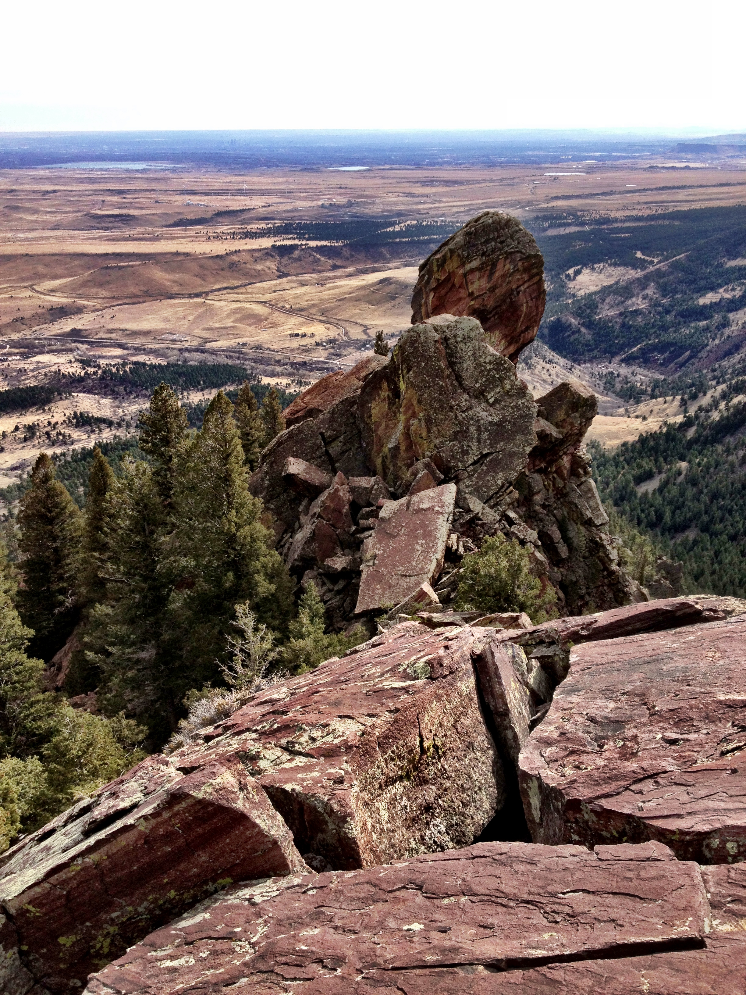
We stopped for lunch at a rocky outcropping that permitted an inspection of the route. We both spoke of later checking for more information to figure out what we’d really done. I was certain we hadn’t done the entire route properly, but I thought we had done most of it.  I couldn’t imagine we had missed nearly the entire thing after the 1st pitch.

Thinking back, now that I am safely sitting in my home office chair, I don’t know if being better prepared would have added to or detracted from the overall experience.  It certainly would have been a safer day.  Yet it was also have been a significantly less adventurous one.   There is a special stress and thrill that comes of not knowing if the route will work or if we’ll have to bail out or resort to the ultimate ignominy:  wait for rescue.

I suppose I shouldn’t rationalize about being careless, or better said, about being insufficiently prepared.  But I am certain we need to go back and give it Kamikaze Overhangs the respect it deserves.

List of Errors:

  1. Did not know where the climb started
  2. Did not know the options on the 1st pitch:  only to reach the slung tree by climbing straight up through the lichen or off to right
  3. Dropped my belay device
  4. Did not know to go straight up and over the 2nd roof obstacle
  5. Did not know how to find the 3rd and main roof/overhang:  only ‘knew’ (it was bad advice) to aim for a dead tree based on an anonymous photo of the roof route

Post Script – 11/2/2013

We went back to do it right when we had another good weekend of weather only 2 weeks later.

And, now that we’ve had another look at the rock, I would say that there is no clear route for the 2nd pitch, only blank, licheny sections of unprotectable rock that you must find a way through.  Having done so, I claim victory.  I took the 2nd pitch and looked at all options straight up and right (poor pro and slabby climbing over crumbling pancakes barely attached to the rock, and, finally left where I found adequate pro and moderate climbing difficulty.  I angled back right toward the roof separating me from the  rock layer that I correctly assumed would lead me to a belay below the crux roof.  To mount the roof I used the corner where the roof turned upward to form a dihedral.  There I found good protection for a liechen covered, thin high step.  From there I had climb straight up 40′ to reach a lower angle seam that I followed to the dihedral that I followed to just below the crux roof.

The crux roof was much better than the chimney option we took on our earlier errant effort.  Brian led the left hand option and setup a belay after only 50′ to provide a good belay for my move over the crux.

The finish was nearly identical to our previous attempt except for the amazing crowds on the 1st Flatiron ridge and summit.

kamakazeroute11022013

Bear Peak Loop and Two Noodles

December 1, 2012

December 1, 2012

The Bear Peak Loop route map - 12/1/2012

The Bear Peak Loop route map – 12/1/2012

Oh, the joy of a warm December day stolen from a frozen Winter season.  On a 70F December 1st,  Brian wanted to shift from cycling to hiking.  While I was reluctant to abandon a fantastic cycling season, I agreed to be agreeable.  My only proviso was to start small and gradually build up our fitness level, since I hadn’t done a serious hike in over a year.  In fact, it has been two years.  Brian agreed and we chose South Boulder Mountain with an option on Bear Peak.  It was a good plan.

Brian and The Maiden

Brian and The Maiden

We started up the Mesa Trail (TH at 5,641′)at 8:45am trying to remember how to hike and remember what we used to bring.  Before we could get too far into the laughing about how long it had been, we noticed a sign that indicated that the trails to South Boulder Peak were closed and there was no access to Bear Peak without hiking over to NCAR (about 5 miles) to ascend the Fern Canyon trail.

It is always a challenge navigating the arbitrary rules of the Boulder Open Space Tyrants.  I have come to feel that their rules should be broken out of principle.

I asked Brian if he wanted to drive over to NCAR or just head out to see if we could find enough adventure despite the closed trails.  He hated the thought of getting back in the vehicle and wanted to proceed.  The main idea would be to hike to The Maiden, with an option on climbing the ridge to Bear Peak (8,461′).

Brian below the Devil's Thumb

Brian below the Devil’s Thumb

We took the standard route toward Shadow Canyon only to find that  the Homestead trail was also closed.  Brian’s comment was ‘I’m glad I don’t live here.’  I couldn’t blame him.  We backtracked and took the Towhee trail to link up to the Mesa trail, hoping that it would lead to Shadow Canyon but prepared to simply scramble up the front side of The Maiden.

It all worked out and we eventually came to the bottom of The Maiden, I believe near the present end of the Shadow Canyon trail.  We turned uphill and enjoyed reliving the scramble that we’d done so many times before.  We arrived at the ridge line near Jamcrack Spire flatiron and traversed over to the start of The Maiden’s Standard route at around 10:30am.  We stopped for a drink and for a change of clothes to combat the suddenly brutal wind.

The great Flying Flatiron seen on a scramble from The Maiden to the Bear Peak summit

The great Flying Flatiron seen on a scramble from The Maiden to the Bear Peak summit

Brian was feeling strong, apparently, and wanted to opt for the ridge bushwhack to the summit of Bear Peak.  We’d done it a couple times before, so we knew it went without too much technical difficulty, but with significant physical exertion.  We weren’t in shape for such an effort, but the thrill of high places and the thought of one last day of good weather allowed us to ignore the damned consequences….and there would be consequences.

Up we went.  The first thing was to scramble back up to the ridge line.

Then, carefully creeping along the ridge line with serious falls awaiting the ‘Uncareful’ (read: other people), we progressed toward the Bear Peak summit.

The initial going was easy and allowed us to stay on the ridge to pass over the top of the Fat Iron (a very good climb, by the way, which has a spectacular view of The Maiden).

We then approached the Devil’s Thumb which is merely the highest of several impassable pinnacles on the ridge.  We dropped down to the east to traverse the low angle, east-facing rock face.  The route-finding became tricky for a short section due to exposure.  I told Brian that I didn’t know where it would lead us, but at least it was going somewhere.  Brian replied, “Good enough.”  It did in fact feel familiar; it was probably the route we’d taken to climb the Devil’s Thumb some years ago.

South Boulder Mountain burn damage from June 2012 fire, seen from near Devil's Thumb

South Boulder Mountain burn damage from June 2012 fire, seen from near Devil’s Thumb

We exited the steep face into the less steep rock below the Devil’s Thumb  (a good but short climb).  The ridge was still impassable, so we continued traversing the eastern rocks until we could enter the gully below the Devil’s Thumb and the Flying Flatiron.  Aiming for the junction of the Flying Flatiron and the primary ridge line was a good route that worked and also allowed us to reminisce about the impressive and terrifying Flying Flatiron summit.  The ‘terrifying’ aspect related to the temporary nature of the pile of rock comprising the arch summit.  When it goes down someday, you don’t want to be on it.

At that point, we were able to scramble back to the ridge where we could see the an impressive view of the Devil’s Thumb, and we could also begin to see the fire damage from the June 2012 “Flagstaff fire”.

Then we hit a section of ridge that we had some memory about…it was a bad memory.

Looking back down the ridge toward Devil's Thumb and the Plains below

Looking back down the ridge toward Devil’s Thumb and the Plains below

The ridge line looked impassable  but we recalled it was just barely passable for the distance required to reach the next milestone, the Angle Wings.  And ‘barely passable’ was good enough as there was no other way to proceed, either via the east face or by descending to the west.  We slowly crept along the cliff face just west of the ridge line, taking care not to fall to our deaths or get into a jam that would require serious risk-taking to escape

Brian was back in his old form, moving without hesitation and finding the least risky path.  By the time we reached the Angel Wings, we were able to descend to the ground to hike up to the north end of the Angel Wings Flatiron.

We stopped for a drink on the crest of the south end of the Bear Peak ridge.  It was a wonderful 50’x50′ spot that was begging for a tent.  And, it was 11:45am…and I was getting very hungry.  I said out loud that we had 15 minutes to reach the summit.

After the enjoyable pause, we started back up toward the summit, but now we were on the edge of the burn area.  We moved even more carefully as we tried to avoid becoming covered in charcoal   After about 50′ Brian said, “I’ve been wondering about the orange color that seems to only be on the tops of the branches and logs…do you think it is fire retardant?”  Of course that was the answer.  Heck, I hadn’t even noticed.  With now another thing to avoid, we were happy to leave the edge of the burn area after only a few minutes.

Brian resting on the edge of the burn zone from the 'Flagstaff Fire' of 6/2012. Bear Peak is visible in the distance.

Brian resting on the edge of the burn zone from the ‘Flagstaff Fire’ of 6/2012. Bear Peak is visible in the distance.

The rest of the way was uneventful except for the increasing hunger.  I managed to get us lost again on the final climb up to the summit block.  We ended up taking the exact same path as we did in 8/2011 when I crawled through a tree infested with ladybugs and inadvertently carried away one million of the little gals.

We reached the summit at 12:30pm.

It is always true, the hungrier I am, the better my food tastes.  My two peanut butter Cliff’s Bars were the best food I’d eaten in months.

After such a hard effort to reach the summit, we are always reluctant to leave.  I suppose there are many reasons.  But the cold and wind was persistent and I was losing the body temperature battle, so we left after 30 minutes.

Joe insists on a summit shot...Bear Peak

Joe insists on a summit shot…Bear Peak

And now we would pay the price of stubbornness   Since Shadow Canyon was closed from the top and we didn’t move the vehicle to NCAR, we’d have to hike down the Fern Canyon trail and then hike 5 miles back to the South Mesa trail head   Yuck.  At least our biking fitness was holding up to the hiking/scrambling effort.

We quickly worked our way down the exposed summit ridge, like two mountain goats who had never taken a break from hiking.  I felt true pleasure from the overdue exercise of skills long in the making.

And then, down the Fern Canyon trail.  Down, down, down.

After about 0.25 mile, I could feel that my legs were getting tired.  It was a bad feeling, since I was so many miles from my 4-Runner…and had so many feet of elevation yet to lose.

After another 0.25 mile, I begged for a rest.  I hoped that a short reprieve would revitalize my muscles…but no.  It was then that I knew I was in trouble.

A look back at the ridge line we traversed to reach Bear Peak.

A look back at the ridge line we traversed (left to right) to reach Bear Peak and then descend the opposite direction to complete the Bear Peak Loop.

Heck, I knew I’d make it home, but I KNEW I was going to suffer for days for my brazen disregard for the laws of physics.

Down, down, down.  My legs were mere noodles.  I was just trying to control the fall as I resisted gravity with every muscle, ligament and bone at my disposal.

After an eternity, we reached the cut-off for Shanahan Trail, which we took to reach the Mesa Trail.  And then only another 4 miles to reach the car.  We made it, naturally, and, I only twisted my ankle twice in the process.

6.25 hours, 8.5 miles RT and 2951′ of elevation gained (and lost!).  What happened to the ‘start small and gradually build up our fitness level’ plan?  My legs were getting stiff before I got into my 4-Runner.  I was in for a rough recovery.

Post-Script (12/3/12):  I have barely moved in the last 36 hours, and have little hope of improvement for another 36.  (12/5/12):  I am still too sore to move correctly but am now certain that I have not permanently crippled myself.  I expect to be ready to go again by the weekend, but no sooner.

Brian’s comment via email on 12/3/12:

Joe:
Our basement staircase took on a malevolent side yesterday, bringing fear every time I went down.  Like the Amityville Horror.  The stair rail got more use than it had all year.
Brian

bearpeakloopsatmapfinal2

Winter Tangen Tunnel

February 18, 2012

February 12, 2012

Ah, sweet success.  After many years of trying the Tangen Tunnel route in winter, Brian and I finally succeeded.  And it came on a day when neither of us expected to succeed due to a late start (my fault) and the highest amount of snow we’d ever seen in the Flatirons.  But once we neared the top, the prospect of retreating down that snowing, icy hell hole was so horrifying that we continued to push on and finally made it.  Heck, we got back to the parking lot with over 30 minutes of daylight.  What a great day!

We came, we saw, we tried like hell, we barely made it.

The start to the Tangel Tunnel route in winter

We started planning the weekend to be our first ski day of the season despite the continuing poor ski conditions (historically low snowbase).  But I had a problem with a toe and couldn’t risk death by ski boot. So I left the choice to Brian with a suggestion of the Tangen Tunnel as an “aggressive” alternative.  I also indicated, unhelpfully, that I could not do an early start due to a commitment.  I suppose I knew that this ruled out success on the Tangen Tunnel route which takes a long time even in good conditions, but that is what came to my mind at that moment. The real problem is that the Flatirons have had so much snow that I just didn’t know what to suggest.

Brian picked Tangen Tunnel route.  (Me and my big mouth, eh?… at least we’d get some exercise, and be outside).

Start

I spent much of my time-constrained morning digging around for my snow gear not seen since the previous spring, and I just couldn’t get to Chautauqua park before 10:15am; but I was better prepared than usual.

We set a good pace up toward the Royal Arch and reached the bottom of the Tangen Tunnel route a bit after 11am.  We could see that we’d be swimming up the route, so we took time to get on all the gear:  insulating liner jacket, gators, warm hat, helmet, and harness, and then we set off.

Snowless images of the initial cave entrance and exit (photo from Fall)I made it 10 feet before being stopped by a 6 foot tall boulder covered by soft snow.  Slipping and sliding, and failing to find purchase on snow flavored air, I eventually resorted to stemming on the icy rock face of Tangen Tower and hooking rock overhead with my ice axe to inch my way over the first obstacle.  During the summer, this obstacle represents a barely noticeable, small scramble; on this day it was a 15 minute puzzle.

Now we knew for certain it was going to be at least an adventure (but hopefully not an epic one).

Epic (climbing slang word)

A climber’s slang term that refers to a big climbing adventure and all the bad stuff that happens on it, like ropes getting stuck, being benighted on a ledge, getting caught in a bad storm, or wandering off route.

~(http://climbing.about.com/od/climbersslang/a/EpicDef.htm)

(1) The 1st Cave/Tunnel

Rabbit Hole #1: the escape hole from tunnel #1 on the Tangen Tunnel route

The rest of the swim to the 1st cave / tunnel was easier, but once inside the cave it was not clear if we would get through it.  When I stopped to look around to remember the path upward, Brian started climbing.  From 10 feet up, he announced that the obvious path didn’t go all the way; but he did think he could wriggle through a slot to get out.  As I watched, he slithered like a snake and was gone.  My turn.

I followed his path and found I could just squeeze under a hanging boulder to reach the exit hole, but once through I could not safely turn around to crawl out.  As I layed there pondering my next move, a rope with a loop tied on the end fell down into the hole.  Good ‘ol Brian to the rescue!

With a secure belay, I managed to maneuver my body around to get a grip on the rock above.  I pulled up and then risked weighting a dead branch wedged in the hole.  The last required move was a high step onto a packed snow cornice that was supported by naught but air.  It held.

I glanced at my watch at saw that it was 12:15pm; we had already burned 45 minutes…to travel about 100 feet.

Joe contemplating his future while looking at the next section of snowy, icy rock.

I then turned and followed Brian uphill, losing a step in the knee to thigh deep soft snow for every two taken.

We quickly learned to stay near the 4th Flatiron rock face where the snow was firmer, perhaps due to snow melt dripping down during the sunny days since the big dump.  Of course, this was also where we faced the risk of falling icicles, which were falling more and more as the sunshine did its work high above us.

As a side note, I always have a mental image of the Tangen Tunnel route as a narrow gully with rocky obstacles.  But somehow I am always surprised on each visit of the wide possible path and the myriad of choices that must be made correctly to stay on route.  At least I remembered that the key was to ‘bear left’…a lesson learned by trial and error over the years.

Post Script:  having just returned to the Tangen Tunnel route (2 months later) I can report that it is a narrow gully with rocky obstacles that appears to be a wide open space when all the rocky obstacles are covered by a thick blanket of white, white snow.  There are few options for completing the Tangen Tunnel route; perseverance is required in all cases.

The entrance to tunnel #2

Just past the start of the 2nd piece of the 4th Flatiron, we came upon a tiny cave entrance.

(2) The 2nd Cave/Tunnel

Brian ducked into the small entrance as I approached.  By the time I crawled to the back of the cave, Brian had crawled out of the 2nd rabbit hole, leaving his pack behind to make his escape.  I handed up his pack and then mine, and then it was my turn to slither skyward.

I found that a layer of clear ice covered much of the rock, and snow falling from above covered the rest.  I got Brian to give me another belay and then made the slippery moves to crawl out.

Looking up at Brian from inside tunnel #2

As I pulled my head above the snow surface, I saw a block of ice the size of a soccer ball plunged from the rock above into the snow 4 feet from Brian. It was an off-target kill shot.  All Brian heard was a muffled but insistent, ‘WHOMP’, as the deep snow cushioned the impact.

The sun was warming and now sufficiently loosened the ice on the exposed rock above; it was time for extreme caution.  And, not wanting to stand in any one place too long, we quickly packed everything away and then continued our ascent.  It was 1pm, and time for a lunch break…if only we could find a safe & dryish place to stop.

We continued up the soft snow, overcoming many snow-covered rock obstacles along the way.  Before long we could see another cave in the distance, in a section of rock that seemed to block our path.

From a distance, the 3rd cave looked much better than the 2nd cave, but we didn’t recall crawling out the back of this one before.  As we got close, it became clear that the cave was not a part of the path as it wasn’t a ‘tunnel’.  But we could skirt it by taking a steep ramp to the left, and it did look like a dry place to sit without fear of falling icicles.  After a bit of deft icy rock scrambling and rock hooking, we settled down for a rest and lunch.  It was 1:30pm.

Brian approaching ‘Lunch Cave’…a surprisingly dry and safe spot to rest and refuel.

(3) The ‘Lunch Cave’ 

Finally, we could add some fuel to the fire.  I had purposely brought no more food than I thought I needed to keep from eating extra for no reason.  Unfortunately, I didn’t leave room for a ‘need more food’ scenario.  I ate my 2 bars and drank a liter.  Now it was just a race to the top (and then bottom) with the sun, hoping not to bonk along the way.

I mentioned that I hoped we could make it to the top to avoid the ugly series of rappels we were doomed to take on the retreat.  Brian reluctantly admitted a lack of confidence in our chances.  I had to admit that the late start didn’t help.

And, just at that moment, as I was looking out of the cave entrance, facing down the mountain, a 100 lbs collection of icicles I had admired (and photographed) over my head a few minutes earlier came crashing down…right onto our tracks in the snow.  Wow.

100 lbs chandelier hanging above the Tangen Tunnel trail

Despite the excitement, sitting on a cold rock, even a dry one with overhead shelter, doesn’t work for long on a cold day.  We left after 10 minutes.

Crawling up and over the escape ramp turned out to be very hard.  We succeeded only by discovering that we could sink our ice axes into the rotting wood of fallen trees and then pull up to gain a bit of altitude. Thunk, thunk, thunk, and then we were past the ‘Lunch Cave’.  I think it is fair to say that this technique plus the ability to hook rocks beyond arm’s reach made all the difference between success and slippery futility.

The next milestone would be the end of the 2nd piece of the 4th Flatiron.

Old Bivy Cave

As we approached the end of the 2nd piece of the 4th Flatiron, I recognized another cave that Brian and I had used several years ago on a failed winter attempt.  We used the cave to rest and light a small campfire for a bit of warmth while we ate our lunch.  At that time we had been lost and decided to turn around to avoid a disaster (‘epic’ adventures make for great stories, but no rational person purposely seeks to experience such days).  It was interesting to discover that we were right on route except for the last decision to head right, which we eventually abandoned before returning to the cave.  This was also the day when we learned to ‘bear left’ on earlier decisions.  It was also the correct choice on this particular route-finding decision.

The objective: Green Mountain summit.

Passing underneath the start of the 3rd piece of the 4th Flatiron was a challenge.  The open space beneath contained thigh deep snow that was too soft to stand on.  I suppose it collected all the snow rolling off the steep section of the Flatiron.  Whatever the reason, it was the worst struggle of the day; but at least we were safe from falling ice or slipping off icy rock.

We could tell that we were nearing the top, but it was after 2pm and daylight was expiring (2-3 hours remaining, at best).  Our current plan was to get to the top and see if we could tell where we were, and figure out the best and fastest way down.  I mentioned that we had several options if we couldn’t find a path to Green Mountain.  I said we could drop down into Skunk Canyon or we could head down toward the 3rd Flatiron.  I felt that we could make it down those paths easier than we could our ascent path; but it was clear that the best way was to prevail in finding a way to Green Mountain’s Greenman trail just below its summit, and then follow that trail down to take the Saddle Rock trail to the bottom.

Joe posing at the high point along the 4th Flatiron ridge below the summit of Green Mountain…our escape is assured

The feeling of desperation was evident in our continuing high energy output. Higher and higher, and by finally by 2:30pm we could see down into Skunk Canyon.  We had made it to the top of the 4th Flatiron.  Naturally, nothing looked familiar. But we reasoned that all we needed to do was hike west, but from every past experience on this section of rock we knew it would be hard.  And with the amazing snow cover, it might be impossible.  Let’s just say that a high stress level was a reasonable reaction.

Now we had to bear to the right, just slightly.  And every break in the trees would lead to an examination of the possible paths down.  If we couldn’t find our way to the Green Mountain trails, it was going to be a hard night.

We kept getting cliff-ed out, and then barely finding a scramble down, we continued making progress toward our goal.

Post Script:  the key is to stay on the ridgeline and find a line of least resistance (which is sometimes the only possible path forward)

(4) The Top (of the ridge)

And suddenly, everything seemed to be below us.  One final outcropping of rock and then it would be an easy stroll to Green Mountain’s Greenman trail.  It was only 3pm!  And we could see the Green Mountain summit!

We were going to make it and with time to spare.  There would be no stumbling down in the dark this time.  I felt so good that I insisted that I get a ‘summit’ photo.

The rest of the route finding was merely an exercise in not losing much elevation, and not gaining much either.  I knew that if we looked to the right while we stayed near the ridge line, we’d see a split rail fence marking the trail.  And, at 3:15pm, we found it.

(5) The Green Mountain Trail

Brian pausing on the trek back to the parking lot for a posed shot behind the 1st Flatiron

The Greenman trail was in beautiful condition for an easy, snow cushioned descent.  We decided to skip the Green Mountain summit, discretion being the better part of valor.

I predicted a 4:15pm arrival at the parking lot and was only off by 5 minutes.  It was a 6 hour round trip.

I can remember when 6 hours was one-third of the hard day, but I was glad to be driving home.

10,000 high steps had taken their toll on an old man.  Carpe diem memento mori

P.S. – I was sore for 4 days.

See all Trip Reports

Alpine Flatiron

October 9, 2011

The first day of the snow season brings a double-sharp sword:  the body’s ability to cope with cold is at a low point which combines with the mind’s poor memory of (and ability to prepare for) the cold. Such a day can cut clean through the self-deception of a risk-less rock climb.

Brian and I knew the weather would be colder, as in the 40F area, and rainy. But Saturday was the only day we could get out, and since we’ve climbed the flatirons in the rain before, we decided it was no big deal. I remarked to Brian that the cooler weather would keep away the lightning, so we shouldn’t have any problems.

We met at the Chautauqua parking lot at 8:30am, both of us wisely with full waterproof shell gear.  I even had a light sweater and liner gloves, just in case.  I thought about bringing a heavier jacket but couldn’t fit it in my pack and didn’t want to wear anything hot on the hike in.  I also could not find any waterproof gloves, but I figured I would be okay with wet hands for only a few hours.

We started up toward the 3rd Flatiron (39.98760, -105.29163) in a light drizzle.  Along the way, we could see the snow dusting that had fallen and stuck to the trees up high on Green Mountain.  We didn’t think it would be too bad.

We were wrong.

A view of Chautauqua Park from the 3rd Flatiron on a snowy rock climb

Naturally, we were alone on the rock. We started up, taking the easiest possible path along the East Face of the 3rd Flatiron.  On a normal day, it would be easy enough to skip a rope (only a few spots as hard as 5.4).  But lichen-covered rock dripping wet in a steady light snow, we knew it wouldn’t take much bad luck to create serious problems. Let’s just say that our progress was justifiably slow.

Within the first 10 minutes, I was very sorry not to have brought more clothes. I was thinking, what kind of idiot goes out to climb in a snow shower without waterproof gloves or even a warm hat, for the love of God.

With my core getting cold, my exposed hands were doomed, and they got worse and worse until they refused to function properly. The climbing gear was nearly impossible to manipulate with immovable fingers.

Fortunately, the climbing required few hand holds.

At first, I stopped every 20 feet to warm my hands on my legs; it helped well enough to get me to the first belay. I told Brian to continue leading if he was able; I was too cold and needed some time to warm up.

He said he was okay and so organized the rope and gear as I jammed my hands inside my clothes to warm them against my belly skin.  My core was warm, but I swear my hands won the temp battle and cooled my core instead of the planned opposite impact.

A view of the First and Second Flatiron from low on the 3rd Flatiron, as the weather worsened

After 2-3 minutes, I accepted failure and put my liner gloves on and made ready to belay Brian.  He took off just as the sky started snowing harder, throwing large clumps of snowflakes. Within a few minutes, my gloves were wet and worse than useless.

We repeated this process 3 times, with the weather getting worse and worse.  On the 4th pitch, my hands were completely gone and my feet were starting to get numb.  I knew I had to get off the rock quickly before I lost the ability to get down at all.

When I reached Brian in the notch below the final pitch, I told him I had to skip the final pitch and scramble to the rappel anchors from there.  He agreed as he had finally succumbed to the elements as well and was shivering like a wet rat.

Brian climbing through a wet, heavy snowfall on the 3rd Flatiron

It was my job to move the belay through the escape gully, but first I had to get some functionality back into my hands.  Once again I jammed my claws down my pants to find warm skin.  This time, I had to endure the thawing agonies that we all know so well.  I was yelling out loud to disrupt my mind’s focus on the pain.  After five minutes, my hands started working again, and in addition, the adrenaline from the pain had warmed up my entire body and mind!  I’m sure it helped that I was sheltered from the wind throughout the process.

I moved the belay and setup the rappel.  I quickly rapped down to the rap ledge and then traversed west to the second anchor where I clipped in before taking myself off rappel.

While I waited for Brian, I could see that the wind blowing south was fierce.  On a south-facing ledge, we were protected for the moment; but soon we’d have to step and rappel into that freezing hurricane.  I was thankful for not facing it all the way to the summit.

Brian quickly followed.  He pulled the rope and handed me an end that I used to setup the 2nd rappel. I clipped in and stepped over the edge.  Only 75 feet from the ground, I was almost safe. Almost.

Brian escaping the brutally cold wind after the descent

About 1/3 of the way down, I noticed that the rope dangling below me had been blown around the corner of the arête and been tangled on rock features seemly designed with deadly intent.  While hanging in a freezing wind, clawing my way toward the snagged rope, the thought ran through my mind:  if I cannot clear the rope quickly, I’ll die here today.

I attempted to clear the tangle as my brake hand (holding my weight on the rope) slowly lost feeling. I couldn’t quite get far enough around the corner to see what the rope was caught on, so I kept flipping the rope in hopes of clearing whatever it had gotten hooked on. After 4 attempts, the rope fell clear.

Then the wind blew again and the rope below me swung around the corner to get caught again. Once again I clawed my way to get as close as I could, and finally was able to clear it.  Before heading down I looked to see if any more tangles would impede my retreat, and could see a massive knot in the ropes well below me, blowing far out to my left in the wind.  My heart sank for a moment until I realized that I could reach the ground before needing to clear the knot. I was safe!

After reaching the ground, I cleared the knot and then scrambled to find some shelter from the hurricane winds while I waited for Brian, who soon joined me for a snowy scramble back to civilization and warmth.

I know it sounds rather pathetic, my near brush with disaster while doing a 5.4 rock climb in the Boulder Flatirons.  But I have to say that Brian and I both felt that we could both be pleased that we found an adventure and persevered on a day when a self-inflicted adventure was all we had time for.

I suppose it is true, adventure is where you find it. And, twenty-four hours later, my fingertips are just starting to regain feeling.

Angel’s Way

August 8, 2010

Sometimes, the adventure is found in just getting in and getting out; but as long as its in there somewhere, it is all good.

With an ankle under repair, I was limited to a short sort of adventure. Brian suggested Angel’s Way, a Flatiron’s route we’d found only a few months earlier and put on top of our Flatiron to-do list.

Angel's Way is the 3rd rib on the north side of Skunk Canyon, sandwiched between Satan's Slab and Mohling's Arete

August 7th, 2010, was going to be a hot one; the high temperature forecast was 96F. To beat the heat, we started from NCAR at 6:30am; but, it was already in the 70’s.

(Position #1 on map)

I had a vague memory of having to hike back down the main NCAR road to find the path leading to the water tank on top of the hill separating us from the Mesa Trail. Brian agreed and we found ourselves hiking through tall grass that made me think of Africa.  I kept wondering if I’d find a sleeping lion in the grass until my mind hit on a more likely scenario:  snakes.  Yikes!

Our Angel's Way map and reference points along the way

My pace was energized by my worrying about my route-finding mistake so early in the day.  Fortunately, we quickly came upon a super high quality trail/road. Heck, it looked brand new.

We then quickly worked our way over to the Water Tank (passing the correct trail junction along the way) and then down to the Mesa Trail.

(Position #2 on map)

We followed the Mesa Trail north for a couple hundred yards before exiting the trail at the end of a switchback, heading west toward Skunk Canyon on a climber’s trail.

Before leaving the Mesa trail, we had been quizzed about our wearing long pants on such a hot day; the sea of poison ivy on the climber’s trail justified the extra water loss. We were forewarned.  We were also warned about the shocking bushwack and route-finding needed to reach the base of Angel’s Way, but we were not prepared for the confusing directions provided to guide our efforts.

Here is where I’ll officially complain about the poor quality of information available to guide us to the base of the climb.  I don’t mean to say that all the information was incorrect; it was all correct.  The problem is that the people providing the information were not thinking about the uselessness of a description that while correct cannot be used to distinguish the right rock or path from many other wrong ones.  Much of it was so bad that it actually seemed to be contradictary, for example:

“It (the 3rd rib) is about 100 yards west of the [2nd] rib that forms Satan’s Slab”

vs.

“The Third Ridge is almost abutting the Second and the gully that separates them is very narrow”

Note: both of these statements turned out to be true, in one way or another

I know, I know.  All we had to do was count the ridges, right? The third ridge comes right after the second ridge which is preceded by the first ridge. And while there is no hiding from this fact, it is only useful if it is obvious what makes up a ridge when you are standing far below them, and for only as long as you knew in advance to avoid losing track of what you’ve already passed.

Neither of us managed to succeed with either requirement. Fortunately, Brian did bring along his brain which proved helpful in isolating the important data and using it to reason out the correct conclusion.

(Position #3 on map)

After considerable debate of the information and our observations (collected via hiking back and forth between the ridges in dispute), we finally found the start to Angel’s Way at 8:30am, with a route-finding cost of about an hour.
To summarize, follow the creek bed and keep careful count of the ribs of rock to the right.
  1. The first rib is Stairway to Heaven; the ridge starts with an overhang.  There is no directly opposing rib of rock on the left side of the creek bed.
  2. The second rib is only 50-100 feet further west and is called Satan’s Slab; the ridge ends in a steep slab that slopes down to the very edge of the creek and meets another rib of rock coming down from the left side of the creek; the two ribs block the creek from easy passage.  Once past this obstacle, you are below the backside of Satan’s Slab.
  3. To find the third rib, leave the creek path and head North following a faint trail.  Continue up and west for 100 yards to find the unimpressive start to the 3rd rib, Angel’s Way. This rib does not reach down into the creek bed
  4. If you continue past Angel’s Way for another 100 yards, you will find Mohling’s Arete.
(Position #4 on map)

Angel's Way Route

After such a confusing start to the day, it was gratifying to finally start climbing and find the climbing to be very enjoyable.

We completed the climb in 8 pitches.
  1. Pitch 1: Brian insisted on starting from the bottom of the ridge for his personal sense of aesthetics, a 15′ exposed climb led to the ridge which he climbed along  for 200′ before belaying in a nice shady spot next to a tree
  2. Pitch 2: I climbed under the ridgeline in a low-angle dihedral to a roof, and then mounted the ridge top and climbed to an exposed belay after approximately 180′
  3. Pitch 3: Brian continued along the ridge for 30′ before stepping climbed near the ridgeline for another 180′.30 feet into Pitch 3 is where I stepped over a horizontal tree and avoided clipping it.  After that came one of the occasional steps in the ridge.
  4. Pitch 4: I climbed up a dihedral and then over some easy rock for 200′
  5. Pitch 5: Brain started up a very boring start, but after 30 feet came a hidden dip in the ridge had a short steep wall on its other side. He then traversed over some dark-colored rock to regain the ridge, and then belayed in the middle of dull-looking spot after 180′.
  6. Pitch 6: I continued up the ridge for about 50′ to find another notch in the ridge.  This notch created a relatively hard required move (I thought of it as the crux), after which the pitch turned into another easy traverse, but this time below the ridge crest which cliffed-out at the end of a big notch in the ridge after 150′.  I climbed down the ground to set up the belay.
  7. Pitch 7: Brian moved the belay up the slope a bit, and then he climbed a steep wall under a tree to reach the ridge
  8. Pitch 8: I led the short climb to the summit, which had better pro than we’d been led to believe

(Position #5 on map)

We did a belayed down climb from the summit and then north to reach a likely down climb.  I should say Brian thought it looked likely, but when I moved the belay to the official ‘rappel tree’ I surely didn’t like the look of it.  Brian allowed me to go first and take the belayed down climb while placing gear to protect Brian’s descent.  I couldn’t figure it out until Brian lowered me past the crux where I found the necessary footholds that Brian shortly used to join me at the bottom.

We then scrambled down the next section before packing away our gear and switching into hiking boots.  We contemplated returning to the start of the climb, but since we had brought our packs along to avoid having to go back down the ridge, we were loath to crawl back into the poison ivy pit of death.

Instead, we started hiking east.  We figured we’d find a way to get to the Mesa Trail and we used Brian’s research into booze to pass the time.

It turns out that Gin, Whiskey & Vodka are all very similar forms of liquor.  Back in the day, the problem with Whiskey was its harshness out of the still.  The only way to make what was essentially Vodka, palettable, to “anyone other than a Russian”, was to put it in wood casks and let it sit for a few years.   That is, until some enterprising Belgian doctor discovered that if you put Juniper berries in the un-aged whiskey and distilled it again, you got something tolerable.  It is called Gin.

If this is incorrect, talk to Brian

(Position #6 on map)

After a considerable amount of bushwacking down and across a moderately steep forest of small pine trees, we broke out onto a talus field.  At this point, we could see that we had been heading a bit NE instead of E, but it was going to work.  We reached an old road cut into the talus which we followed NE for a 100 yards to its end, and then we scrambled further down the talus to reach the current Mesa Trail.  We turned south and hiked toward NCAR.

(Position #7 on map)

It had been a hot day, but really it was not so long compared to others we’ve done recently.  We powered back up to the water tank and then took the proper trail toward NCAR.  A few hundred feet of hiking got us back to the car at 2pm.

My first thought was that now I get to cross off one more flatiron from my endless list of flatirons not yet climbed. I haven’t done much of that in the last few years; if I don’t pickup the pace, I may never finish that list.

See all trip reports

See Boulder Flatiron list

2nd Flatiron Waterfall Climb

June 16, 2010

Brian and I had scheduled a Lumpy climb for Saturday, June 12, 2010; but the weather didn’t cooperate.  After a month of hot, clear weather during which Brian skiied and I did therapy on my knee, the forecast for our rock climb was rain and cold.  Thanks.

But the forecast for Sunday looked better, so we agreed to push the plan back a day; and in addition, we agreed to move the climbing to lower elevation. We agreed to go to Eldo if the weather was good or Flatirons if the weather was bad.

We didn’t have a plan for very bad weather.

When the forecast turned to “rain all day”, we agreed at the last moment to do the 3rd Flatiron.  We’ve done the 3rd in snow and ice; we felt confident we could do it in a steady rain as well.

We started hiking from the Chautauqua Ranger Station parking lot around 8am, taking the old paved road to avoid the muddy trench that the main trail becomes when wet. It was steadily drizzling into the standing puddles that had accumulated over the past 2 days of rain. On the hike in we discussed Paul Graham’s essay on Why Nerds are Unpopular (in school).

At the turnoff the Royal Arch trail to the 2nd/3rd Flaitron approach, Brian stopped to look at the “Rock Climbing Closure” sign.  Shit.  We’d forgotten about that stupid raptor closure program that I’ve had to contend with since before I moved to Boulder many years ago.  The 3rd Flatiron was closed until the end of July.

There is no nonsense so arrant that it cannot be made the creed of the vast majority by adequate governmental action.

~Bertrand Russell (1872 – 1970)

Neither of us had a guidebook, so we resorted to mining our failing memory about past climbs and unclimbed objectives that might work under the current horrendous conditions.

My first comment was that the Tangen Tunnel route would be perfect except for the blanket of Poison Ivy living in that particular gully. I then offered the idea to finally climb the Royal Arch, but Brian rightly thought the climbing would be too steep for exceptionally slippery rock.  Brian then suggested the 1st Flatiron, but there was no way I was going up the steep East Face Direct in a steady rain.  I’ve done it wet by accident; I wasn’t going to do it intentionally.  Then I had the idea to do the 2nd Flatiron.  I remembered someone telling me about the “Highway”,  a 4th class route that went up the gully between the South Block and the main portion of the 2nd Flatiron that led to the Hanging Garden below the “Pullman Car” that capped the 2nd Flatiron.  Of course we’d skip the Pullman Car, I said.  The route had been described to me about 10 years ago, but it still felt fresh in my mind because I had thought about it every time I’d climbed the 2nd Flatiron. Brian agreed and we started for the base of the 2nd Flatiron.

Unfortunately, I was completely wrong.  The route was not “Highway” but “Freeway” and that route doesn’t go up the gully but rather up the face well to the right of the gully.  The route that does go up some of the gully is “Dodgeblock” but it starts differently and dodges the Pullman Car to the right; it does not go left of the Pullman Car and into the Hanging Belay.

In fact, no established route, 4th or 5th class, goes up the gully all the way to the Hanging Belay. I misunderstood what I was told about “Freeway” all those years ago and I never bothered to check it out. My foolishness would be the catalyst for an interesting day in the rain.


The 'Waterfall' route and our other regular routes up the 2nd Flatiron


On the way there, the weather actually worsened.  It was raining hard by the time we started up the vegetated gully.

Position #1

About 100 feet above the hiking trail, we stood beneath a house sized boulder choking the gully.  It looked like we might be able to work up and around to the right, but Brian wanted to try to climb the left side up a low angled dihedral. We got our harnesses on and then he started up in his hiking boots. He refused a belay.

Under the current conditions, I surely did not want to be standing beneath him when he came sliding back down the slip-n-slide.  It would have been a bad tumble back down the rocky, tree-filled gully.  I stood off to the side and encouraged him to request a belay. He explained that the rope might let him avoid getting so wet and dirty (he was laying on the rock for full body friction), but ‘no thanks’. Apparently, he was working on his mental toughness.  Fortunately, he made it to a small ledge with injury only to his clothing.

I took a belay and managed to avoid the mud wallow Brian endured, but it was very sippery. I was very glad to have the belay. I continued up the next obstacle and setup a belay behind a large tree another 50 feet above.  It was a wet, gooey, slippery experience, not significantly different from how I would imagine the experience of climbing a waterfall with mossy vegetation beneath the water.

Position #2


Our route followed the rock seam and then the tree lined gully toward the 'Hanging Garden'. Photo not from rainy day (imagine torrents of water pouring down the gully)


We then scrambled up another 100 feet to reach the bottom of a true waterfall. The water was cascading down a broad slab of smooth rock with a channel cut just below a rib of rock; the channel looked to be cut into the rock by thousands of years of running water. The slab of rock blocked easy access to the tree-filled gully 100 feet above. Uh oh.

With most of our views obscured by trees and by the heavily falling rain & mist in the air, I wasn’t sure where we were.  At first I (wishfully) thought we were underneath the Pullman Car, but it was just the overhang on the South Block.  I noticed another gully to the right (north) and thought I had found the way up; we traversed north 50 feet and then scrambled up 50 feet to were I could see well enough to know where I was.  We here standing at the bottom of the gully that we use to reach the bottom of the Pullman Car on our normal 2nd Flatiron route (which is similar to Free For All).  I remembered that this water-smoothed gully is steep with delicate climbing when dry and in rock shoes, and that the only escape I knew was the 5.6 traversing crux underneath the Pullman Car.  No way we were going to do that in these conditions. Shit.

That was when I knew that I had screwed up.  We weren’t going to make it. If we were going to push ahead, we’d have to commit to a risky effort. Turning around was a solid option, in my mind.

Position #3

We returned to the waterfall and Brian said he wanted to try it. I tried to talk him out of it as I thought the protection would run out after 20 feet. My point was we were in a good place to bail from, while 50 feet up with no way to secure a rappel would not be a good place to decide to go home. But Brian was feeling adventurous, I suppose; and he started up the waterfall. At least, this time he took a belay.

But, the rock was too slippery for hiking boots, and we figured rock shoes would be worse.  He slid back to the ground before putting in a single piece of protection, and gave up on the waterfall.

Position #4

I looked around and then pointed to a seam and a potential ramp in the rock above us and to the left, just below the South Block.  I wondered out loud if that would allow us to work our way above the waterfall area. Brian jumped to it, apparently determined not to go home just yet.

He led a scrambling pitch to a saddle between the waterfall gully and the South Block of the 2nd Flatiron.  From that platform, we could see the diving board flake that is the crux of the Southeast Ridge route on the South Block; it’s a 2-move route, but it is awesome set of moves. We could also see that our best bet was the seam in the rock face that led toward the tree-filled gully.

Brian again took the sharp end and oh-so-gingerly worked his way across the slick rock using the rock seam.  The seam provided just enough protection and friction to make it possible to cross this amazingly slippery rock in hiking boots while dragging a 20 lbs rope (soaked with water).  Brian yelled that the slabby bit at the end (after the seam ended) wasn’t as bad as it looked from afar.  When it was my turn to cross it, I complained that it was exactly as bad as it looked.  Yet, we both made it without a slip.

Position #5

And once we were past the waterfall area, I felt sure we would make it.  Despite all evidence to the contrary, I still clung to a certainty in my mind for the climb-ability of the gully beneath the Hanging Garden that I had casually glanced at on a number of occasions over the years. It surely was a day for being very wrong.

A 20 foot scramble led to another waterfall, and this time the water fell over an overhanging lip of rock; we wouldn’t be climbing directly up it. We found a path to the right that required a significant reach to utilize a hold big enough to pull our bodies out of the falling water. As I pulled my gore-tex protected bulk out of the water, I could feel the difference between a good rain jacket and a dry suit; I could only wish for the latter.

Position #6


The 'Waterfall' route crux


Another 20 feet of scrambling led to another waterfall, and this was a big one. It was directly below the Hanging Garden between the summit of the South Block and the Pullman Car atop the 2nd Flatiron. And, it was another overhanging rock formation that we would not be able to climb.  But while we could climb around it, I could finally see the gully beneath the Hanging Garden; and I could see how it was steep and featureless, and I could see how so very wrong I had been all day long.

I got that sinking feeling, the one that says “I’m screwed!”

Brian rightly insisted on solving one problem at a time, and we climbed up and right to get past the waterfall and reach the bottom of the technical climbing directly beneath the Pullman Car formation.  From there, we’d have to traverse left back into the gully, and then climb straight up into the Hanging Garden.

This was it.  The crux.  If we couldn’t slither our way past this last section of rock, we’d have to rappel all the way back down the gully.  I dreaded it with all my heart.

And, it looked hard.  Just looking at the smooth rock, I wasn’t confident we could even get around the corner to get back into the gully below the Hanging Garden.  The rock was slick and it lacked the normal flatiron features we’d been using to get this high.  Once again, Brian started up.  I told him to aid it, if he could.

The only thing going our way was the weather.  At last the rain had stopped.

Position #7

He put in a yellow camalot and then the grey one in the overhanging lip on the corner.  He managed to pendelum out into the gully and then climb up a few feet, but soon slipped back down.  It was too slippery. It wasn’t going to work.

In desperation, I suggested he try his rock climbing shoes.  I was just thinking that we should try all the possible variations; I really didn’t think the treadless rock shoes would hold any better. Brian returned to the belay to change shoes.

It was still agonizingly slow, but Brian managed to work back out to the gully and then upward about 1/2 way to the Hanging Garden before bringing me up. I took my own advice and put on my rock shoes; they stuck to the wet, slabbly rock very well.  We should have known. I quickly made my way up to Brian with the gear he’d need to complete the rest of the climb.

He started up again, slowly making progress toward the Hanging Garden. Near the top, he made an awkward flopping move to mount a block that he then used to step up to the belay ledge.  He made it!  We didn’t have to rappel all the way back down the gully!

I followed, using a batman rope climbing move to quickly overcome a particularly thin and slippery section. I was amazed at the volume of poison ivy that I had to trod upon to escape.  But I did escape.

We had to overcome another tricky move to reach the last layer of the Hanging Garden, but from there I knew how to escape the Hanging Garden and led Brian to the downclimb that led to the backside of the 2nd Flatiron.

We made it! I think we actually put up a new route in the process.  I think I’ll call it the “Waterfall” route. I cannot say I recommend it.

We stopped for quick, late lunch and to put away the gear. It was approximately 1:30pm.

After the short break, we started hiking up slope behind the 2nd Flatiron to reach the descent trail between the 1st and 2nd Flatirons, which we took all the way back to the parking lot.

On the hike out we discussed on plans for the year.  We decided to next do the Spiral Route on Notchtop and then the traverse from Thatchtop to Powell as preparation for a fun scrambling climb around the Solitude Lake Cirque, climbing up Arrowhead to McHenry to Powell to Thatchtop.

And, yes, the lower part of the main trail was a miserable, slippery muddy mess (that is still stuck to my boots).  But at least I didn’t slip this time, unlike 6 months ago when I slipped on the same trail, icy instead of muddy, and spoiled my 2010 ski season.

We always find a way to find adventure, and so far, we always get home to tell tall tales.  And we share credit this time: Brian gets all the credit for the positive outcome, while I get all the credit for getting us into a jam.

See all trip reports

Flatiron Blizzard

April 15, 2010

It was April 16, 2000, and the ski season at Vail was over.  Due to an injury, I wasn’t ready for any big snow climbs; I asked Brian if he would accept a chilly 1st flatiron climb as a minor adventure just this one time.  He agreed.

We met at Chautauqua Park at 7am and made the short hike to the 1st Flatiron together.  The weather was cold and overcast, but we didn’t even discuss a change in plans.  We’ve gone up the 1st Flatiron in every kind of condition, including heavy snow, ice, and rain.  Heck, I didn’t even bring water proof pants or gloves.

When we got to the rock, we were surprised to see rivers of water running down the rock.  Apparently, there were enough patches of hidden snow up high melting to create the water of a rain shower.

We started up anyway.  The first couple pitches are short on protection, so we took our time and made our way up carefully.  Still, it was rather nerve-racking.  As we progressed higher and higher, the weather started to show it true nature.  It started snowing.

Our route up the 1st Flatiron during the Blizzard of 2000

Position #1

By the time we reached the big platform one pitch below the ridge, the snow was coming down so heavy we knew we had to bail.  And that was saying something; we had never bailed on a Flatiron before.

It was my lead and I decided to take the easiest possible way to the ridge.  I believed that there was a bail spot and had a vague memory of an anchor on the ridge up and right of our position.  I started up and found the snow was accumulating fast, even as it was melting.  Everything was wet and slick as snot.

Position #2

When I arrived at the ridge, I could see no way to set an anchor without leaving behind some iron.  I decided to head up to the normal belay spot we use after initially reaching the ridge line.  I knew we could set a safe anchor there using just cord.  Unfortunately, I also knew I couldn’t reach it before running out of rope.  I would go as far as I could and then bring Brian up to finish.

Position #3

I found a good belay about 20 feet below the ridge and set it up.  It was a relief to be anchored into the rock, but I was getting cold fast.

I put on my gloves, but they weren’t waterproof and so were soon soaking wet.  My rock climbing shoes were soaked, and my pants were soaked as well.  Thank God I had a waterproof jacket with a hood.  But it wasn’t enough.

Of course Brian climbed very slowly in such conditions.  I was shivering violently by the time he arrived; he had managed to bring waterproof jacket and pants plus had wisely changed into his hiking boots to give him some traction on the slick, wet snow.   Brian offered to let me go ahead so I could warm up, but my hands were bad and my feet were numb below the ankles so I didn’t think I could climb safely.

He hurried as well as he could and shortly pulled up the rope.  I had trouble standing up at first, but slowly was able to get ready to climb. I got my hands warm enough to hold on to big holds, which allowed me to crawl up the rock despite feet slipping off of everything.  I arrived at the anchor and waited for Brian to setup the rappel.  Then I clipped in and started to slide off the edge into space.

Position #4

In a panic, I realized I wouldn’t be able to hang onto the frozen rope with wet-gloved, frozen hands.  I desperately pulled off one glove with my teeth and managed to hold on as I swung out into space.  I was then able to descend to the ground.

While Brian came down, I changed into my hiking boots.  But I could barely walk since my legs were now numb below the knees. Fortunately, the activity warmed me up enough to thaw my legs down to the ankles.  I was able to walk out.

My feet stayed numb for 24 hours while my big toes were numb for 2 weeks.

It turns out that even a Flatiron climb demands and should be given respect by us puny humans.

Pretty stupid, huh?

See all trip reports

See all Boulder Flatirons List

The Maiden

January 12, 2010

I first heard of The Maiden while taking a climbing class with the Colorado Mountain School in 1992.  We had taken a day to climb in the Boulder or Eldorado Canyon area; one of the climbs we considered was The Maiden.  The guides described it as a “scary but easy” climb up the last pinnacle in the Flatirons to be summited due to its lack of a non-technical route. We did the Yellow Spur in Eldo instead, but the name stuck in my head.

While back in Chicago, I found another reference while reading about John Gill, the great boulderer.  I read that climbing The Maiden inspired Gill’s rock climbing career after a climb done as a kid while on vacation with his family.  I decided that The Maiden was on my tick list of climbs I just had to do someday.

Yet, somehow, the sense of high priority fell out of my consciousness once I moved to the Boulder area.  I guess I just had so many things I wanted to do and, as many new climbers discover, to find a climbing partner often meant doing what the other person wants.  When Brian (very early in our climbing partnership) suggested The Maiden, it all came flooding back.

The Maiden looks like any other minor flatiron when seen from afar. Photo from different trip.

Now, from the road, The Maiden isn’t much to look at.  I’ll bet most people don’t even know about it, tucked beneath the ridgeline below the well-known Devil’s Thumb.  And I’ll bet that Brian would never have considered The Maiden via the standard route [5.6s] under normal circumstances, as it is too easy and too short to consume a precious weekend day. But this wasn’t a normal situation:  it was Wednesday, January 1st, the last holiday of the holiday season and the 11th day of winter.

We were in a bit of a heat wave, as far as winters go, and so still in the “inbetween” time between the climbing season and the skiing season.  We figured one or two more weekend until the snow would be good enough to warrant 6-7 hours of driving.  And with another warmish forecast, we thought we’d climb in the Flatirons.

And as it turned out, January 1, 1997 made its way into the record books as the warmest January 1st in the last 100 years, with a high of 70F!

So, on January 1st, we set out from Eldorado Canyon to hike up the old Mesa Trail to reach Shadow Canyon.  Following Roach’s advice in “Flatiron Classics”, we turned off the trail aiming for pinnacles on the ridge. Scrambling up the talus, we were in a “green-out”…blind to our destination as we couldn’t see anything except the trees around us.  Eventually, we topped the ridge; and as I looked up to see the rock I was struck with an emotion that I can only describe as terrible excitement.

"The Cobra!"

The rock looked like a giant cobra ready to strike! Yet, the route was only rated 5.6 so it promised to be an amazing climb.

I took the first pitch and found it had no protection.  About the time I started to feel insecure, I reached the top of the 40 foot climb.  After setting up the anchor, I looked around to take in the sights and noticed I was nearly level with the summit of the flatiron.  It was very weird.  The rest of the climb would gain almost no additional altitude; essentially, we’d just be traversing.

Brian took the second “lead”…it was essentially a top-rope downclimb.  Following it was a very strange experience to follow on a downclimbing pitch…it felt like I had all the risk of a fall.  But Brian had figured it out and did a good job of protecting the pitch for my descent.  This took us to the “Crow’s Nest”….a small, secure belay station 115′ beneath the summit and yet, somehow, set atop 120′ vertical cliffs to either side.

The Maiden from the first belay...Brian (in red) on lead

I took the 3rd pitch, which moved to the vertical north side of the The Maiden.  At first, the pitch continued the downclimbing trend, following a ramp down to the crux wall. I was happy to find the piton that Roach mentioned was originally used to pendulum across the crux.  Clipping it, I then set out to do the “12-foot ascending traverse” to reach the ledge with a tree.  I tried it a couple of different ways:  I could either have good feet or good hands, as best I could tell. I actually started to think about doing a pendulum, but then my hands found a bomber, super-positive hold that eliminated all doubt.  Brian followed without finding the bomber hold and was impressed with my lead. I guess he did the 5.9 version.

Brian then took off on the 4th pitch, starting with a climb of the tree.  He found some bolts and followed them. Neither of us understood that the standard route descended further, but the “Walton Traverse” Brian used was a superior route anyway.  This route lead us to a big alcove just below the primary, low-angled, east face.

I scrambled out of the alcove and climbed up onto the east face where I found “normal” flatiron climbing; it was easy with spectacular views of the Boulder area.

The Maiden standard route, Walton Traverse variation. Photo taken from the Fatiron, which is the next flatiron to the north.

Once on the summit, we agreed that The Maiden is a spectacular climb, and was worthy of prime time climbing. When it was time to go home, we moved over to the edge of the summit where we could see down to the “Crow’s Nest” and study the rappel anchor.  The bolts didn’t look so great to us; apparently they didn’t look great to many others as about 50 slings were backing them up. We added a sling to the tapestry for a little courage.

Brian rappelling from the summit of The Maiden to the Crow's Nest

Brian clipped in and slid over the ledge.  I watched him dangling on the end of his string, and swing back and forth slightly in the wind, and hoped he would land on his tiny perch of rock, the Crow’s Nest.  My initial assessment was it looked fun and a little scary.  He made it, and then it was my turn.  And this is when I figured out what the real crux of The Maiden really was…the rappel!

On a normal rappel, the anchor is at or above your waist (and harness).  This means you can weight the rope right away and slowly lower by feeding the belay/rappel device slack at whatever pace seems prudent.  And, in most situations, the rock face is directly below the anchor, allowing you an additional measure of control by using feet or a hand on the rock as you descend. But not on The Maiden.

On The Maiden, there are no rappel pleasantries.  To start with, since the anchor is on the surface of the ledge (where you sit), it is below the climber’s waist.  And since this rappel requires two ropes, the knot connecting the two ropes adds a bit of extra rope between the harness and the anchor.  These characteristics mean slack in the rope between the climber and the anchor that must be taken up quickly (by jumping) or slowly (by downclimbing). But on The Maiden, there is no downclimbing as the summit is severely overhanging.  And since there is no jumping either (if you don’t know, believe), the climber desperately searches for a 3rd option.

I had watched Brian tie a security knot in the rope to let him use both hands to hang onto the anchor while he slid his body off the ledge.  But I didn’t like the thought of a knot in the rope (and possibly not being able to undo it and hanging 3 feet below the ledge for the rest of my life) or the notion of not holding onto the brake line at all times.  My solution was to hang onto the anchor with one hand (the other hand on the brake line) while sliding my body off the ledge.  But I was so tight, I had to recheck my harness, the rope knot and the anchor 3 times before I could start myself sliding over the ledge.

Then I was hanging by a string, dangling in the wind.

It was a “trip”, meant in the 70’s slang way of “intense and mind-altering experience”. My mind kept threatening to run amok; I could feel panic creeping in at the edges.  The sense of fighting your own weakness in a battle of wills (conscious vs. unconscious) is a disconcerting one. I had no idea I was so weak. I think the key was the duration of the experience.  A 115′ rappel takes a long time, enough time to ponder many bad things:  would the rope break, would the anchor pull, could my harness break, could I miss the landing, etc.

All I could do was breathe and focus on my hand on the brake line, feeling the rope run through and heat up my hand, while at the same time knowing that I checked all the common failure points. And then it was over; I was standing in the Crow’s Nest.  I had made it, without screaming.  And after a more personal experience, I had to update my original assessment of the rappel to:  “scary and a little fun.”

“The Maiden has the most famous free rappel in Colorado.”

~ Richard Rossiter, Guidebook Author

To prepare for the 2nd rappel, I tied into the anchor, unclipped from the rope, and started to pull the rope down.  It took a second for the realization to come over me that the rope wouldn’t pull…it was stuck.

And then I remembered.  In my near panic at the start of the rappel, I’d forgotten to pull the knot over the edge of the summit ledge. Now, with 115′ of stretch in a free hanging rope and in a position of limited mobility, we were screwed if the knot was really stuck.  The only thing we could do was walk the rope up 30 feet of the 2nd pitch to improve the angle and pray. It worked, and we didn’t have to spend the rest of the winter in the Crow’s Nest waiting for the spring climbers.

And after the 2nd rappel, we were down.

It was the most magnificent climb I had ever done in the Flatirons, and 12 years later it is still the best.  Not the hardest. The best.  And Brian and I go back ever year or so to re-live that experience, and we don’t wait for bad weather.  And that rappel still gets me tight every time.

The Maiden summit poses for Joe (left) and Brian (right)

See all trip reports

See all Boulder Flatirons List