December 1, 2012

The Bear Peak Loop route map – 12/1/2012
Oh, the joy of a warm December day stolen from a frozen Winter season. On a 70F December 1st, Brian wanted to shift from cycling to hiking. While I was reluctant to abandon a fantastic cycling season, I agreed to be agreeable. My only proviso was to start small and gradually build up our fitness level, since I hadn’t done a serious hike in over a year. In fact, it has been two years. Brian agreed and we chose South Boulder Mountain with an option on Bear Peak. It was a good plan.

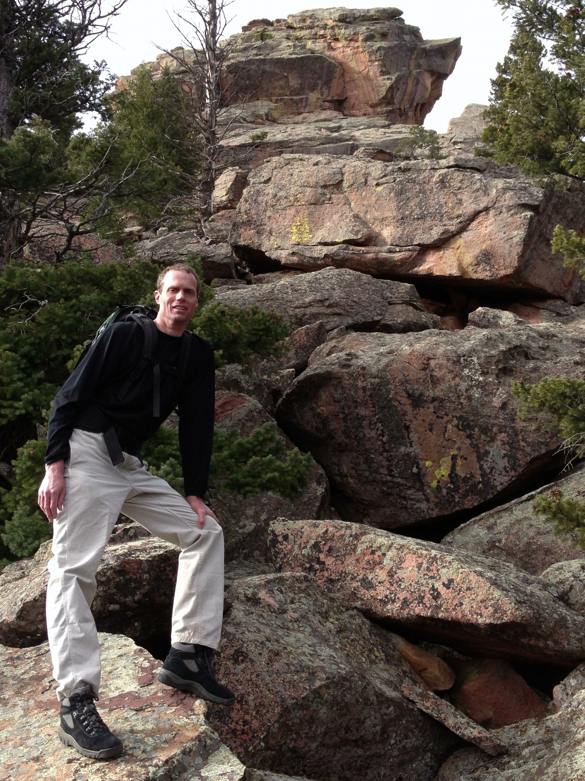
Brian and The Maiden
We started up the Mesa Trail (TH at 5,641′)at 8:45am trying to remember how to hike and remember what we used to bring. Before we could get too far into the laughing about how long it had been, we noticed a sign that indicated that the trails to South Boulder Peak were closed and there was no access to Bear Peak without hiking over to NCAR (about 5 miles) to ascend the Fern Canyon trail.
It is always a challenge navigating the arbitrary rules of the Boulder Open Space Tyrants. I have come to feel that their rules should be broken out of principle.
I asked Brian if he wanted to drive over to NCAR or just head out to see if we could find enough adventure despite the closed trails. He hated the thought of getting back in the vehicle and wanted to proceed. The main idea would be to hike to The Maiden, with an option on climbing the ridge to Bear Peak (8,461′).
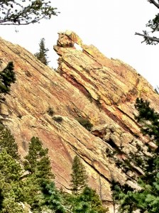
Brian below the Devil’s Thumb
We took the standard route toward Shadow Canyon only to find that the Homestead trail was also closed. Brian’s comment was ‘I’m glad I don’t live here.’ I couldn’t blame him. We backtracked and took the Towhee trail to link up to the Mesa trail, hoping that it would lead to Shadow Canyon but prepared to simply scramble up the front side of The Maiden.
It all worked out and we eventually came to the bottom of The Maiden, I believe near the present end of the Shadow Canyon trail. We turned uphill and enjoyed reliving the scramble that we’d done so many times before. We arrived at the ridge line near Jamcrack Spire flatiron and traversed over to the start of The Maiden’s Standard route at around 10:30am. We stopped for a drink and for a change of clothes to combat the suddenly brutal wind.
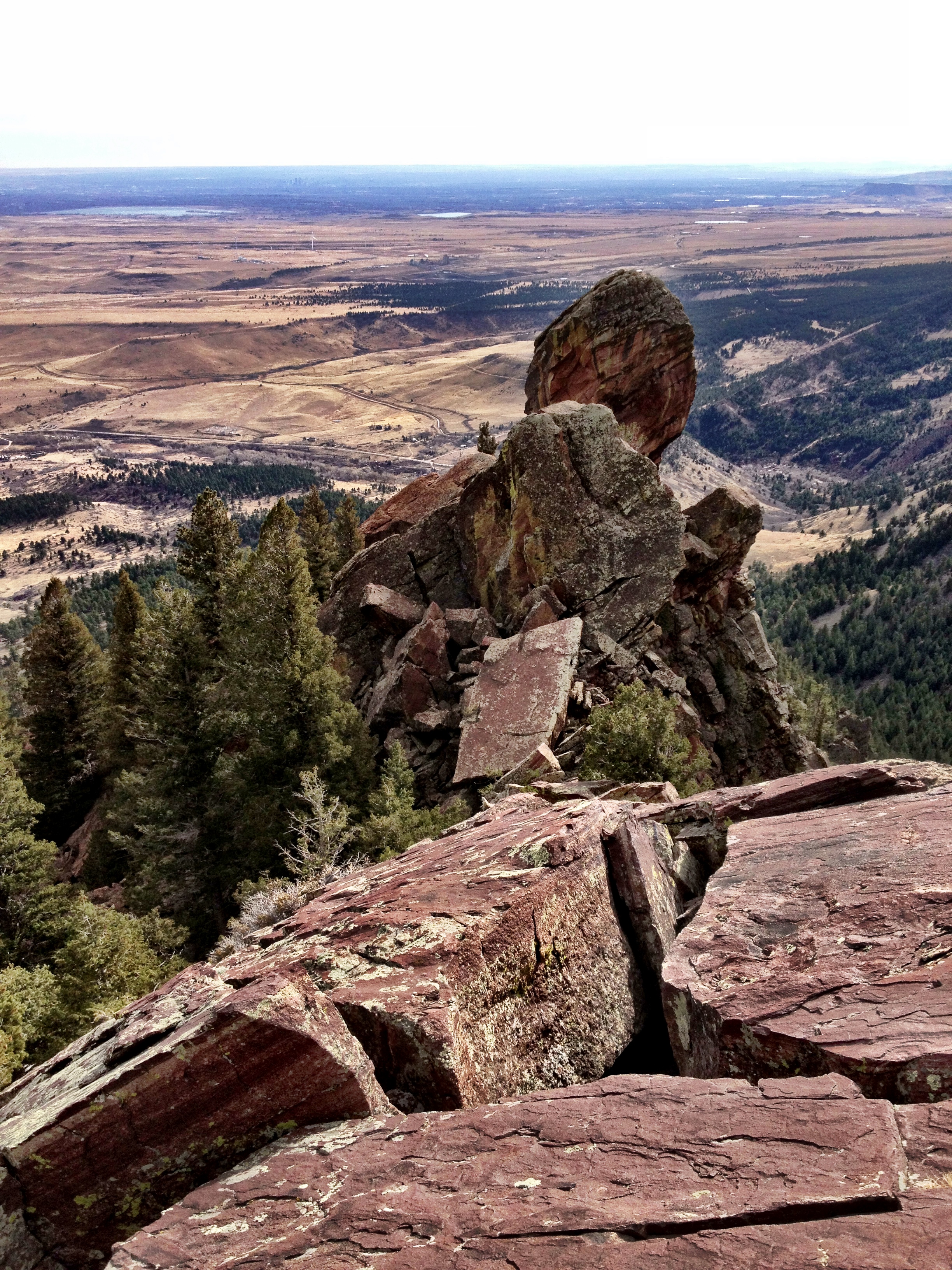
The great Flying Flatiron seen on a scramble from The Maiden to the Bear Peak summit
Brian was feeling strong, apparently, and wanted to opt for the ridge bushwhack to the summit of Bear Peak. We’d done it a couple times before, so we knew it went without too much technical difficulty, but with significant physical exertion. We weren’t in shape for such an effort, but the thrill of high places and the thought of one last day of good weather allowed us to ignore the damned consequences….and there would be consequences.
Up we went. The first thing was to scramble back up to the ridge line.
Then, carefully creeping along the ridge line with serious falls awaiting the ‘Uncareful’ (read: other people), we progressed toward the Bear Peak summit.
The initial going was easy and allowed us to stay on the ridge to pass over the top of the Fat Iron (a very good climb, by the way, which has a spectacular view of The Maiden).
We then approached the Devil’s Thumb which is merely the highest of several impassable pinnacles on the ridge. We dropped down to the east to traverse the low angle, east-facing rock face. The route-finding became tricky for a short section due to exposure. I told Brian that I didn’t know where it would lead us, but at least it was going somewhere. Brian replied, “Good enough.” It did in fact feel familiar; it was probably the route we’d taken to climb the Devil’s Thumb some years ago.

South Boulder Mountain burn damage from June 2012 fire, seen from near Devil’s Thumb
We exited the steep face into the less steep rock below the Devil’s Thumb (a good but short climb). The ridge was still impassable, so we continued traversing the eastern rocks until we could enter the gully below the Devil’s Thumb and the Flying Flatiron. Aiming for the junction of the Flying Flatiron and the primary ridge line was a good route that worked and also allowed us to reminisce about the impressive and terrifying Flying Flatiron summit. The ‘terrifying’ aspect related to the temporary nature of the pile of rock comprising the arch summit. When it goes down someday, you don’t want to be on it.
At that point, we were able to scramble back to the ridge where we could see the an impressive view of the Devil’s Thumb, and we could also begin to see the fire damage from the June 2012 “Flagstaff fire”.
Then we hit a section of ridge that we had some memory about…it was a bad memory.
Looking back down the ridge toward Devil’s Thumb and the Plains below
The ridge line looked impassable but we recalled it was just barely passable for the distance required to reach the next milestone, the Angle Wings. And ‘barely passable’ was good enough as there was no other way to proceed, either via the east face or by descending to the west. We slowly crept along the cliff face just west of the ridge line, taking care not to fall to our deaths or get into a jam that would require serious risk-taking to escape
Brian was back in his old form, moving without hesitation and finding the least risky path. By the time we reached the Angel Wings, we were able to descend to the ground to hike up to the north end of the Angel Wings Flatiron.
We stopped for a drink on the crest of the south end of the Bear Peak ridge. It was a wonderful 50’x50′ spot that was begging for a tent. And, it was 11:45am…and I was getting very hungry. I said out loud that we had 15 minutes to reach the summit.
After the enjoyable pause, we started back up toward the summit, but now we were on the edge of the burn area. We moved even more carefully as we tried to avoid becoming covered in charcoal After about 50′ Brian said, “I’ve been wondering about the orange color that seems to only be on the tops of the branches and logs…do you think it is fire retardant?” Of course that was the answer. Heck, I hadn’t even noticed. With now another thing to avoid, we were happy to leave the edge of the burn area after only a few minutes.

Brian resting on the edge of the burn zone from the ‘Flagstaff Fire’ of 6/2012. Bear Peak is visible in the distance.
The rest of the way was uneventful except for the increasing hunger. I managed to get us lost again on the final climb up to the summit block. We ended up taking the exact same path as we did in 8/2011 when I crawled through a tree infested with ladybugs and inadvertently carried away one million of the little gals.
We reached the summit at 12:30pm.
It is always true, the hungrier I am, the better my food tastes. My two peanut butter Cliff’s Bars were the best food I’d eaten in months.
After such a hard effort to reach the summit, we are always reluctant to leave. I suppose there are many reasons. But the cold and wind was persistent and I was losing the body temperature battle, so we left after 30 minutes.

Joe insists on a summit shot…Bear Peak
And now we would pay the price of stubbornness Since Shadow Canyon was closed from the top and we didn’t move the vehicle to NCAR, we’d have to hike down the Fern Canyon trail and then hike 5 miles back to the South Mesa trail head Yuck. At least our biking fitness was holding up to the hiking/scrambling effort.
We quickly worked our way down the exposed summit ridge, like two mountain goats who had never taken a break from hiking. I felt true pleasure from the overdue exercise of skills long in the making.
And then, down the Fern Canyon trail. Down, down, down.
After about 0.25 mile, I could feel that my legs were getting tired. It was a bad feeling, since I was so many miles from my 4-Runner…and had so many feet of elevation yet to lose.
After another 0.25 mile, I begged for a rest. I hoped that a short reprieve would revitalize my muscles…but no. It was then that I knew I was in trouble.
A look back at the ridge line we traversed (left to right) to reach Bear Peak and then descend the opposite direction to complete the Bear Peak Loop.
Heck, I knew I’d make it home, but I KNEW I was going to suffer for days for my brazen disregard for the laws of physics.
Down, down, down. My legs were mere noodles. I was just trying to control the fall as I resisted gravity with every muscle, ligament and bone at my disposal.
After an eternity, we reached the cut-off for Shanahan Trail, which we took to reach the Mesa Trail. And then only another 4 miles to reach the car. We made it, naturally, and, I only twisted my ankle twice in the process.
6.25 hours, 8.5 miles RT and 2951′ of elevation gained (and lost!). What happened to the ‘start small and gradually build up our fitness level’ plan? My legs were getting stiff before I got into my 4-Runner. I was in for a rough recovery.
Post-Script (12/3/12): I have barely moved in the last 36 hours, and have little hope of improvement for another 36. (12/5/12): I am still too sore to move correctly but am now certain that I have not permanently crippled myself. I expect to be ready to go again by the weekend, but no sooner.
Brian’s comment via email on 12/3/12:
Joe:
Our basement staircase took on a malevolent side yesterday, bringing fear every time I went down. Like the Amityville Horror. The stair rail got more use than it had all year.
Brian


