Archive for the ‘Trip Reports’ Category

Pikes Peak Hill Climb Shiverfest

August 31, 2014

shiv·er  \ˈshiv-ər\
: to undergo trembling : experience rapid involuntary muscular twitching especially in response to cold

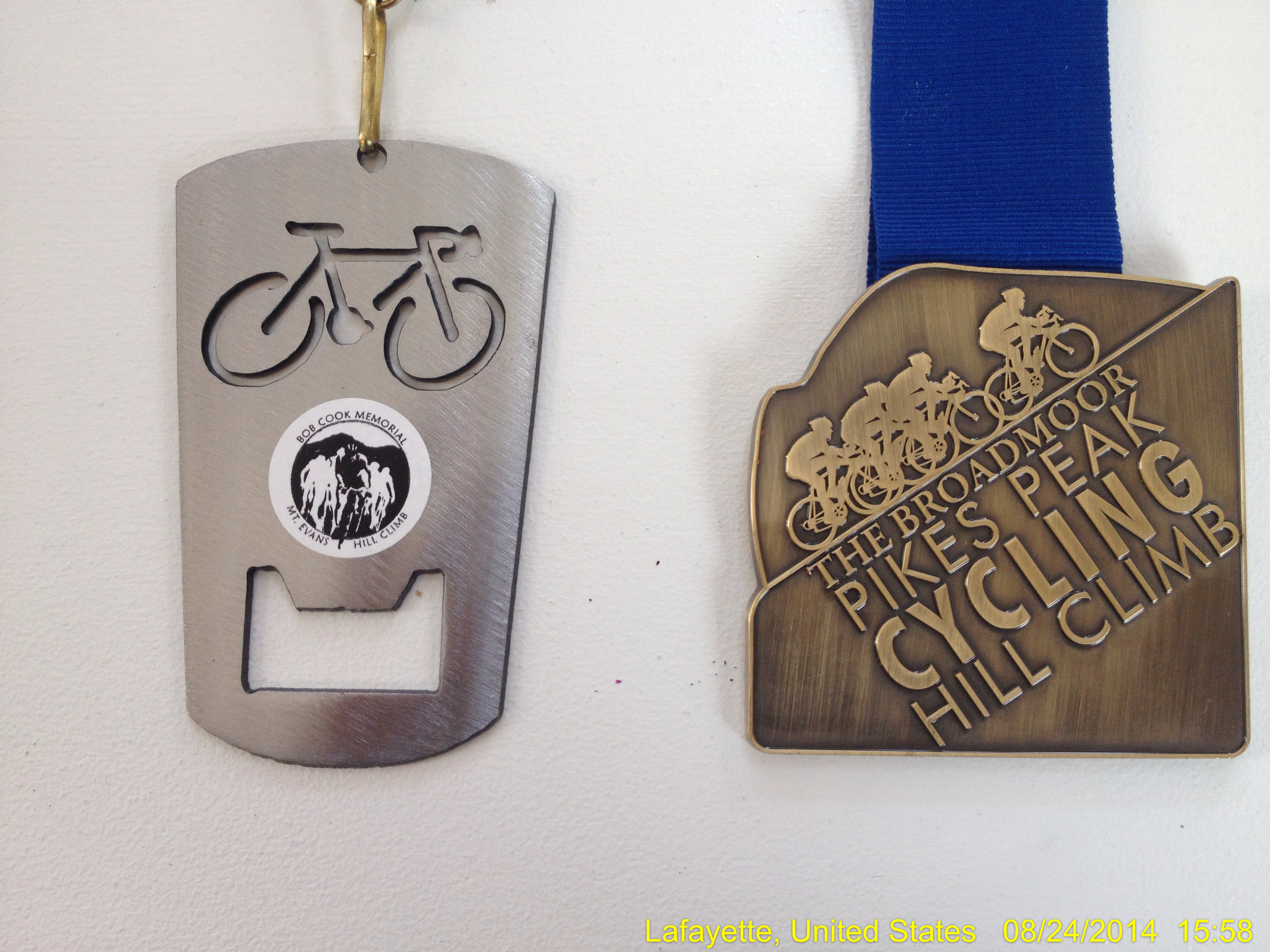
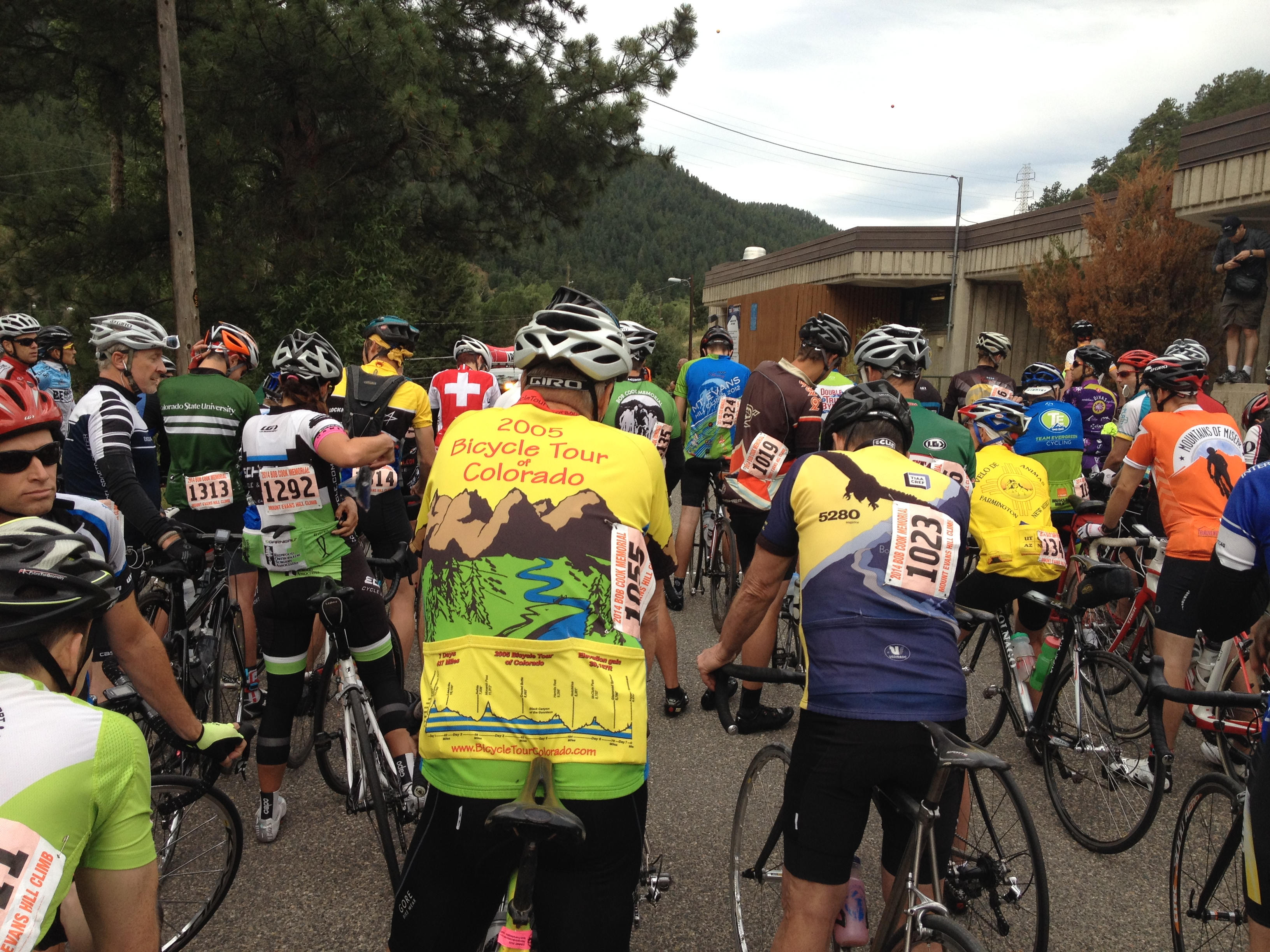
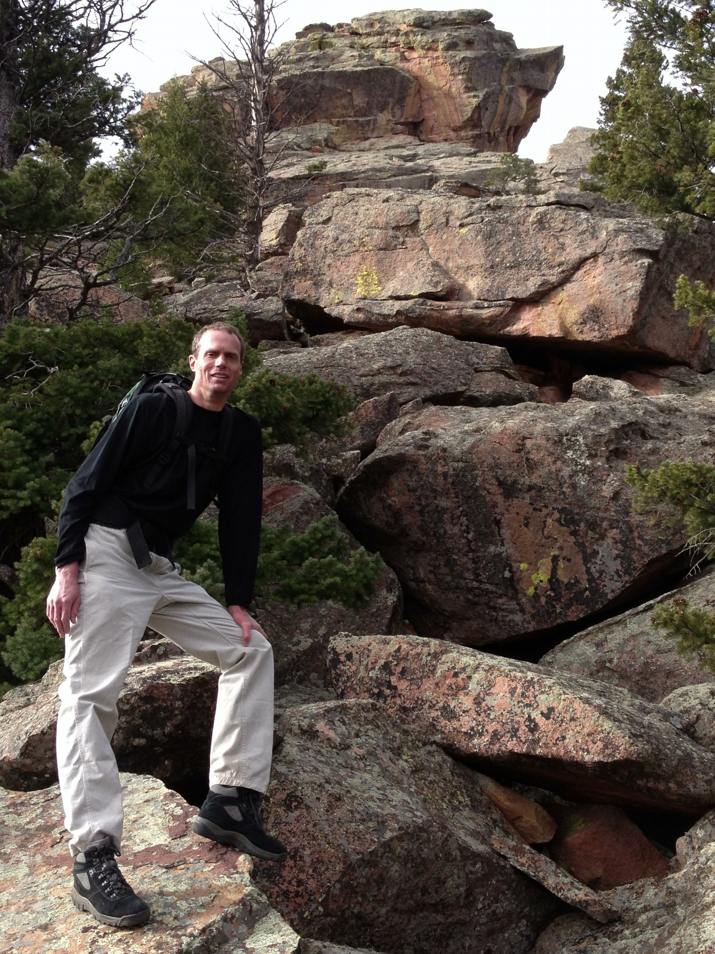
After completing in the Mount Evans Hill Climb in late July 2014, I knew that I had to ride the only other paved road to the top of a Colorado 14er:  Pikes Peak (14,110;).  After a bit of a search, I found the Pikes Peak Cycling Hill Climb was scheduled for August 26, 2014; I signed up as soon as I could figure out how (it’s a long story).  Little did I know that the Pikes Peak Cycling Hill Climb would be an epic adventure rivaling my most extreme mountaineering adventures.  Three hours worth, anyway.

pikespeakridephoto

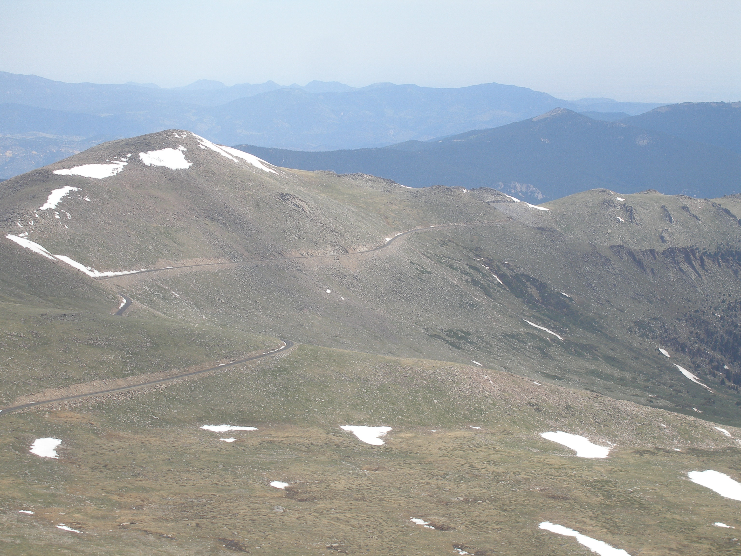
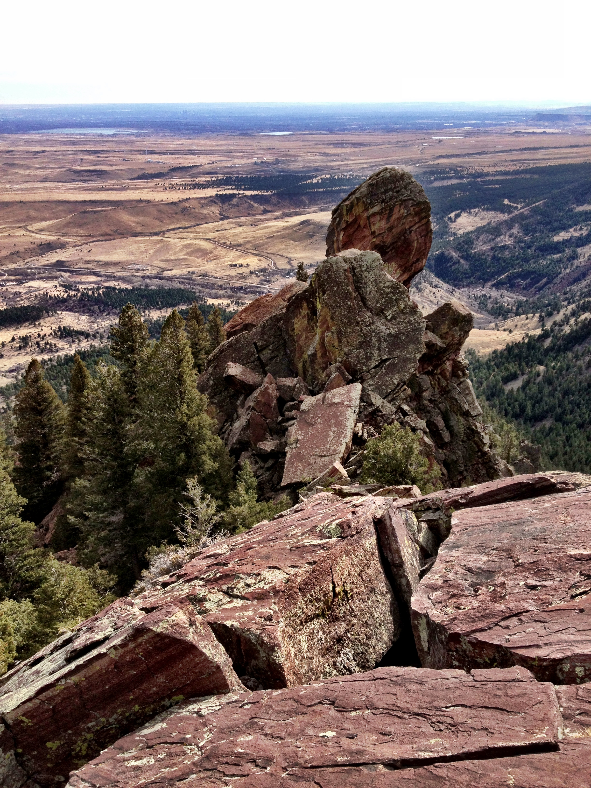
A view of much of the Pikes Peak Tollway, including the Crystal Resevoir (the start of the race), the lower switchbacks lead to Glen Cove (the 1/2-way point of the race), the treeline, and the start of the infamous “Switchbacks” above treeline.

I had done a lot of riding since my first organized ride, The Triple Bypass in July 2014.  The road cycling thing had begun to feel like old-hat: I was no longer consumed with attention to every variable or stressing over potential disasters.  For the Pikes Peak ride, I really only had two major concerns:

  1. What would the weather be like at 14k?
  2. Would my lingering illness-related breathing issues (asthma?) be resolved by race day?

Both questions would be slow to resolve, and the answers would reveal themselves rather dramatically.

On Saturday the night before the race, as I lay feeling sorry for myself in my Manitou Springs motel bed, I wondered why I put myself into such a miserable place.  I wondered how I could leave my family so early on a Saturday evening to live alone for a night in a dirty hotel room attempting to watch Bronco football on a TV with reception so poor as to be unmatched since my teen years watching Benny Hill reruns on a UHF station.  The uncertainty of my health and the weather, and the dread of waking up at 3am was making me feel stressed and unhappy; and I wondered out loud why I did this to myself.

But almost immediately, the answer came.  I did it because I loved it.  The feeling of stress and misery vanished, replaced by a feeling of anticipation and excitement.  Although I did retain a hope that I wouldn’t catch anything serious in the nasty room which had not been adequately cleaned since the previous night’s occupant.

I awoke before my alarm and made ready for a hard morning workout.  My first task was to check the weather for the morning. I was surprised at the low temperatures for the early hours (high 40’s), which suggested very cold temps nearly a mile higher, on the summit.  At the least the question of whether to wear my arm and leg warmers was resolved.  I ate, dressed, packed up my car, and left for Pikes Peak at 4:15am to pick up my packet at the tollway entrance, and then drive another 7 miles to the starting line.

Climate data for Pikes Peak summit
Month May Jun Jul Aug Sep Oct Nov Dec Year
Average high °F 28.4 38.5 47.6 48.1 39.2 28.4 16.0 10.7 25.8
Average low °F 14.3 24.6 33.7 32.9 24.3 14.2 3.9 −2.7 11.9
Snowfall inches 31.5 25.0 11.3 11.0 13.5 20.9 33.1 36.3 337.6

I didn’t know what sort of speed I could sustain over the 12+ mile, nearly 7% grade course, so I didn’t have much to go by in predicting a finish time. I understood that I had to finish within 3 hours to get a medal, so ‘better than 3 hours’ was my original goal. As always, I hoped to do better than the minimum, and I planned to go as hard as I could. I definitely would not stop, give up, quit, or die before reaching the summit, as per usual.
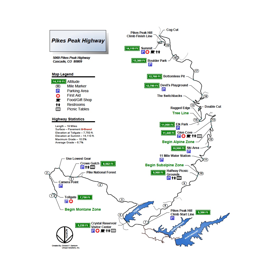
Official map

Official map

The day before the ride I discovered that the course pro records were only about 10 minutes over an hour (~10 mph), I decided I would do much better than 3 hours but still could not guess at a time. On the Mt Evans ride, I averaged just under 10 mph, but that route is not nearly as steep on average. I just didn’t dare hope for under 2 hours.

After dropping off my summit gear bag (I would not make that mistake again), I arrived at the start line with my jacket in my pocket and 5 minutes to wait.  I managed to secure a spot close to the front, near mile marker 7; the ride would take me to the Pikes Peak summit, just past mile maker 19, for a 12.4 mile ride gaining over 4,700 feet of elevation.

As we waited, the riders around me worried aloud about the wind we all could hear blowing through the tops of the trees. High winds plus cold temps would make for a very difficult day.  I was pleased that I had put on my arm and leg warmers.

“More than 300 riders took part in The Broadmoor Pikes Peak Cycling Hill Climb in the early hours, braving it through bone-chilling temperatures, low visibility, steep cliffs and furious winds at their head.

And the higher they climbed, the tougher the conditions became.

‘Just being a part of this climb this year is an incredible achievement. The times don’t matter,’ elite rider LeRoy Popowski said.”

~ The Gazette

Mile Markers 7-9 (2 miles)

The race started at 6am, and I took off very fast to maintain my near front starting position. The first mile was a mild incline and was behind us very quickly.  The second mile was a bit steeper, but also went by quickly.  The 3rd mile began at mile marker 9, and that was also the start of the hard climbing.  The wind was occasionally strong but didn’t seem life changing, unlike previous mountain rides.

Mile Marker 9-11 (2 miles)

I stayed with my group for about 1.5 miles of steep climbing, but I could not catch enough air to sustain it. I lost contact with the group as I focused on getting enough air.  As feared, my lungs were not working well, and I was suffocating.  It was tremendously disappointing, but finishing was the priority.

Mile Marker 11-13 (2 miles)

Pikes Peak Cycling Hill Climb Route copyI stayed with the effort, though, concentrating on fully exhaling and inhaling. And, slowly my breathing improved. I was able to pick my pace back up and keep my breathing under control. And I stopped losing ground to the other riders that I could see.  I also started drinking my water to prepare for a stop at the 1/2 point at Glen Cove.

At 6:50am, when I reached the half way point (near mile marker 13), I checked my watch and was amazed to discover only 50 minutes had gone by; I was under a 2 hour pace.  I hadn’t finished my 1st bottle of water, so I decided to skip the aid station.  I’d stop at the next station further up the mountain.

Mile Marker 13-16 (3 miles)

Emboldened, I pushed harder. I started passing the people who had earlier crept by me. And the wind started getting worse.

I started up the switchbacks as I left the trees, and the wind transformed into an opponent.

pikes metalWatching the riders ahead of me fight uphill like salmon swimming up waterfalls, the experience was surreal. The buffeting of the wind felt like some of the worst mountaineering experiences I’d suffered through. There were times when I was moving <1 mph, so slowly that I could only barely go faster than the riders who had gotten off their bikes to walk up the road. And, the wind-chill was deadly.  The real fear of death or injury combined with the extreme effort made for a powerful feeling of adventure.

In a weird part of my mind, I loved it.  It was a thrill to be a part of it, right up to the point that I couldn’t feel my hands anymore.

While I knew I should do it to protect my core, I hadn’t put on my jacket yet; I kept thinking I could finish without it due to the massive calorie burn. I didn’t want to lose the time.  I did have on arm and leg warmers, but my well-ventilated, full-fingered gloves were not nearly enough. My hands were so cold I had to keep looking down at my hands to make sure I wasn’t inadvertently pulling on the brake levers.

At 7:35am, the small group I was with finished the switch back section just after mile marker 16, and sped up to capitalize on the temporarily easier terrain before the last 1.5 miles of climbing.  I had 25 minutes to finish under 2 hours; surely 25 minutes was enough to ride 3 remaining miles to the summit.

My legs were still strong, especially when standing on the bike.  While I could no longer stay with the group while I sat in the saddle; I could close the gaps whenever I would stand up and brave the brutal wind.  I decided to pass by the final water station as I hadn’t even started on my 2nd bottle due to an inability to take a hand off the handlebars; I just didn’t dare lose any control while under attack by the wind.

“High winds that forced the windchill factor below 20 degrees thrashed the riders who attempted the 12.4-mile climb to the peak’s 14,115-foot summit.”

~pikespeaksports.us

Mile Marker 16-19 (3 miles)

I couldn’t find mile markers anymore but the ride organizers put up kilometer remaining signs starting with 5k (3 miles).

At 3k (1.86 miles), the final climb was on.  But this final stretch averaged 10% grade.  It would be very painful.

I was feeling strong despite getting progressively hypothermic.  I wasn’t even feeling cold anymore, just numb, as the wind-chill was finally penetrating my core. The thought to put on my jacket was never out of my mind, but I just couldn’t give up the time. I really wanted to beat 2 hours, and it looked like I would be just a couple minutes slow already.

Riders were stopping left and right, and I was determined to stay with this group, and I would sprint to the finish, so help me God.

1 km to go.

I was going to make it for certain; but ‘under 2 hours’ was getting away from me. I couldn’t afford the distraction of calculating an estimated ETA…I just pushed as hard as I could.  The group was bunching up and continued to drop jacket-less guys who were too cold to keep up the pace. We went by another couple guys who had accelerated away from my group a few miles before.

The visibility was bad as we were finishing in a fast-moving cloud. Through the haze, I could see the finish line. This was my time.

I accelerated, finding speed I didn’t think I still had to pass the entire remaining group, ‘counting coup’ as I went by each one.

Results for Pikes Peak Cycling Hill Climb   Fun Ride   USA CyclingI finished at approximately 10:05 am.  I did not finish in under 2 hours.

My finish time was 2:05:55, yet, I still felt I had recaptured that portion of my pride lost during my weak finish to the Mt Evans Hill Climb.

“With bone chilling temperatures, 40 mile per hour winds and a dense fog limiting visibility at the summit this year’s event was a true challenge to every rider!”

~Pat McDonough, Event Director

The race was over for me, but the adventure was still on. I had to get out of the freezing wind NOW.  The thought of taking summit photos never entered my mind.  I was focused on survival, which meant escape the wind, get on more clothes, and get the hell down.

And as I scanned the mostly blank summit area, I realized I had no idea where to find my gear bag or find shelter. There were a couple parked vehicles next to a building in the distance; I rode over to the parked vehicles hoping one of them had my gear bag. A guy in a down parka rolled down his window and told me to put my bike in the van if I wanted a ride down. I asked where I could find the gear bags.  He said to look in the Cog Railway building, and pointed to the other side of the summit. I walked my bike as quickly as I could over broken, sloping ground where I found a door in what appeared to be an abandoned building.  I tried the door and was surprised it opened.

I went inside the abandoned building to escape the wind; I would at least be able to put on my jacket.  But when I entered I found a dozen people milling around or sitting on the floor amid a sea of gear bags. I had found it!

It wasn’t a warm room, but it had my gear.  Unfortunately one-half of the bags looked exactly like my own, which I eventually found at the far end of the room. By this time, I was shivering violently and struggling with stiff fingers to open the bag and put on my fleece sweater. I finally got the fleece on and my rain jacket over the top. My hands were starting to thaw and hurt, so I decided to accelerate the process to end the pain. I put my hands on the skin of my torso, which didn’t feel much warmer but still worked. Absolute agony. The thawing pain was severe; I hurt so badly I was afraid I’d throw up. It subsided after 5 minutes that seemed to last an hour.

I looked in the gear bag to see what else I had managed to pack; I found a balaclava and a pair of socks. I did not find the hand warmer packs which I had expected and counted on to keep my hands warm on the ride down. (I later found the hand warmers in the front seat of my car).  But it was enough; I would definitely ride down.

I put on the balaclava, which prompted another rider asked me if I was riding down. I replied “I had to”; I just couldn’t come all this way and then ride the bus down. Still, he had a point. It was cold, the wind was dangerous, and I was not starting from a warm base.

I consumed the 2nd bottle of water I had carried from the parking lot, and then filled it again out of habit.  There was zero chance I would take a hand off the handlebars on the descent.  Then I left the building and started down the road.

Almost immediately, I started shivering.  But I was making decent progress down the winding road, also weaving between the riders and walkers who did not look up from their misery and efforts. Occasionally, the wind was too strong and I slowed to nearly a stop to keep from crashing.

I was shivering so badly my arms were pulling on the handle bars, twisting my front wheel as I was trying to stay upright despite the blowing wind. The combination of uncontrollable arm twitching and violent gusts of wind made for some of the least well controlled riding of my life…all while riding along-side a steep cliff.

But I made it.  A few hours later I was home and pulling myself together to join my wife at her company picnic.

A couple of days later I found I had finished 17th of 96 finishers of the “Citizen’s Ride”. Not too bad for an old dude.

See index of Mountain Ride reports

Advertisement

Red Rocks Century

August 25, 2014

I had heard the Red Rocks Century was one of the hard ones. I thought I’d like to do it; and, I was right, mostly. It is truly a wonderful ride through the beautiful Front Range Colorado mountain terrain.  But, on this day, I started out too fast, and had to hang on like grim death.

“For five years the Red Rocks Century, formerly the Healing Wheels Tour, has been known as the toughest and most scenic of the Colorado Front Range cycling events.”

~ 303cycling.com

Iconic photo of Red Rocks Century

Iconic photo of Red Rocks Century

I selected the Red Rocks Century from among a number of great sounding rides.  I was originally interested in the Copper Triangle (8/3), and then it was the USA Pro Challenge Experience (8/10).  I settled on the Red Rock Century because of the low cost (boring, eh?) and its reputation as being hard (yes, seriously).  I was also attracted to the relative closeness of the start/finish to my home; I could be home in the early afternoon.

The Red Rock Century would be my 2nd long organized ride; my 1st was the Triple Bypass.  This one would be 96 miles vs. 120 mile with 10,200′ vs. 10,900′ of climbing. While shorter by 24 miles, the Red Rocks route would be somewhat steeper.

I wondered how much better I would ride than I could muster on the Triple Bypass.  My endurance and speed seemed to be getting better over the last few weeks.  The week before, I rode from Lafayette to Brainard Lake, and then through the town of Raymond on my way to Lyons.  I made it home after 6 hours, completing a 84 mile / 7400′ ride.  And, the previous weekend, I had finished the Mt Evans Hill Climb in under 3 hours. I was feeling very strong and confident.

Unfortunately, three days before the Red Rocks ride I started to come down with a cold, or some cold like symptoms.  I hoped it was allergies, but it didn’t seem like it.  Over the next couple days, the symptoms didn’t get worse, but they didn’t go away.  I stopped my workouts all together (no taper) to fend off the illness, imagined or otherwise; but, it didn’t seem to do any good.  I resolved to proceed with the ride no matter what, and just take it slow.  I hoped that by going slowly, I could ride 96 miles and climb 10,200′ of elevation with an illness.  Consequences be damned!

My only other concern was getting lost.  The route seemed complicated, and me with no GPS or bike computer, I had to rely on a map in my pocket.  I just couldn’t see how that was going to work.  I hoped for good signage.

Red Rocks Century Route (I had to recreate to get the correct altitude gain)

Red Rocks Century Route (I had to recreate to get the correct altitude gain)

I arrived at Bandimere Speedway, the start of the Red Rocks Century, at 4:45am for a 5:30am race start.  I was the 5th vehicle in the lot that could hold 2,000 vehicles.  I picked up my packet and made ready to ride (after waiting for the organizers to run to the store to buy a box of pins). During a brief start delay at the start line, I looked around at the mass of riders around me and was surprised to only see 100-150.

We set off at 5:40am, following our police escort (5,767′ elevation).

I was delighted to find myself among the first 30 cyclists on the road.  Maybe I’ll get a high finish!  But, no; I quickly realized that the fast riders would, annoyingly, be going by me all day.  Rather than a buzz kill, though, I found this inevitability to be a motivator; I’d stay away as long as I could, dammit.

So much for my plan to take it easy.  But what the heck, I felt great.

I started passing riders until I got behind a strong-looking, largish (for a cyclist) fellow on a $5,000 bike who looked like he knew what he was doing without going too fast for me to follow.  I decided to ride his wheel for a while.

The pair of us pedaled north up the frontage road adjacent to C-470, then turned onto Alameda Rd heading west through North Dinosaur Park.  After a climbing, winding few miles (~4.5 miles overall; 500′ of climbing; 2.1% grade), we turned onto Trading Post Rd to descend past Red Rocks Park to reach Red Rocks Park Rd on which we descended toward Morrison reaching Bear Creek Rd (Hwy 74) after losing most of the elevation gains of the day (~6 miles overall).

We would climb to the famous Brooks Forest Inn for the next 19 miles, gaining 3,000 feet; 1,000 of which would occur in the last 3.5 miles.

The first 15 miles of this section wasn’t too bad.  I followed my lead-out for about 1/2 this distance until I got squeezed out in a merging of two groups.  Rather than go to the back or sit in the wind, I powered ahead to catch a guy in a Copper Triangle Jersey who had blasted past both groups earlier but was still in sight.  I caught up to him after about 20 minutes and hung on his wheel.  He was fast!

Luckily for me, the Copper Triangle guy knew where he was going.  I followed him through a complicated multi-way, weird-angled, stop-sign intersection; I had no idea where to go and saw no sign or mark on the road until after we were through the intersection.  We picked up another rider (Tony) who said he had been dropped from the lead group, and he couldn’t figure out where to go, either.

The three of us turned onto Brooks Forrest Rd, heading toward our first water/food station of the day (the 1st scheduled water station had not opened yet when we went by).  With the grade steepening, my earlier extravagant energy expenditures began to catch up to me.  With about 2 miles to go to the top of the climb, I got dropped.  I didn’t bonk; I just could generate enough power anymore.

I put my head down, got into my lowest gear, and spun my legs as best I could manage (creating an oxygen-free dead zone along the way).  And, I kept Tony in sight.  Eventually, the top neared and, at 8:45am (25 miles in; 8,918′), I stopped for a much needed rest.  Copper Triangle guy was gone already, but Tony was just leaving.

I discovered, to my horror, that the aid station didn’t have any electrolyte replacement other than Poweraid. Crap! (I left my Nuun at home thinking there was a zero chance of this outcome). Yuck. I filled and finished a bottle anyway, and then refilled both bottles. I also ate a banana and a Clif Bar, counting on a long descent down Shadow Canyon Rd. to digest. Then I took off, seeking to catch Tony if possible.

Surprisingly, I caught him quickly, and we traded leads back down to Hwy 73, which we followed back into Evergreen (after a quick recovery from a wrong turn).  As we approached Bear Creek Rd from the opposite direction, completely turned around and not finding any route signage whatsoever, we stopped to consult the map.  We correctly divined a left onto Bear Creek Rd was the way; and then, we barely managed to notice the turnoff to the left to Upper Bear Creek Rd.

This beautiful cycling route had turned into orienteering exercise.

We followed Upper Bear Creek Rd for 4.5 miles, passing Evergreen Lake and then turned right onto Witter Gulch Rd (42 miles in; 7451′ elevation).  WARNING:  if you ever see this name on a road sign, and you are not ready for a leg destroying climb, flee.

Witter Gulch Road was a beautiful ride.  It would be one of my favorites if nearer to my home.  It is 4.6 miles of 7.1% grade (including many double digit spots), gaining 1,736 feet to reach Squaw Rd at 9,187′.   Apparently, the last 2 miles of Witter Gulch Road was only recently paved; the last 3 miles is a sustained climb of almost 8% with multiple switchbacks near the top.  Thankfully my Mt Evans ride had prepared me, mentally, for this leg killer.  Tony wasn’t so fortunate; he kept saying it was steeper than anything he had ever done.

Tony led the first part as my legs were still recovering.  When it was my turn, I found I was strong again.  I pushed hard to reach Hwy 103.  At the end of the road, Tony was starting to fall back a little bit (~30 feet); after the last switchback, I yelled back that it was almost over.

Turning onto Hwy 103, I happened upon a group of riders from Evergreen.  We chatted for a while, while the grade allowed a bit of talking.  They laughed about how much I would ‘like’ the Floyd Hill climb back to Evergreen. And, Tony was gone.  I’d dropped him somewhere since the start of Hwy 103.

After a few miles, the Evergreen group pulled off the road to enjoy the views.  So I was all alone, not chasing anything but the clock.  Except for the two real cyclists who rode past Tony and me earlier, I was still among the first 5-10 riders as far as I knew.  I liked the feeling and didn’t want to let anyone get by me without earning it.  So I kept pushing.

I found the aid station at Squaw Pass at 11:15am and stopped to refill my bottles and grab some food.  As I was leaving, Tony pulled in.  I asked him what happened to him.  He replied, “I got my ass kicked!” He wished me well, and I took off with fresh legs to climb to Juniper Pass (54.5 miles in; 11,148′) and then to fly down past Echo Lake to Idaho Springs (71 miles in; 7,500′).

The descent was fun and fast.  It was my 3rd descent from Echo Lake in over the past month; I knew the road well.  As I entered Idaho Springs, I had some idea of where to go but managed to catchup to another rider who seemed to know where to go.  Together we passed through downtown and found an aid station at a public restroom I had used many years ago on a rafting trip.  As I arrived, just leaving the aid station was my old pal, Copper Triangle guy, who I’d last seen before the top of the climb to Brook Forest Inn.

Another bottle refill and a banana, a quick pee, and then another hello to Tony who was just puling in, and then I left chasing Mr. Copper Triangle.  He was somewhere ahead of me, but I was lost.  I tried to use 25th street to cross under I-70 (per the instructions) but couldn’t figure it out. I backtracked and then sprinted ahead to stay within sight of another rider who had passed me (#3) during my wandering.

We followed the on-ramp to I-70, but stayed on the far frontage road and then to a bike path which followed I-70 along the canyon wall, which skirted the I-70 tunnels.  Frankly it wasn’t much of a bike path:  patches of dirt and wildly undulating terrain. But since the route was still descending, I was strong enough to catch up to my new guide, but my climbing legs were dead. The last climb, Floyd Hill, would not go easy for me.

We crossed under I-70 to US-6, and then took the steep ramp to Evergreen which I had always wrongly imagined was an on-ramp to I-70 (76 miles in; 7,200′).  This was Floyd Hill, the 1.8 mile, 6% grade segment the Evergreen riders told me with a chuckle I would enjoy.  I did not.  My new guide was too fast, and I was too slow; but, I held on long enough to catch up to my original target, Copper Triangle guy.

The two of us climbed up the steep ramp in the burning sun, sucking down the exhaust from 100 cars backed up due to the tunnel blasting delays.  It was a hell.  Slowly we approached Evergreen. My legs were spent; I couldn’t keep up sitting in the saddle, and so had to stand up to claw back any gaps.

Another (and last) rider passed us (#4 so far for my day), and then the hard part was done.  We exited Floyd Hill (Hwy 40) onto Rocky Village Dr. (80 miles in), and then lost and gained a hundred feet over the next 4 miles to connect with Evergreen Parkway.  We rode north on Evergreen Parkway a short way to reach Kerr Gulch Rd (84 miles in; 7,784′) and the descent back into Morrison.

The descent was nice except for the volume of cars driving down the two-lane, winding road with only an intermittent shoulder.  I stayed behind Copper Mountain guy to make sure I could find the finish line.

Thirteen miles later we hit Morrison and a confusing intersection.  I followed the police officer’s directions and ended up ahead of Mr. Copper Mountain on a bike path for the last couple hundred yards of riding.  I raced ahead with visions of a top 10 finish.  As I passed under the finish arch at 12:40pm (96 miles in), I couldn’t find a single Official to ask for my official finishing time (I didn’t know that no one keeps track in a Century ride). And since the shorter route options had already finished, the finish line expo area was jam-packed with people. So, I had no idea if I had my top 10 finish; I admit it was a letdown.

And then I saw Tony.  We congratulated each other on a good day of riding, and then the sky opened up and dumped rain.  We sat under a huge tent eating our free fish tacos & free beer as I told him of finally catching Copper Triangle guy.

I finished in 7 hours, including 40 minutes of stopping time.  That’s about a 15 mph average, which is about the same as I did on the Triple Bypass.  I’m satisfied.

P.S. – I did finally come down with a cold the next day.

See index of mountain ride reports

Mount Evans Hill Climb Done Right

July 31, 2014
Photo by Footwarrior

Mt Evans parking lot seen from summit. Photo by Footwarrior

I first stood atop Mt Evans in 1997, after an amazing car ride up the highest paved road in the United States.  The Mt Evans road first opened in 1931, and was planned as a segment of a 150-mile road linking Longs Peak (14,259′) to Pikes Peak (14,114′). Alas, the road yet extends only 14.5 miles to just below the Mt Evans summit at 14,130′, fulfilling a 100-year-old prophecy to become, “…a road that starts nowhere, ends nowhere, and never gets there” (W.F.R. Mills, Commissioner of Improvements, 1915).

But as far as cycling is concerned, it is certainly enough.

Official course map

Official course map

Prior to 2014, I had returned to the Mt Evans summit four times to hike or climb some snowy aspect of the mountain. The last time I did so was 10 years ago, in May 2004, when my good friend Brian tricked me into riding my old mountain bike from the parking lot at Echo Lake (10,500′).  The excuse was the Forest Service road would be closed to car traffic for the day due to recent snow fall, and we could have the road to ourselves for once.

The affair was total misery for me (and a funny story) as I was not nearly in shape for powering an old, heavy bicycle up 7 miles of steep road carrying an extra 50 lbs of blubber and snow climbing gear (click to see and laugh about my Mt Evans Climb and Bike Ride trip report).  I have long desired to return to do it right, and reclaim a bit of my dignity.

I waded and crawled, I rolled and hopped, I cursed and yelled.  And then I finally lost my cool completely and swore out loud that I’d never do another snow climb.

With my last drop of energy, I crawled onto the road; and then I stood up, collected myself once more, and thought, “that was a good bit of exercise.”

~ excerpt from Mt Evans Climb and Bike Ride trip report

Mt Evans summit on the left with Summit Lake and the highest paved road in the USA below

Mt Evans summit on the left with Summit Lake and the highest paved road in the USA below (taken in 2002).

On July 26, 2014, full of cycling confidence after successfully completing the Triple Bypass Ride (120 miles; 11,000′ climbing) two weeks before, I started riding up toward the summit of Mt Evans once again, this time from Idaho Springs, a little over 27 miles away and nearly 7,000 feet below. The 49th Annual Bob Cook Memorial Mt. Evans Hill Climb would keep the cars away and bring my dignity within reach.

Awaiting the start of the Mt Evans HIll Climb Gran Fondo

Awaiting the start of the Mt Evans HIll Climb Gran Fondo

The Gran Fondo didn’t start until 7:20am, but I needed to arrive before 6am to carry out a number of tasks:

  1. avoid long delays for I-70 tunnel blasting (did it)
  2. secure a reasonably close-in parking spot (did it)
  3. have enough time to get my race packet containing my race numbers which had to be pasted/pinned to the various parts of my body and bike (did it)
  4. send some clothes to the summit to wear on the ride down (decided I didn’t need to do it; big mistake)
  5. secure a good placement in the Gran Fondo mass start (did it)

The Mt Evans Hill Climb came highly recommended.  It is advertised as one of the great cycling climbs in North America; not only a test of physical fitness, but also a means to measure a rider’s mental toughness. Heck, I guess there just aren’t many places where riders can climb for hours on end without a rest, which must be the definition of ‘awesome’ in cycling climber-speak. Starting in Idaho Springs, road grades to Echo Lake average 3.5% for 6.7 miles and 5.8% for 5.8 miles. Echo Lake to the summit averages 5.6% for 5.5 miles, then 4.1% for 2.7 miles and finally 5.7% for 4.25 miles through 11 switchbacks to the top.  Still, the experienced riders say the Mt Evans Hill Climb isn’t hard due to the grade.  It’s hard due to (1) length of the climb, (2) the gain in altitude, (3) the high altitude (low oxygen) reducing the ability to produce power, and (4) the challenge of staying hydrated due to drier air.

course stats tableThey also say, half of the challenge is in the mind, and patience is the key:  ‘focus on small victories along the way’, ‘focus on the 10 feet in front of you’, and ‘find a mantra to repeat or sing to yourself for motivation’.  And, lastly, ‘when you reach the summit, take in the splendor and accomplishment of riding up one of the highest peaks in America.’

Anyway, they had me at ‘no cars’.

Heading up on the relatively flat road out of Idaho Springs, I found myself conflicted between my twin objectives:  (1) conserve energy to make sure I could finish (ego preservation) and (2) go fast enough to beat my 3 hour time estimate (ego maximization).  This internal conflict was made more difficult by my lack of bike computer or even a watch; I couldn’t tell how hard I was working or how fast I was going.  I had to go on feel alone.

The pack thinned out pretty well after the initial few miles.  The very fast riders were quickly gone, never to be seen again.  Luckily, I did find a strong rider my age who was pulling a pace just above what I liked; he must have started further back in the pack and passed me a few miles in.

I figured I’d stay on his wheel for as long as I could, which turned out to be quite a while.  He was a chatty fellow out of Grand Junction, having a quick conversation with everyone we passed along the way.  As we approached Echo Lake, I was looking forward to taking a short but needed rest while I refilled my water bottles.  We sprinted along the lake, taking advantage of the short downhill section just before the Ranger Station; I had no problem burning through my energy reserves knowing I had a rest coming.  As we neared the Ranger Station, I could see the aid station was not what I expected. They were handing out filled water bottles as we went by…no stopping.  No rest. I was going to have to do the 27.4 miles and nearly 7,000′ in a single push, doubling the height of any single climb I had ever done.

Mt Evans road above treeline (CDOT photo)

Mt Evans road above treeline (CDOT photo)

As we got above treeline, I was starting to struggle to stay with my ‘rabbit’. We did have a chat along the way where I assured him that I would not have brought my cyclocross bike up Mt Evans if I had a lighter weight bike. He estimated we were on a 3 hour pace, which by then sounded like a very good time.  Around mile marker 5 above the Ranger Station, my rabbit got away from me and my tiring legs; and I picked up another, somewhat slower host.

This point is also about where the riders can see the rest of the ride, and I assure you it is a soul crushing sight to see so many miles of winding, treeless road that must be ridden before a rest.  Fortunately, I had been scarred by this sight 10 years earlier and was psychologically buffered against such a reaction. I followed my new rabbit to about mile market 9 where I passed him on the short descent to Summit Lake (12,830′) over shockingly rough, winter-broken road.

Joe nearing the top of the Mt Evans Rd

Joe nearing the top of the Mt Evans Rd

The 1/4 mile downhill ended at a sharp left bend which led to a final 5-mile, 1,400′ climb along guardrail-less road hanging over cliffs above oblivion. And, for the first time, I was alone, riding up the first of 11 switchbacks all by myself, battling the wind without any help.  I could feel the growing empty spaces in my body that used to contain my vast reserves of energy. And, now, the altitude was getting very high, and my limiting factor was shifting from muscle strength to available oxygen.  Unable to collect enough oxygen to fully power what remained of my muscles, my body temperature plunged.

I kept spinning my legs.  I also kept looking up to catch of glimpse of something familiar, something to give me hope of a near conclusion.  This was an incredible, memorable ride, but I wanted it to be over.

I finally could see the astronomical observatory tower located near the summit, and then I knew the end was near.  I kept spinning my legs.  I knew to look for mile marker 14, the signal for the final half-mile; but, I couldn’t remember to look at the signs as they went by.  I kept spinning my legs.

The money shot.

The money shot.

I came around a final right hand switch back to find a 100 yard sprint finish, but, I had no ‘kick’ to give. I kept spinning my legs, and crossed the  finish line at 10:13am for a ride time of 2 hours & 53 minutes. This time represented an average speed of 9.5 miles per hour, below my hoped for 10 mph which was based on nothing.  I was never so happy to be finished with a ride.

26th of 85 riders in my age group who finished the ride (31st percentile)

78th of 334 gran fondo riders who finished the ride (23rd percentile)

I rode my bike over to the Mt Evans sign to collect a personalized photo.  When I finished (see photo), I looked back toward the parking lot to find the food and water. Instead found a man standing in front of me.  It was Brian!

I nearly had a heart attack over the shock of his presence.  Brian explained that he had climbed Mt Beirstadt and then traversed the Sawtooth Ridge to Mt Evans to say hello.  I am often amazed by my cancer surviving, great friend.

Joe and Brian in front of the ruins of the Crest House (1941–1942) a restaurant and a gift shop that burned down on September 1, 1979

Joe and Brian on Mt Evans, in front of the ruined Crest House, a restaurant and a gift shop that burned down on September 1, 1979

As we chatted about the day, I started shivering.  I realized then that I should have had a jacket brought to the summit for me to wear while riding down at 30-40 mph through the cool air. Later, I found out that the all-time high temperature measured for the Mt Evans summit is 65F.  This wasn’t it (45F). There was little wind on the summit, but flying downhill on my bike was going to be brutal. But Brian saved the day by giving me his fleece jacket to wear on my descent. What a guy.

The descent to Summit Lake was still freezing.  I flew down the steep, twisting road, teeth chattering and hopping the bike over the worst of the cracks in the pavement. The short climb from Summit Lake warmed me enough to stop the shivering, but the road was still a broken and cracked mess. Once past the Ranger Station, the descent into Idaho Springs was a delight. With good roads and minimal traffic, got my speed fix for the day.

And, then it was over.  I had done it right this time.  I had reclaimed my dignity and even captured a bit of pride to call my own.

Now I just need to do the Pikes Peak ride to earn that “14er x 2 Cycling Cap” I’d read about. Who wants to join me?


Sharkstooth Sprint

July 18, 2013

July 13, 2013

The Sharkstooth taken on approach in July 1992

The Sharkstooth taken on approach in July 1992

I did my first rock climb of 2013 on June 30  and was amazed to discover that this latter-day cyclist missed his rock climbing days. It had been over a year since I had done any climbing on non-snowy or icy rock, and afterward I found myself actually moved to happiness simply by thinking of possible climbs to do this summer. And then, after a wonderful day in Eldorado Canyon State Park July 6th, my mind moved immediately to Rocky Mountain National Park (RMNP). I wanted alpine rock, and what better place to start than Sharkstooth (12,630′), the location of my very first alpine climbing adventure 21 years ago this July 10th.

In truth, I suppose I might have gotten ahead of myself a little bit.

The jump from moderate climbs on Eldo’s Wind Tower to RMNP’s Sharkstooth is a rather dramatic one:  a short walk from the car at 5200′ elevation for few 2-3 pitch climbs in the sunshine vs. a 5 mile approach in the pre-dawn dark over rough trail and talus gaining 2700′ to begin a 5-pitch climb that would take 4 hours to ascend another 650′ and 1 hour to descend for a 10-12 hour adventure. But I had done it many times before, and so it did not feel like foolish overconfidence to claim I could do it.

And Brian agreed with only the slightest hesitation.

Sharkstooth seen from Zowie

Sharkstooth seen from Zowie in 2010

With such a plan in hand, due diligence includes checking the weather report to understand whether the climbing window is wide, narrow, or closed for the targeted day.  The month of July is the height of the thunderstorm season for Colorado and its high peaks, and depending on our overall speed we would need 6 to 7.5 hours after first light to do it: a 30-60 minute talus hop through The Gash to the base of Sharkstooth plus a 30 minute climbing prep (including breakfast) plus 5-6 hours of climbing/descending to get off the mountain. And this not counting another 45 minutes would get us below tree-line, and out of the danger zone.

The thursday forecast was for ‘showers and storms starting at 9am’, but the friday forecast would rule for a saturday climb.  While waiting for friday’s report, below is a ranking of possible weather forecasts, from worst to best that I carried in my mind:

Storms starting:

  1. at or before 10am, meaning less than 6 hours to finish (nope; reschedule)
  2. at 11am, meaning about 6 hours to finish (everything goes perfectly plus we hike out in storm; take a chance?)
  3. at noon, meaning about 7 hours to finish (everything goes perfectly; go for it)
  4. at 1pm, meaning about 8 hours to finish (probably safe; definitely)
  5. at 2pm, meaning about 9 hours to finish (very safe; a no brainer)
  6. at or after 3pm, meaning 10 or more hours to finish (no weather risk at all)

On friday afternoon, the forecast improved to ‘storms starting mostly after noon’.  We decided to proceed and make every effort to start fast, maintain speed and finish safely.

This ‘go fast’ strategy required three tactics:

  1. get up very early to start hiking very early
  2. hike as fast as possible (i.e., hiking fast as possible in the dark)
  3. reach the trail-less talus right at first light (daylight needed for navigation) to avoid lost daylight
  4. be first on the rock to avoid having to wait for other climbing parties

Just to be safe, we decided on an extra early start to give ourselves some extra margin for age-related slowness now that we are both over 50.  We decided to meet in Boulder at 2:15am and drive together to the Glacier Gorge trailhead in RMNP for a 4am targeted hiking start. The only obstacle to starting even earlier was the need to have some daylight to navigate the giant talus field in The Gash below Sharkstooth; if we got there too early we would have to wait for the sun to catch up.

The Day

I got up at 1am and met Brian at 2:15am. After throwing my gear into his truck, we started from Boulder right on schedule and arrived at the trailhead (9,240′) a bit after 3:30am to find only 1 or 2 cars. We assumed they were left the day before by bivying parties since no one could be crazy or worried enough to arrive even earlier than us. After an bit of last minute dumping of extra gear and water to save weight (and needless suffering), we started up the star and moonless trail at 4am.

We made great time in part by not stopping to rest. It was about 5:15am as we approached Andrews glacier in the dark. Brian said, “headlights,” and my heart fell. Damn. As I looked to where he pointed, Brian said, “I wonder what they are doing up there?” They were way off the hiking route to Sharkstooth and seemingly headed toward nothing that we knew. “Perhaps they are planning a climb up that way,” Brian said hopefully, but without conviction.

Approach to the Sharkstooth via the Loch Vale trail and junction to Andrews Glacier & Pass

Approach to the Sharkstooth via the Loch Vale trail and junction to Andrews Glacier & Pass

The sky was lightening quickly and was sufficient to start across the talus when we arrived at 5:30am. The lightening sky also revealed a cloud filled sky.

It wasn’t long until we could see that they were headed toward Sharkstooth.  I said, “Let’s go faster.” And we did.

We used a patch of snow to gain a chunk of ground on the other party, and a short distance later, we passed them. They didn’t know the area, but they were not slow.  And now that we were showing them the way, we had to keep up the brutal pace. We did it. We arrived at 6am, about 15 minutes before they did, ensuring a clear path to the top.  When they arrived, we discovered they had started hiking at 2am and simply got lost in the dark.  One of the cars at the trailhead was theirs!

It is worth noting here that we only took 2 hours to hike 5 miles and ascend 2,700′ to reach the base of Sharkstooth. That is 2.5 mph and 1,350 feet per hour, with 20 lbs of iron in the pack.  That pace is off my personal speed chart and a full 50% faster than we managed almost 17 years ago as 34 year old men. With such evidence in hand, I am pleased to report that Brian has regained nearly all of his pre-illness strength, and that my increased cardio fitness (and lower weight) has held off the ravages of age for a bit longer than expected.

Pitch 1:

After changing into dry, warm clothes and consuming a bit of breakfast and 1 of 2 liters of water I brought for the day, I started up the rock at 6:30am, taking the most obvious dihedral.  My fingers quickly froze as I slowly worked past the wet vegetation, straight up to a large ledge directly below the slot marking the start of the 2nd pitch.  They key for us was to stick to the route we knew to minimize any lost time.  The sky was not yet threatening, but did look like it could rain in the next few hours.

Pitch 2:

Brian continued straight up until reaching a ledge at the top of the prominent left facing flake.  I followed the rope without much thought for route finding until I reached the flake.  I paused to decide whether to face climb the rock to the left (as I had done before) or simply layback up the flake.  I decided to do the classic layback to reach the belay in style.

Pitch 3:

View of Estes Park from top of 3rd pitch

View of Estes Park from top of 3rd pitch

I continued straight up the steep but bucket-filled terrain to reach a big flat ledge that marked the start of a recognizable arete. Every variation of the NW Ridge route must hit this ledge, as it is the first part of peak that actually forms a ridge.  The views are spectacular off both sides.  This was the longest pitch of the day, taking nearly the entire 200′ rope.

At this point, the clouds seemed to be thinning.  It seemed that we would get lucky with the weather, as we have so many times when we show proper respect.  Still, it looked to be raining in parts of RMNP, so we stayed alert.

Pitch 4:

Brian climbed up the off-width crack and belayed at the next large ledge below the white face.  I followed after taking many photos in a foolish attempt to capture the majesty of the views from that spot.

Pitch 5:

I took the last pitch, starting by moving left of the white face and climbing the rough rock toward the summit.  I stayed left to avoid rope drag, continuing past the next big ledge to belay a few feet below the summit level.

We untied and scrambled to reach the summit at 10:30am.  We enjoyed the views for a moment before heading down to get some water; it had been 4 hours since our last drop of water.  And, while the weather had held, we were still at least 1.25 hours from treeline.

Panorama from Sharkstooth summit July 2013

Panorama from Sharkstooth summit July 2013

The Sharkstooth rappels are always interesting for the questionable anchors; we sacrificed a sling on on the middle anchor where the slings looked particularly aged.  After downclimbing the final 70 feet, we scrambled down few hundred feet over blocky talus to reach our packs.  I found that the marmots had knocked my pack down from a ledge in a vain attempt to get my food (I had carried it with me).

View of Petit Grepon and Sky Pond from Sharkstooth rappels

View of Petit Grepon and Sky Pond from Sharkstooth rappels

We got back to the packs right at 11:30am.  With the improvement in the weather, we stopped to rehydrate and eat lunch before starting the long walk to the trailhead.  I finished my last liter of water and a couple Larabars.

The steep descent was brutal on my aging knees, but we kept up a good pace to get to treeline before any late arriving weather spoiled the day.  We continued back down the way we came up; I was dreaming of ice for my knees.

We arrived at the trailhead at 2pm for a 10 hour truck-to-truck roundtrip.

Not bad for two 51 year olds.

Timeline:

  • 1:00am – I wake up before alarm goes off after 3.5 hours sleep
  • 2:00am – leave the house for Boulder
  • 2:15am – meet Brian at 29th street mall and leave together for RMNP
  • 3:30am – arrive at Glacier Gorge Trailhead parking lot
  • 4:00am – start hiking toward Sharkstooth
  • 5:15am – see headlights ahead of us
  • 5:30am – arrive at turnoff for The Gash and The Sharkstooth; first light
  • 6:00am – arrive at base of Sharkstooth (15 minutes ahead of other party)
  • 6:30am – start climbing
  • 7:15am – finish 1st pitch
  • 8:00am – finish 2nd pitch
  • 9:15am – finish 3rd pitch
  • 9:45am – finish 4th pitch
  • 10:30am – finish 5th pitch; arrive at summit
  • 11:30am – descend to base; eat lunch
  • noon – packup and leave for trailhead
  • 1:00pm – arrive at Loch Vale
  • 2:00pm – arrive at trailhead and leave for home
  • 2:30pm – stop in Estes for ice
  • 3:30pm – arrive in boulder
  • 4:00pm – arrive home 14 hours after departure to hike 10 miles, ascend (and desend) 4000′ of elevation, burn 4000 kcal
  • 4:05pm – soak in hot bath until cooked and pruned

An Arctic Sky Pond

March 20, 2013

March 17, 2013

It was one of those days.  The weather was warming and clear in Boulder, and I was suffering from a strained bicep tendon (from the previous week’s Tangen Tunnel adventure) and an Achilles tendon (that started complaining the day before for no discernible reason).  I wanted to do a bike ride to protect my sore bits.  Brian was determined to get to the high country, and while he preferred skiing, he would settle for a hike in RMNP to Black Lake or Sky Pond.

As the more reasonable of the two, I agreed to go to RMNP.  And, it was a great adventure, even if it was a bit on the quick side.

We left my house at 8:30am, after waiting for Susan to return from her predawn hike.  On the drive in, the clear skies allowed us to see that the mountains were socked in above treeline.  We started hiking at 10am and made quick time to the Black Lake – Loch Vale junction (Glacier Junction?).  Based on a previous day review of the RMNP weather report, I was worried about how solid the lakes would be for hiking on.  I wanted to head to Sky Pond to minimize the hassle of thawing lakes.  Brian thought we might be getting into bad weather at Sky Pond, but I convinced him we would be fine so far below the Continental Divide (where we have experienced numerous freezing hurricanes).

IMG_0551

The Cathedral Spires seen from Loch Vale

We made quick work of the trail to Loch Vale, and discovered the lake as frozen as we’ve ever seen.  We continued up over and then past the lake, following a well-beaten trail in the snow.  The trail was surprising populated with a dozen or so of hikers, skiers, and ice climbers, but still empty compared to a summer day.

As we approached the waterfall below Glass Lake, the weather began to reveal its unfriendly nature.  We worked up to the right of the waterfall area and then back left to avoid the rocky summer scramble which was covered in ice and snow.  We found 3 fellow adventurers doing an ice climb on some beautiful waterfall ice, in the bitterly cold wind and blowing snow;  the belayer must have been suffering in the seriously cold and strong wind.

Brian climbing past the sign pointing to Sky Pond

Brian climbing past the sign pointing to Sky Pond

We crossed the frozen pond beneath the climbers despite their warnings of  falling ice, and then we started up the steep snow covering the frozen waterfall.  There were enough firm patches for us to make it up the 30 foot slope, albeit with some difficulty.  When we crested over the top, we were greeted by a blast of constant 50 mph wind.  I hid behind a boulder as I endured a bit of suffering to add a down layer to my clothing.  It was either that or just go home.

Properly insulated, I could focus all my energies on route finding and stable footing over the icy boulders and frozen standing water.  As we crossed Glass Lake, we encountered a 2-man party heading toward safety.  The lead fellow looked official (read:  guide) while the fellow behind looked frozen and afraid.  The official looking fellow asked if we were okay, and admonished us to “make good decisions”.  He then told us roughly the location of a snow cave he had built and then left for better conditions.

The visibility was very poor, with the snow fall and blowing snow, but the air cleared periodically to allow us to find our way.  We hoped to find the snow cave for some shelter while we ate our lunch, but the directions were a bit vague, the area large, and the conditions did not encourage exploration.  After reaching Sky Pond and hiking along the Petite side for about 1/2 the length of the lake, we turned back to avoid freezing to death.  Brian said he was shivering already.

The Cathedral Spires seen in a brief moment of visibility. Taken from Sky Pond.

The Cathedral Spires seen in a brief moment of visibility. Taken from Sky Pond.

We backtracked to a hollow between the two lake where we’d found some windless air on the way in.  The wind was again muted in the low-lying hollow, and we found further shelter in a snow well beside a large boulder.  There, we stopped for lunch around 1pm, which also allowed us to enjoy the accomplishment of the day while extending the sense of adventure.

I quickly ate my frozen food and finished my water (in an insulated bottle holder).  And, before long, even my down layer wasn’t enough.

We started back and quickly lost our bearings in the near whiteout.  But we knew the area and a 15 degree adjustment put us back on our old tracks.

Crossing Glass Lake was challenging as the wind turned our bodies into sails, pushing us while we had near zero friction on the ground.  I managed to find my way and maintain my footing by traversing the lake perimeter.  The waterfall area descent was a fun glissade after I was able to catch a glimpse of the bottom and know that I wouldn’t hit rocks or go over a cliff.

photo-25

Self portrait taken during a lull in the wind.

And then it was just a matter of slogging back to the parking lot.  Before heading for Boulder, I stopped to use the latrine and looking down into the pit, with immediate regret, I was reminded of the quote from the movie, Wall Street:

… if you gaze into the abyss, the abyss gazes also into you.  ~Friedrich Nietzsche

It is an exhilarating experience, the living for a while so close to the edge where the slightest miscalculation could result in death.  It is even fun when you know you can get out whenever you want to go home and get warm.

The news headline the next day about the fatal avalanche on Ypsilon Peak, several miles to the north of Sky Pond, was a grim reminder of the risks we all take when we venture onto dangerous ground.

Estes Park man presumed dead, hiking guide author rescued after avalanche in RMNP – Boulder Daily Camera

Bear Peak Loop and Two Noodles

December 1, 2012

December 1, 2012

The Bear Peak Loop route map - 12/1/2012

The Bear Peak Loop route map – 12/1/2012

Oh, the joy of a warm December day stolen from a frozen Winter season.  On a 70F December 1st,  Brian wanted to shift from cycling to hiking.  While I was reluctant to abandon a fantastic cycling season, I agreed to be agreeable.  My only proviso was to start small and gradually build up our fitness level, since I hadn’t done a serious hike in over a year.  In fact, it has been two years.  Brian agreed and we chose South Boulder Mountain with an option on Bear Peak.  It was a good plan.

Brian and The Maiden

Brian and The Maiden

We started up the Mesa Trail (TH at 5,641′)at 8:45am trying to remember how to hike and remember what we used to bring.  Before we could get too far into the laughing about how long it had been, we noticed a sign that indicated that the trails to South Boulder Peak were closed and there was no access to Bear Peak without hiking over to NCAR (about 5 miles) to ascend the Fern Canyon trail.

It is always a challenge navigating the arbitrary rules of the Boulder Open Space Tyrants.  I have come to feel that their rules should be broken out of principle.

I asked Brian if he wanted to drive over to NCAR or just head out to see if we could find enough adventure despite the closed trails.  He hated the thought of getting back in the vehicle and wanted to proceed.  The main idea would be to hike to The Maiden, with an option on climbing the ridge to Bear Peak (8,461′).

Brian below the Devil's Thumb

Brian below the Devil’s Thumb

We took the standard route toward Shadow Canyon only to find that  the Homestead trail was also closed.  Brian’s comment was ‘I’m glad I don’t live here.’  I couldn’t blame him.  We backtracked and took the Towhee trail to link up to the Mesa trail, hoping that it would lead to Shadow Canyon but prepared to simply scramble up the front side of The Maiden.

It all worked out and we eventually came to the bottom of The Maiden, I believe near the present end of the Shadow Canyon trail.  We turned uphill and enjoyed reliving the scramble that we’d done so many times before.  We arrived at the ridge line near Jamcrack Spire flatiron and traversed over to the start of The Maiden’s Standard route at around 10:30am.  We stopped for a drink and for a change of clothes to combat the suddenly brutal wind.

The great Flying Flatiron seen on a scramble from The Maiden to the Bear Peak summit

The great Flying Flatiron seen on a scramble from The Maiden to the Bear Peak summit

Brian was feeling strong, apparently, and wanted to opt for the ridge bushwhack to the summit of Bear Peak.  We’d done it a couple times before, so we knew it went without too much technical difficulty, but with significant physical exertion.  We weren’t in shape for such an effort, but the thrill of high places and the thought of one last day of good weather allowed us to ignore the damned consequences….and there would be consequences.

Up we went.  The first thing was to scramble back up to the ridge line.

Then, carefully creeping along the ridge line with serious falls awaiting the ‘Uncareful’ (read: other people), we progressed toward the Bear Peak summit.

The initial going was easy and allowed us to stay on the ridge to pass over the top of the Fat Iron (a very good climb, by the way, which has a spectacular view of The Maiden).

We then approached the Devil’s Thumb which is merely the highest of several impassable pinnacles on the ridge.  We dropped down to the east to traverse the low angle, east-facing rock face.  The route-finding became tricky for a short section due to exposure.  I told Brian that I didn’t know where it would lead us, but at least it was going somewhere.  Brian replied, “Good enough.”  It did in fact feel familiar; it was probably the route we’d taken to climb the Devil’s Thumb some years ago.

South Boulder Mountain burn damage from June 2012 fire, seen from near Devil's Thumb

South Boulder Mountain burn damage from June 2012 fire, seen from near Devil’s Thumb

We exited the steep face into the less steep rock below the Devil’s Thumb  (a good but short climb).  The ridge was still impassable, so we continued traversing the eastern rocks until we could enter the gully below the Devil’s Thumb and the Flying Flatiron.  Aiming for the junction of the Flying Flatiron and the primary ridge line was a good route that worked and also allowed us to reminisce about the impressive and terrifying Flying Flatiron summit.  The ‘terrifying’ aspect related to the temporary nature of the pile of rock comprising the arch summit.  When it goes down someday, you don’t want to be on it.

At that point, we were able to scramble back to the ridge where we could see the an impressive view of the Devil’s Thumb, and we could also begin to see the fire damage from the June 2012 “Flagstaff fire”.

Then we hit a section of ridge that we had some memory about…it was a bad memory.

Looking back down the ridge toward Devil's Thumb and the Plains below

Looking back down the ridge toward Devil’s Thumb and the Plains below

The ridge line looked impassable  but we recalled it was just barely passable for the distance required to reach the next milestone, the Angle Wings.  And ‘barely passable’ was good enough as there was no other way to proceed, either via the east face or by descending to the west.  We slowly crept along the cliff face just west of the ridge line, taking care not to fall to our deaths or get into a jam that would require serious risk-taking to escape

Brian was back in his old form, moving without hesitation and finding the least risky path.  By the time we reached the Angel Wings, we were able to descend to the ground to hike up to the north end of the Angel Wings Flatiron.

We stopped for a drink on the crest of the south end of the Bear Peak ridge.  It was a wonderful 50’x50′ spot that was begging for a tent.  And, it was 11:45am…and I was getting very hungry.  I said out loud that we had 15 minutes to reach the summit.

After the enjoyable pause, we started back up toward the summit, but now we were on the edge of the burn area.  We moved even more carefully as we tried to avoid becoming covered in charcoal   After about 50′ Brian said, “I’ve been wondering about the orange color that seems to only be on the tops of the branches and logs…do you think it is fire retardant?”  Of course that was the answer.  Heck, I hadn’t even noticed.  With now another thing to avoid, we were happy to leave the edge of the burn area after only a few minutes.

Brian resting on the edge of the burn zone from the 'Flagstaff Fire' of 6/2012. Bear Peak is visible in the distance.

Brian resting on the edge of the burn zone from the ‘Flagstaff Fire’ of 6/2012. Bear Peak is visible in the distance.

The rest of the way was uneventful except for the increasing hunger.  I managed to get us lost again on the final climb up to the summit block.  We ended up taking the exact same path as we did in 8/2011 when I crawled through a tree infested with ladybugs and inadvertently carried away one million of the little gals.

We reached the summit at 12:30pm.

It is always true, the hungrier I am, the better my food tastes.  My two peanut butter Cliff’s Bars were the best food I’d eaten in months.

After such a hard effort to reach the summit, we are always reluctant to leave.  I suppose there are many reasons.  But the cold and wind was persistent and I was losing the body temperature battle, so we left after 30 minutes.

Joe insists on a summit shot...Bear Peak

Joe insists on a summit shot…Bear Peak

And now we would pay the price of stubbornness   Since Shadow Canyon was closed from the top and we didn’t move the vehicle to NCAR, we’d have to hike down the Fern Canyon trail and then hike 5 miles back to the South Mesa trail head   Yuck.  At least our biking fitness was holding up to the hiking/scrambling effort.

We quickly worked our way down the exposed summit ridge, like two mountain goats who had never taken a break from hiking.  I felt true pleasure from the overdue exercise of skills long in the making.

And then, down the Fern Canyon trail.  Down, down, down.

After about 0.25 mile, I could feel that my legs were getting tired.  It was a bad feeling, since I was so many miles from my 4-Runner…and had so many feet of elevation yet to lose.

After another 0.25 mile, I begged for a rest.  I hoped that a short reprieve would revitalize my muscles…but no.  It was then that I knew I was in trouble.

A look back at the ridge line we traversed to reach Bear Peak.

A look back at the ridge line we traversed (left to right) to reach Bear Peak and then descend the opposite direction to complete the Bear Peak Loop.

Heck, I knew I’d make it home, but I KNEW I was going to suffer for days for my brazen disregard for the laws of physics.

Down, down, down.  My legs were mere noodles.  I was just trying to control the fall as I resisted gravity with every muscle, ligament and bone at my disposal.

After an eternity, we reached the cut-off for Shanahan Trail, which we took to reach the Mesa Trail.  And then only another 4 miles to reach the car.  We made it, naturally, and, I only twisted my ankle twice in the process.

6.25 hours, 8.5 miles RT and 2951′ of elevation gained (and lost!).  What happened to the ‘start small and gradually build up our fitness level’ plan?  My legs were getting stiff before I got into my 4-Runner.  I was in for a rough recovery.

Post-Script (12/3/12):  I have barely moved in the last 36 hours, and have little hope of improvement for another 36.  (12/5/12):  I am still too sore to move correctly but am now certain that I have not permanently crippled myself.  I expect to be ready to go again by the weekend, but no sooner.

Brian’s comment via email on 12/3/12:

Joe:
Our basement staircase took on a malevolent side yesterday, bringing fear every time I went down.  Like the Amityville Horror.  The stair rail got more use than it had all year.
Brian

bearpeakloopsatmapfinal2

4th Flatiron Revisted

March 24, 2012

Holy Cow!  How long has it been since I did the complete 4th Flatiron east face.  I could barely remember the 3rd piece of rock and I couldn’t find any record of an ascent since 1998.  Now, it couldn’t have been that long, but I’ll bet its been at least 10 years.  I am learning to hate how time slips by.

If you’ve been paying attention, you’d know that Brian and I failed on an attempt on the 4th earlier this year (see 4th Flatiron Slowfest).  Now, climbing the 4th in March is plain crazy, but in January is flat out stupid; let’s just say I didn’t feel too badly about not finishing on the earlier effort.  But now, since the weather has been in the 70’s for 2 weeks and the snow is essentially gone,  we had to finish it.  We just had to.

We started up at 8am, which was strange since that was the plan (I was on time).  We hiked up the trail at a brisk pace and made ready to climb at the base of the 4th by 9am.

Brian announced that he’d like to do the ‘chimney pitch’ which required me to take the first pitch. I accepted.

Pitch 1

I scrambled up the 1st pitch, which is only 75 feet long to a nice ledge.  I remembered to bring my rock shoes, and I enjoyed the security at every step.

The squeeze chimney at the back of the 4th Flatiron cave

Pitch 2

Brian took off toward the cave with a grim determination to crawl out the hole in the top.  He pulled through and setup an awkward belay to bring me up.  I scrambled up to the opening of the cave, handed up the packs, and then barely fit through.  And, I mean barely.  It was a near thing, and I nearly had my harness pulled off as I ssssqqqqquuuuueeeeezzzzeeeeddddd through.  I most certainly would not have fit through 20 lbs ago.

Brian put it well:  the chimney was worth doing…once.  He named it the Commoner’s Cave (a corollary to the Royal Arch)

Joe pulling his body through the narrow slot on the 4th Flatiron chimney

Pitch 3

I stretched out the 200 foot rope to make a nice ledge.  I even got in a few pieces of pro.

Pitch 4

Brian took the entire rope length to reach the only nice ledge in the vicinity.

Pitch 5

I took the finish to the 1st piece and continued on to the start of the next pitch on the 2nd piece of the flatiron.  We stopped for a brief snack at approximately 11am. We paused long enough to fully appreciate what a beautiful day we had to enjoy….and once again appreciate how lucky we are to live in Colorado.

Pitch 6

4th Flatiron East Face Route

Brian took the sharp end into the gully and stopped quickly after finding a good belay spot.  He had learned a hard lesson the last time, when he couldn’t find a belay and had to simulclimb over terribly exposed and slippery rock to reach the hanging garden.  I didn’t blame him one bit.

Pitch 7

I could not find much pro along this entire stretch that nearly reached to the Hanging Garden.  It was a bit unnerving.  I was forced to setup a belay in a a sea of thorn bushes.  I got a hundred tiny thorns imbedded in my flesh for my trouble.  I also froze to death as the wind picked up in the natural wind tunnel.  I luckily remembered to bring a jacket, which I wore for the rest of the day.

8 – Scramble to Garden

Brian finished the scramble to the garden and then we walked to the backend of the garden…. and then out to the 3rd and final piece of the 4th Flatiron. Unfortunately, neither of us could remember how to finish this damned route.  I remembered descending a bit and then taking a right curving line to get back into the big gully.  Brian remembered nothing. Note:  I read later that the ‘official’ route is to walk directly across from the Hanging Garden and head up and left.  I’ll try to remember that.

Pitch 9

But Brian doesn’t scare off; he accepted the challenge and took off.  He didn’t get any pro for a while, but eventually made it to the base of the wide portion of the big gully.

Pitch 10

This was hard, for a mere 5.4 route.  Water polished rock with no pro.  I didn’t let myself think about it too much and just kept moving up.  Eventually I did start finding pro, but the slick difficulty did not relent until I reached a nice ledge below the exit to the final crack.  A part of the problem was the wet mess leftover from the snowpack in the center of the gully where otherwise there might be better footing.

Brian on the summit of the 4th Flatiron

Pitch 11

Brian flew up the final pitch.  I remembered thinking that this was the crux pitch on previous climbs, but not this time.  It was 3rd hardest, at most.  We arrived at 3pm.

Descent

The descent off the overhanging ledge is always tricky.  I didn’t hesitate this time and just downclimnbed until I could jump.  Brian remarked, “always anticlimactic”.  I responded, “it felt climactic to me”.  It really did.  Be ready.

We then followed our line from our earlier Tangen Tunnel climb (see Winter Tangen Tunnel), staying on the ridge line as we climbed and passed a series of ribs to reach the descent trail from Green mountain.

Joe on the 4th Flatiron summit with Bear Peak in the background

At 5pm, we arrived at the parking lot.  I was surprised that we managed to do a 9-hour day without much difficulty.  Not too old, I guess.

Keys to climb:

  1. Do the chimney once, then not again
  2. Watch the rope drag on the 3rd pitch
  3. The 2nd piece of the 4th is only 40 feet from the top of the 1st piece
  4. Be prepared for stemming in the big gullies
  5. Go straight across from the Handing Garden to start the 3rd piece
  6. From the summit of the 4th, it’s just under 2 hours to the car
  7. On the hike to Green Mountain trails, stay on the ridge crest and find the line of least resistance

See all Trip Reports

Green Mountain Wander

March 22, 2012

March 17, 2012

On St. Patrick’s Day 2012, the day before my 11th wedding anniversary, I had only a short time slot available for adventure.  Brian and I eventually decided to spend it bushwacking up the northeastern slope of Green Mountain with a twofold goal:  (1) stay out of the raptor closure area and (2) work our way up and around the 5th Flatiron from the Skunk Canyon area.  These were actually Brian’s goals that seemed strange to me, but I agreed to be agreeable.  And, I was pleasantly surprised how well it worked out despite a lengthy work-related phone delay, some of the worst terrain I’ve ever traversed, and a tricky (icy) descent from the backside of the 5th Flatiron.  In fact, aside from innumerable cuts and scratches that will haunt me for the next two weeks, it was quite fun.

I’m delighted that a bit of open-mindedness allowed me to participate in Brian’s screwball idea that was only partially ruined by a bit of poor mental mapping on my part (the local expert!), which I’ll explain later.

Green Mountain Wander Route Map

The Setup

Due to my insane work schedule, Sunday was ruled out and I couldn’t start on Saturday until 11am…oh, and I had to be home by 4:30pm.  At least the ski conditions continued to be poor enough for me to avoid feeling miserable about missing another day of skiing.  We planned to start at the Mesa trail parking lot near Eldo for a scramble up the East side of the Maiden followed by a ridge climb to the Bear Mountain summit, but we couldn’t find parking.  We then backtracked to highway 93 and then moved south a few miles to NCAR, which always has parking, and started hiking around 11:30am.

Once we hiked to where we could see the rocks, the Maiden looked too far away for such a time constrained day.  Brian then suggested Skunk Canyon where we’d take one of the gullies near Satan’s Slab toward the top of Hippo Head and a descent past the 5th Flatiron.  It was a very ambitious idea, but I had committed to being agreeable on this day since my restricted schedule had limited Brian’s options severely.

Step 1

We started east toward the green water tank and then down and north toward the Mesa trail which we followed a north short distance to Skunk Canyon.  At the cutoff for Skunk Canyon, Brian paused to look at the stupid Raptor Closure sign posted on the fence I had stepped over.  He noted aloud that our route would trespass on the closure area.  I paused for a moment and then asked if he wanted to do something else merely because of a sign nailed to a split rail fence.  Brian said he had a new idea.

Step 2

Brian’s new idea was to hike up to and then along the raptor closure and work our way around to the 5th Flatiron.  Then we’d hike up the south side of the 5th and descend to north side down to the Royal Arch trail.  I contributed the idea of going north on the Mesa trail for a 100 yards or so to get a better view of our options.  This turned out to be a waste of hiking unless you count the extra exercise as a bonus, which I did.

Step 3

We worked our way up the grassy slope to the first slight ridge before the rocky ridges within the Raptor Closure.  At approximately 12:30pm my phone rang, and I had to stop for a work related phone call for 30 minutes.  I called it a lunch break.  I actually ate a bit while I chatted on the phone; Brian just sat quietly in the shade, probably thinking that I was either an ass or an idiot.

Step 4

The Royal Arch, from the south side. The City of Boulder is in the distance.

We followed the ridge north and then east as it disappeared into the rim of a basin with the Royal Arch on the other side.  This was some of the worst scramble/hiking terrain I’ve ever encountered.  I remarked that it looked haunted, as it was full of dead, twisted trees and logs with large and small lichen covered boulders everywhere.  And dark!

We also found a new flatiron to climb someday…I’ll have to figure out what it is called at some point that has not yet come to pass.

Step 5

Weaving through and around the various bits of Flatironettes sprinkled across the slope, we eventually reached the climbers trail connecting the Royal Arch trail to the south end of the 5th Flatiron, which we followed to the base of the 5th.

Continuing with Brian’s plan, we ascended the improbable line up the south side of the 5th that seems to be impassable at every step except for a single, improbable escape that allowed us to continue until, finally, we reached the top.

Step 6 

Brian was finally ready for his lunch and so we stopped at the top of the 5th to eat a snack and change into our snow gear (long pants and gaiters)

After a short rest, we descended the always steep and treacherous climbers trail down the north side of the 5th Flatiron.  I managed to bruise my ass by falling on a sharp rock when a dead branch I trusted broke; it still pains me as I write this trip report 2 & 5 days later.

The descent from the 5th Flatiron and our escape down the Tangen Tunnel Route

Step 7

We were stopped by the most tricky part of the 5th descent, a delicate downclimb which was made worse by the remaining snow and ice.  I believe many people rappel this part, but we didn’t bring any ropes.  After watching Brian struggle to wriggle down a rabbit hole, I announced that I was going to look for a way to move further north for easier descent ground.  Brian said that sounded like ‘Chickening out’…I replied that I’m all over that.  ‘Discretion’ is the hallmark of my personal climbing philosophy.

Step 8

Brian starting down Tangen Tunnel #2 (numbering from #1 at bottom of route)

Brian agreed and found a slot in the northern rock (Tangen Tower) that we could slither through.  It was a genius maneuver that took us directly to the Tangen Tunnel route.

The snow cover was still sufficient to protect our descent of the generally impossible, without ice gear, section above the 2nd cave, and then both caves were essentially free of snow and ice.  It was perfect!

Brian posing in front of Tangen Tunnel #1. With the snow gone, the Tangen Tunnels are no longer dangerous, just pure fun.

Once we reached the Royal Arch trail, we changed back into our dry, hot weather gear.  Brian wanted to go up to the Royal Arch and then bushwack down to the Mesa Trail directly.  I was worried about the time and assured him that the Royal Arch trail would descend must faster as it was a very well established trail and would not take us too far out of the way.  I was even so bold as to proclaim that he’d be surprised to see how far south the Bluebell shelter actually was…it was beneath the Royal Arch more than beneath the 3rd Flatiron.  He agreed and we made very fast time down the great trail.

And since the chance of getting lost was zero, I could just enjoy the great outdoors and views as I got a last bit of exercise.

Step 9

Once we reached the Bluebell shelter, I turned to show Brian what I meant about the direct descent path only to find that I was completely wrong.  We were actually on the north side of the 3rd Flatiron.  The Royal Arch trail wanders all over hell and back.

Crap.

The Finish

Oh well.  It was only 1.5 miles back to the turnoff to NCAR, just a short bit of walking.  But we should have tried Brian’s idea for the finish, especially since now looking at the map, I believe we descended in that general vicinity last year when descending, a bit lost, from Angel’s Way (approximate path noted on map).

Heck, we didn’t even break any laws, but it was fun anyway.

And, it was the start to a great St. Patrick’s Day / Anniversary celebration that my wife and I finished off with an evening at the Boulderado for its St. Patrick’s Day party.  I couldn’t get the Irish beer I wanted and was forced to discover that a Black & Tan is one of the great pleasures in life.

See all Trip Reports

Winter Tangen Tunnel

February 18, 2012

February 12, 2012

Ah, sweet success.  After many years of trying the Tangen Tunnel route in winter, Brian and I finally succeeded.  And it came on a day when neither of us expected to succeed due to a late start (my fault) and the highest amount of snow we’d ever seen in the Flatirons.  But once we neared the top, the prospect of retreating down that snowing, icy hell hole was so horrifying that we continued to push on and finally made it.  Heck, we got back to the parking lot with over 30 minutes of daylight.  What a great day!

We came, we saw, we tried like hell, we barely made it.

The start to the Tangel Tunnel route in winter

We started planning the weekend to be our first ski day of the season despite the continuing poor ski conditions (historically low snowbase).  But I had a problem with a toe and couldn’t risk death by ski boot. So I left the choice to Brian with a suggestion of the Tangen Tunnel as an “aggressive” alternative.  I also indicated, unhelpfully, that I could not do an early start due to a commitment.  I suppose I knew that this ruled out success on the Tangen Tunnel route which takes a long time even in good conditions, but that is what came to my mind at that moment. The real problem is that the Flatirons have had so much snow that I just didn’t know what to suggest.

Brian picked Tangen Tunnel route.  (Me and my big mouth, eh?… at least we’d get some exercise, and be outside).

Start

I spent much of my time-constrained morning digging around for my snow gear not seen since the previous spring, and I just couldn’t get to Chautauqua park before 10:15am; but I was better prepared than usual.

We set a good pace up toward the Royal Arch and reached the bottom of the Tangen Tunnel route a bit after 11am.  We could see that we’d be swimming up the route, so we took time to get on all the gear:  insulating liner jacket, gators, warm hat, helmet, and harness, and then we set off.

Snowless images of the initial cave entrance and exit (photo from Fall)I made it 10 feet before being stopped by a 6 foot tall boulder covered by soft snow.  Slipping and sliding, and failing to find purchase on snow flavored air, I eventually resorted to stemming on the icy rock face of Tangen Tower and hooking rock overhead with my ice axe to inch my way over the first obstacle.  During the summer, this obstacle represents a barely noticeable, small scramble; on this day it was a 15 minute puzzle.

Now we knew for certain it was going to be at least an adventure (but hopefully not an epic one).

Epic (climbing slang word)

A climber’s slang term that refers to a big climbing adventure and all the bad stuff that happens on it, like ropes getting stuck, being benighted on a ledge, getting caught in a bad storm, or wandering off route.

~(http://climbing.about.com/od/climbersslang/a/EpicDef.htm)

(1) The 1st Cave/Tunnel

Rabbit Hole #1: the escape hole from tunnel #1 on the Tangen Tunnel route

The rest of the swim to the 1st cave / tunnel was easier, but once inside the cave it was not clear if we would get through it.  When I stopped to look around to remember the path upward, Brian started climbing.  From 10 feet up, he announced that the obvious path didn’t go all the way; but he did think he could wriggle through a slot to get out.  As I watched, he slithered like a snake and was gone.  My turn.

I followed his path and found I could just squeeze under a hanging boulder to reach the exit hole, but once through I could not safely turn around to crawl out.  As I layed there pondering my next move, a rope with a loop tied on the end fell down into the hole.  Good ‘ol Brian to the rescue!

With a secure belay, I managed to maneuver my body around to get a grip on the rock above.  I pulled up and then risked weighting a dead branch wedged in the hole.  The last required move was a high step onto a packed snow cornice that was supported by naught but air.  It held.

I glanced at my watch at saw that it was 12:15pm; we had already burned 45 minutes…to travel about 100 feet.

Joe contemplating his future while looking at the next section of snowy, icy rock.

I then turned and followed Brian uphill, losing a step in the knee to thigh deep soft snow for every two taken.

We quickly learned to stay near the 4th Flatiron rock face where the snow was firmer, perhaps due to snow melt dripping down during the sunny days since the big dump.  Of course, this was also where we faced the risk of falling icicles, which were falling more and more as the sunshine did its work high above us.

As a side note, I always have a mental image of the Tangen Tunnel route as a narrow gully with rocky obstacles.  But somehow I am always surprised on each visit of the wide possible path and the myriad of choices that must be made correctly to stay on route.  At least I remembered that the key was to ‘bear left’…a lesson learned by trial and error over the years.

Post Script:  having just returned to the Tangen Tunnel route (2 months later) I can report that it is a narrow gully with rocky obstacles that appears to be a wide open space when all the rocky obstacles are covered by a thick blanket of white, white snow.  There are few options for completing the Tangen Tunnel route; perseverance is required in all cases.

The entrance to tunnel #2

Just past the start of the 2nd piece of the 4th Flatiron, we came upon a tiny cave entrance.

(2) The 2nd Cave/Tunnel

Brian ducked into the small entrance as I approached.  By the time I crawled to the back of the cave, Brian had crawled out of the 2nd rabbit hole, leaving his pack behind to make his escape.  I handed up his pack and then mine, and then it was my turn to slither skyward.

I found that a layer of clear ice covered much of the rock, and snow falling from above covered the rest.  I got Brian to give me another belay and then made the slippery moves to crawl out.

Looking up at Brian from inside tunnel #2

As I pulled my head above the snow surface, I saw a block of ice the size of a soccer ball plunged from the rock above into the snow 4 feet from Brian. It was an off-target kill shot.  All Brian heard was a muffled but insistent, ‘WHOMP’, as the deep snow cushioned the impact.

The sun was warming and now sufficiently loosened the ice on the exposed rock above; it was time for extreme caution.  And, not wanting to stand in any one place too long, we quickly packed everything away and then continued our ascent.  It was 1pm, and time for a lunch break…if only we could find a safe & dryish place to stop.

We continued up the soft snow, overcoming many snow-covered rock obstacles along the way.  Before long we could see another cave in the distance, in a section of rock that seemed to block our path.

From a distance, the 3rd cave looked much better than the 2nd cave, but we didn’t recall crawling out the back of this one before.  As we got close, it became clear that the cave was not a part of the path as it wasn’t a ‘tunnel’.  But we could skirt it by taking a steep ramp to the left, and it did look like a dry place to sit without fear of falling icicles.  After a bit of deft icy rock scrambling and rock hooking, we settled down for a rest and lunch.  It was 1:30pm.

Brian approaching ‘Lunch Cave’…a surprisingly dry and safe spot to rest and refuel.

(3) The ‘Lunch Cave’ 

Finally, we could add some fuel to the fire.  I had purposely brought no more food than I thought I needed to keep from eating extra for no reason.  Unfortunately, I didn’t leave room for a ‘need more food’ scenario.  I ate my 2 bars and drank a liter.  Now it was just a race to the top (and then bottom) with the sun, hoping not to bonk along the way.

I mentioned that I hoped we could make it to the top to avoid the ugly series of rappels we were doomed to take on the retreat.  Brian reluctantly admitted a lack of confidence in our chances.  I had to admit that the late start didn’t help.

And, just at that moment, as I was looking out of the cave entrance, facing down the mountain, a 100 lbs collection of icicles I had admired (and photographed) over my head a few minutes earlier came crashing down…right onto our tracks in the snow.  Wow.

100 lbs chandelier hanging above the Tangen Tunnel trail

Despite the excitement, sitting on a cold rock, even a dry one with overhead shelter, doesn’t work for long on a cold day.  We left after 10 minutes.

Crawling up and over the escape ramp turned out to be very hard.  We succeeded only by discovering that we could sink our ice axes into the rotting wood of fallen trees and then pull up to gain a bit of altitude. Thunk, thunk, thunk, and then we were past the ‘Lunch Cave’.  I think it is fair to say that this technique plus the ability to hook rocks beyond arm’s reach made all the difference between success and slippery futility.

The next milestone would be the end of the 2nd piece of the 4th Flatiron.

Old Bivy Cave

As we approached the end of the 2nd piece of the 4th Flatiron, I recognized another cave that Brian and I had used several years ago on a failed winter attempt.  We used the cave to rest and light a small campfire for a bit of warmth while we ate our lunch.  At that time we had been lost and decided to turn around to avoid a disaster (‘epic’ adventures make for great stories, but no rational person purposely seeks to experience such days).  It was interesting to discover that we were right on route except for the last decision to head right, which we eventually abandoned before returning to the cave.  This was also the day when we learned to ‘bear left’ on earlier decisions.  It was also the correct choice on this particular route-finding decision.

The objective: Green Mountain summit.

Passing underneath the start of the 3rd piece of the 4th Flatiron was a challenge.  The open space beneath contained thigh deep snow that was too soft to stand on.  I suppose it collected all the snow rolling off the steep section of the Flatiron.  Whatever the reason, it was the worst struggle of the day; but at least we were safe from falling ice or slipping off icy rock.

We could tell that we were nearing the top, but it was after 2pm and daylight was expiring (2-3 hours remaining, at best).  Our current plan was to get to the top and see if we could tell where we were, and figure out the best and fastest way down.  I mentioned that we had several options if we couldn’t find a path to Green Mountain.  I said we could drop down into Skunk Canyon or we could head down toward the 3rd Flatiron.  I felt that we could make it down those paths easier than we could our ascent path; but it was clear that the best way was to prevail in finding a way to Green Mountain’s Greenman trail just below its summit, and then follow that trail down to take the Saddle Rock trail to the bottom.

Joe posing at the high point along the 4th Flatiron ridge below the summit of Green Mountain…our escape is assured

The feeling of desperation was evident in our continuing high energy output. Higher and higher, and by finally by 2:30pm we could see down into Skunk Canyon.  We had made it to the top of the 4th Flatiron.  Naturally, nothing looked familiar. But we reasoned that all we needed to do was hike west, but from every past experience on this section of rock we knew it would be hard.  And with the amazing snow cover, it might be impossible.  Let’s just say that a high stress level was a reasonable reaction.

Now we had to bear to the right, just slightly.  And every break in the trees would lead to an examination of the possible paths down.  If we couldn’t find our way to the Green Mountain trails, it was going to be a hard night.

We kept getting cliff-ed out, and then barely finding a scramble down, we continued making progress toward our goal.

Post Script:  the key is to stay on the ridgeline and find a line of least resistance (which is sometimes the only possible path forward)

(4) The Top (of the ridge)

And suddenly, everything seemed to be below us.  One final outcropping of rock and then it would be an easy stroll to Green Mountain’s Greenman trail.  It was only 3pm!  And we could see the Green Mountain summit!

We were going to make it and with time to spare.  There would be no stumbling down in the dark this time.  I felt so good that I insisted that I get a ‘summit’ photo.

The rest of the route finding was merely an exercise in not losing much elevation, and not gaining much either.  I knew that if we looked to the right while we stayed near the ridge line, we’d see a split rail fence marking the trail.  And, at 3:15pm, we found it.

(5) The Green Mountain Trail

Brian pausing on the trek back to the parking lot for a posed shot behind the 1st Flatiron

The Greenman trail was in beautiful condition for an easy, snow cushioned descent.  We decided to skip the Green Mountain summit, discretion being the better part of valor.

I predicted a 4:15pm arrival at the parking lot and was only off by 5 minutes.  It was a 6 hour round trip.

I can remember when 6 hours was one-third of the hard day, but I was glad to be driving home.

10,000 high steps had taken their toll on an old man.  Carpe diem memento mori

P.S. – I was sore for 4 days.

See all Trip Reports

First Alpine Adventure

January 28, 2012

The Sharkstooth taken on approach in July 1992

 It sounded like just the thing (i.e., far away, complete different, somewhat stupid, brag-able material) and so I signed up. 

On July 10, 1992, the Sharkstooth was the very first alpine climb I ever did, using the Northeast Ridge (II, 5.6) route.  The Sharkstooth is the highest (12,630′) and farthest west in the Cathedral Spires and has the most elevation gain above any col. This adventure was an unexpected part of my week-long rock climbing course at Colorado Mountain School (CMS), which in itself was a last minute, spur-of-the-moment decision made while sitting comfortably in my air conditioned office in tropical Miami, Florida.

I had lived my entire adult life (albeit I was only 30) and my entire childhood since the age of 4 in Florida.  I loved the ocean and the adventures I found therein, but I had a sudden craving for some new kind of adventure. A co-worker, Bill, who had taken me to a climbing wall in the recent past suggested I take a class at CMS in Estes Park, Colorado. It sounded like just the thing (i.e., far away, complete different, somewhat stupid, brag-able material) and so I signed up. And, two weeks later, I was in Colorado and relying on every ounce of my Triathlon training fitness to survive the daily onslaught of hiking and climbing exertion.

It was a serious grind complicated by high altitude (I lived at 16′ elevation in Coconut Grove, Florida) and overwhelming fear (see Scared to Death on Pear Buttress).

Approach to the Sharkstooth

At the time, the 5 mile approach in darkness and 6 pitches of technical climbing for a total of 3350’ in elevation gain over snowy rock were far beyond anything I had ever experienced to that point in my life. Adding to the allure, I was told that Sharkstooth was the only officially named peak (i.e., name is on map) in RMNP that required a technical climb to stand on the summit. It seemed the perfect candidate to be the only peak I would ever summit, and I planned to brag about it for the rest of my life. It was too bad that I was wholly unprepared for such an adventure.

CMS 'Bunk House' 1992 (photo by Mark)

I had been told that the weather forecast was poor, and to expect chilly conditions in the low 30’s. Now that doesn’t sound so bad today, but 20 years ago, to a life-long Floridian, 30F sounded deadly. In fact, my biggest concern about the climb was the possibility of freezing to death. I brought extra food so I would have enough energy to stay warm, but I didn’t bring any hiking boots, long pants, hat or gloves. I didn’t even bring a flashlight.  But unlike every other moment of unpreparedness I’ve faced in the years since, I just didn’t know better. Twenty years later, I cannot recall if the equipment list provided to me was incomplete or I merely stubborn (all suspicions indicate my guilt), but I did not bring anything useful besides a rain suit and a ridiculous ski sweater I bought the night before in panic. Naturally, I did have the rock shoes (the newly introduced Five Ten), harness, stitch plate (an old fashioned belay/rappel device) and pack (think: rucksack) I rented at the beginning of the class.

My classmates, Mark and Jim (both from Chicago), and I slept badly in the CMS lodge until awoken by Mike Caldwell, our guide, at some ungodly hour.  It was so far before dawn that I wasn’t fully awake until after we started hiking. I didn’t have any idea why we’d start so early, but my only serious concern was a lack of light since I had no flashlight or headlamp. I asked what I should do, hoping someone had a spare light; I was told to follow behind someone and step where they did.

On the hike in, Mike Caldwell in the lead position

That sounded like a dumb idea to me, but what choice did I have. The trail turned out to be rather flat, so I was able to keep up without mishap for the first 1/2 mile.  About 100 feet past the first creek crossing, Mike abruptly stepped off the trail and headed uphill into the even darker forest.  He announced that this was a great climbers’ shortcut that would shave 1/2 mile from our hike, which was somehow our top priority.  Oh, it was a stumblefest for me. I had to resort to asking for the kindness of a light a number of times, but by the grace of youthfulness I survived with only minor ankle and knee twisting. What a great shortcut!

Our shortcut eventually reconnected with the main trail and then quickly took a fork to the right toward something called ‘Loch Vale’. It was still pitch dark, and the Sharkstooth was apparently still so far away that it didn’t seem manly to ask how much farther.

We continued to and then around Loch Vale, which turned out to be a very interesting, oblong lake that we couldn’t see very well.

Loch (/ˈlɒx/ or /ˈlɒk/) is the Irish and Scottish Gaelic (cognate with the Welsh llwch) word for a lake or a sea inlet.

Once

Loch Vale on approach to the Sharkstooth.

past the far side of the lake, we continued along the trail until we reached a small creek with a log bridge crossing. We crossed the slippery log carefully and then turned right to leave the path (again) and head toward Andrews Glacier. After a bit of steeper hiking through the forest on a faint path that quickly diverged from the creek, we emerged into a rocky and snowy valley that was the source of the creek water. At this point, the morning was dawning and I could finally see the impressive panorama. In the distance was Andrews Glacier bracketed by Mt. Taylor to the left and Mt Otis to the right. Below Otis and directly to our right was Zowie, a scary-looking tower that was described as similar to the Petit Grepon. To our left was a rocky buttress that we were told held the ‘Cathedral Peaks’ on the far side, including the Petit Grepon.  The Sharkstooth was not yet visible, but it was supposedly close.

The snow cover seemed truly Arctic to a Floridian, but no one else seemed to care so I didn’t mention it. And while the temperature and my feet (clad in running socks and shoes) were cold, it did dawn on me that I might not freeze to death. If the weather was not so socked in, I might have even felt happy. As it was, I was still afraid.  But I was not a quitter.  And think of the stories I would tell!

To tell the truth, I was willing to take a serious chance on death to finish this goal. My first climb, Pear Buttress, frightened me so badly that I was willing to quit climbing forever, but after another week of learning and overcoming fear, I was ready for ‘something massive’ (to quote The Eiger Sanction) … something that would really scratch the itch that led me to seek an adventure in the first place.

Nearing Andrews Glacier on approach to the Sharkstooth

As we approached Andrews Glacier, moving past the Cathedral Peaks buttress to our left, a massive, toothy pinnacle appeared in the gloom. Holy shit! We were going to climb that? Of all the unlikely things I had done during this past week as a part of my rock climbing class, this was the most unlikely.  But since everything seemed to go without a hitch, I had no reason to doubt the word of our excellent guide, Mike Caldwell.

We turned left and hiked directly toward the Sharkstooth, moving over massive boulders when possible and consolidated snow when necessary. I was carrying a ice axe that Mike had forced me to carry because I didn’t know how to do a self-arrest on snow. Hell, I didn’t know how to use an ice axe either, except as a hiking pole.  And on talus that demanded a 2 handed assist, the ice axe seemed more like a prank designed to get me skewered.

We made good speed, but we seemed to be ‘almost there’ for quite a while before we actually reached the base of the climb. It was hard to judge the scale of the Sharkstooth; but you can trust me, it’s big.

As we prepared to climb, the weather worsened. The sky started spitting hail and a snow/hail mix called graupel which quickly covered the ground.

Graupel forms when snow in the atmosphere encounters supercooled water. The size of graupel is typically under 5 millimeters, but some graupel can be the size of a quarter (coin). Graupel pellets typically fall apart when touched or when they hit the ground.  Also Known As: snow pellets, soft hail, small hail, tapioca snow, rimed snow, ice balls.

We put on our rain gear and then Mike started up the rock belayed by Mark.  My Florida conditioning (heat management) did not prepare me for the cold I began to feel as I cooled down from the morning exertions. I was not only lacking a tolerance for cold, I didn’t have any idea what to do to conserve heat or whether the symptoms I was feeling meant approaching death or merely discomfort.  You can believe that I was once again feeling stressed about the situation.  The intermittent thunder and lightning exacerbated my pervading sense of doom.

The belaying technique that Mike used to belay 3 climbers was to bring up Mark and I at the same time, and then I would belay Jim while Mike started up the next pitch, belayed by Mark.  I always tried to watch Mike carefully, to know where to climb; but inevitably, once I touched the rock I couldn’t remember a thing.  Mark started up a path of his choosing, but I didn’t like the look of it; I followed my nose. I couldn’t believe the amount of vegetation on the rock; it felt like my hand went into wet moss on every hold.  My hands were numb in a matter of minutes. And, I had climbed myself into a box I couldn’t get out of.

I yelled down to Jim, “Don’t follow me, I’m screwed. Take Mark’s route.”

Mark recalls:

I had just turned 30 and was looking for some adventure.  [Nearly 20 years later,] I remember one scary hanging belay, the fear and the lightning. The lightning was made worse by Mike’s story of the static electricity catching his wool hat on fire. I remember thinking “great, one more way to die up here”

Somehow I made it to the first belay.  As my hands thawed and gave me my first thawing agonies, I thought I was in trouble.  I worriedly asked Mark if such terrible pain was normal….he just looked at me without comment as if I had requested permission to mumble dogfish to the banana patch (Steve Martin, anyone?).  I soon found that I would live.

In the cold, the body reduces blood flow to the extremities to keep the vital organs — heart, lungs and brain — warm.  Reduced blood flow starves the extremities of oxygen, forcing them to use a less efficient type of metabolism, and in effect causing a mild injury. All of these factors together cause the release of a chemical soup that triggers inflammation and pain.  Cold can block the transmission of nerve signals, so you may feel no pain in your cold, numb fingers, but when you thaw out, the blood vessels dilate, increasing the blood flow. More oxygen gets delivered, and you get that throbbing feeling as the blood pulses into the oxygen-hungry areas. Oxygen wakes up the nerves, and you feel pain.  These changes are normal, and not harmful so long as the cold exposure is brief.

~from Wisconsin State Journal, Kristine Kwekkeboom, an assistant professor at the UW-Madison School of Nursing

Slowly the sky cleared as we progressed up the rock following the narrow buttress at the right edge of the east face.  Aside from the conditions and the exposure blowing my body and my mind, the climbing was easy (in the 5.5 to 5.6 range) and ended in a short scramble to the airy summit.

Me and my classmates on the Sharkstooth summit in 1992. From left to right, Mark, Jim, Joe

We did it!  We had reached the summit of the Sharkstooth. It was a supreme moment of achievement. We were all beaming.  And I was satisfied that my climbing career had reached a fitting pinnacle.

After a summit photo and a quick lunch we started down.  The rappel route we took seems different in my memory from the presently accepted rappel route even though the present route seems nearly the same as described in Fricke’s 1971 guide book.  I think the route we took was the route described in Rossiter’s 1997 guide book RMNP Rock & Ice Climbing:  The High Peaks.

Fricke (1971):  From the southeast corner rappel from one of several old pitons or a bolt into the “meadow”. Walk down to the very bottom of the meadow and find the lowest possible anchor on the left (north) side. Rappel (150′ plus a bit of fourth class) to the belay ledge which constitutes the top of the lead one of the Left Gully route.  From a spike of rock rappel 150′ down the gully.  Then scramble onto the small ridge to the left (north) and down it to the notch. 

Rossiter (1997):  Rappel down the east side from fixed anchors (pitons with slings). Rappel 150 feet to a grassy ledge, then walk north along the ledge about 100 feet to another anchor.  Rappel 150 feet to grassy ledge where an easy 300′ scramble (cl3) leads down to the East Col. 

On descent from the Sharkstooth, a view of The Saber with Thatchtop in the distance.

On the 2nd rappel, I set up my rappel device with the brake rope on the opposite side from all 3 other times in my life.  I didn’t think much of the situation and felt rushed, so I proceeded anyway with my right hand holding the brake rope instead of my left.  About 10′ down, the wind blew hard and my foot slipped, causing me to swing into the rock.  To protect myself I reached out with my hand to slow my impact speed.  Unfortunately I instinctively used my right hand, releasing my hold on my rappel brake….my life line.

But nothing happened.

Fortunately, the ropes we were using were worn 11mm ropes that were actually 13-15mm thick due to the frayed sheathing.  The stitch plate I was using just barely fit such ropes and did not require any friction from my brake hand to stay static.  At that moment I looked up at Mike Caldwell who was watching me rappel.  He shook his head and looked away.

At the bottom of the 2nd rappel, we were standing atop a large steeply sloping grassy area waiting for Mike to set up the next anchor.  When he arrived he told us to simply walk down the rest of the way.  We all looked at each other as the apparent death sentence worked its way into our mutual understanding.  No one moved.  Mike then offered to belay us if we felt unsecure; we all accepted.

Once at the base, I begged anyone to take the ice axe down…I pleaded that it was going to kill me to carry it. Jim took pity and carried it out, and let me enjoy the rest of the day.

I was delighted to have survived my adventure and be able to tell my Florida family and friends about it.  I had no intention of ever doing another climb….ever. I was so beat up afterward that while I was waiting for my flight home at the airport the next day, a man and his young son who were waiting nearby asked me if I was a boxer.

Such was the start to my Alpine climbing career and the beginning of my love for the Sharkstooth and RMNP.

See Trip Reports
See all RMNP Trip Reports

%d bloggers like this: